Crête des Alleyrons and the Veymont forest hut

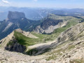
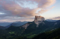
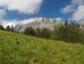
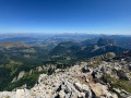
Not a very long walk, but with a magnificent view and an exposed section that’s guaranteed to give you a thrill.

Details

n°28740918
Creation:
Last update:
Last review:
  • Walking
    Activity: Walking
  • ↔
    Distance: 4.80 mi
  • ◔
    Average duration: 3h 55 
  • ▲
    Difficulty: Moderate

  • ⚐
    Back to start: Yes
  • ↗
    Ascent: + 1,926 ft
  • ↘
    Descent: - 1,896 ft

  • ▲
    Highest point: 5,781 ft
  • ▼
    Lowest point: 4,094 ft

Photos

Description of the walk

The route starts from the car park at the Gresse-en-Vercors ski area.

(S/E) Take the path running alongside the Torrent de la Gresse.

(1) At the junction on the edge of the forest, turn left. Follow the signs for “Crête du Brisou” (yellow and green markings). The start of the climb follows the green run, which is fairly wide and unremarkable, up to the top of the Blavet ski lift, where there is a small shelter.

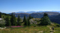
(2) Head up through the forest, continuing in the direction of the previous path. The climb takes place under the trees. Only the last 400 metres are in the open and offer a very beautiful view. Reach the top of the Alleyrons ski lift.

(3) Stay on the ridge heading south and do not take the signposted paths. The path is clearly visible and accessible for the first half.

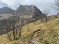
(4) From this point, the narrow path climbs steeply. This section is not recommended for children (turn back if necessary). In places, on either side of the path, the slope is very steep. Take care in strong winds! Near the summit of this walk, the ridge joins a yellow and green-marked path.

(5) On the left, the path descends towards the east. Turn right and continue climbing for a short while. The descent is then easy along a wider path. Wild animals (chamois, etc.) can be spotted on the opposite slope and on the scree slope to the left. You’ll reach the path at the bottom of the valley.

(6) Turn right towards the Veymont Forest Hut. From the hut, continue along the wide track, following the yellow and green markings.

(7) Leave the track to follow a small path that starts on the left. Cut across the track further down and carry on straight ahead.

(1) Carry on straight ahead to the car park (S/E).
Waypoints

  1. S/E : mi 0 - alt. 4,094 ft - Car park at the Gresse-en-Vercors ski area
  2. 1 : mi 0.11 - alt. 4,124 ft - Signpost, junction of the circular loop
  3. 2 : mi 0.56 - alt. 4,469 ft - Top of the Blavet ski lift (shelter)
  4. 3 : mi 1.52 - alt. 5,502 ft - Top of the Alleyrons ski lift
  5. 4 : mi 1.93 - alt. 5,456 ft - Start of the perilous section
  6. 5 : mi 2.13 - alt. 5,663 ft - Return to the marked path
  7. 6 : mi 3.03 - alt. 5,062 ft - Junction towards the Veymont Forest Lodge
  8. 7 : mi 3.72 - alt. 4,747 ft - Leave the track, take the path on the left
  9. S/E : mi 4.8 - alt. 4,094 ft - Car park at the Gresse-en-Vercors ski area

Notes

The unmarked section is easy to follow but very steep. Take great care in strong winds. Not recommended for children.

Reviews and comments

5 / 5
Based on 1 review

Reliability of the description
5 / 5
Ease of following the route
5 / 5
Route interest
5 / 5
quito84
quito84

Overall rating : 5 / 5

Date of your route : Oct 19, 2023
Reliability of the description : ★★★★★ Very good
Ease of following the route : ★★★★★ Very good
Route interest : ★★★★★ Very good
Very busy route : No

A lovely walk, especially between the summit of the Crête des Alleyrons and the forest hut. Stunning views at the Côte de Quinquambois. The path is very well marked and presents no difficulties (although there are one or two slightly exposed sections). Didn’t see a soul; the weather looked threatening and it was very windy… Thanks for the suggestion!

Machine-translated

Other walks in the area

For more walks, use our search engine .

The GPS track and description are the property of this route's author. Please do not copy them without permission.