The hillsides and banks of the Seine at Saint-Pierre-du-Vauvray

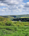
Discover the Seine valley from the magnificent viewpoint at Vironvay.

Details

54776611
Creation:
Last update:
Last review:
  • Walking
    Activity: Walking
  • ↔
    Distance: 5.66 mi
  • ◔
    Average duration: 3h 00 
  • ▲
    Difficulty: Easy

  • ⚐
    Back to start: Yes
  • ↗
    Ascent: + 407 ft
  • ↘
    Descent: - 413 ft

  • ▲
    Highest point: 420 ft
  • ▼
    Lowest point: 30 ft

Photos

Description of the walk

Park in the station car park.

(S/E) Leaving the car park, keep the railway line on your right as you follow Rue de la Gare. Turn right at the bend to join Grande Rue.

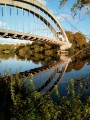
(1) Carry on straight ahead, continuing to follow the railway line along Rue du Vieux Saint-Pierre: you’ll see the concrete bridge over the Seine.

(2) Leave the street on your left – you’ll take this on the way back – and carry on straight ahead between the Seine and the railway line.

(3) At the end of the street, turn right to go under the small bridge, walk up for 50 metres, then turn left and follow the tarmac road (Allée du Roule). This road turns into a path after about 400 metres as you enter the woods.

(4) Keep to the left, pass the former gatekeeper’s house (on the old Paris–Les Andelys line) and follow the narrow path alongside the railway line, which is on your left.

(5) Turn right onto the path to begin the climb. Keep left at the fork that appears shortly afterwards: as you climb, look out for theGR® signposts, which will guide you to the viewpoint.

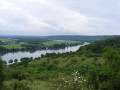
(6) Magnificent 180° view over the Seine valley. There’s a spot further down where you can have a picnic.
Then walk round the cemetery, pass through the Place des Tilleuls and follow the Chemin des Côtes. Further on, ignore a path branching off to the left and continue to a junction.

(7) Turn left onto the stony path; this marks the start of the descent. At the first viewpoint, keep slightly to the right to continue down the slope.

(8) Cross the level crossing with the utmost care to reach the banks of the Seine. Take the path on the left that runs as close as possible to the Seine: this is a cycle route, so watch out for cyclists and any local residents’ vehicles. Follow this path for approximately 3.5 km.

(2) At the junction you passed on the way there, turn right and follow Rue du Vieux Saint-Pierre for 200 m.

(1) Turn right to follow the greenway, head to the banks of the Seine and go under the concrete bridge.

(9) At the junction with the Chemin de la Digue, cross carefully and take the Chemin des Amoureux opposite to join the Route de Porte-Joie. Cross carefully and turn left to follow the road to the station car park (S/E).

Waypoints

  1. S/E : mi 0 - alt. 43 ft - Car park - Gare de St-Pierre-du-Vauvray
  2. 1 : mi 0.2 - alt. 33 ft - Shared crossing for both directions
  3. 2 : mi 0.34 - alt. 36 ft - Junction with the circular loop
  4. 3 : mi 0.59 - alt. 33 ft - Bridge
  5. 4 : mi 1.06 - alt. 62 ft - Junction
  6. 5 : mi 1.55 - alt. 43 ft - Start of the climb
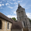
  7. 6 : mi 1.97 - alt. 407 ft - Panorama and the church at Vironvay
  8. 7 : mi 2.37 - alt. 413 ft - Junction, start of the descent
  9. 8 : mi 3.13 - alt. 46 ft - Level crossing - Le bellengault
  10. 9 : mi 5.34 - alt. 36 ft - Chemin de la Digue junction - Seine [la]
  11. S/E : mi 5.66 - alt. 43 ft - Car park - Gare de St-Pierre-du-Vauvray

Notes

As the ground is limestone and clay, take care when descending towards the Seine in wet weather.
At the bottom of this descent, there is an automatic level crossing. Please observe the rules at this level crossing.

Worth a visit

There are numerous viewpoints overlooking the Seine valley.
The bridge piers in the Seine from the old Paris–Les Andelys railway line.
The little church at Vironvay.
The small town centre of Saint-Pierre-du-Vauvray.

Always be cautious and plan ahead when you're outdoors. Visorando and the author of this route cannot be held responsible for any accidents occurring on this route.

The GR® and PR® markings are the intellectual property of the Fédération Française de Randonnée Pédestre.

Reviews and comments

4.8 / 5
Based on 2 reviews

Reliability of the description
5 / 5
Ease of following the route
5 / 5
Route interest
4.5 / 5
maingaultp@orange.fr

Overall rating : 4.7 / 5

Date of your route : Mar 06, 2025
Reliability of the description : ★★★★★ Very good
Ease of following the route : ★★★★★ Very good
Route interest : ★★★★☆ Good
Very busy route : No

Stunning, sweeping views over the Seine valley and the surrounding hillsides.
A very pleasant end to the walk along the banks of the Seine and through the village of St Pierre

Machine-translated

Pitreslau
Pitreslau

Overall rating : 5 / 5

Date of your route : Feb 06, 2025
Reliability of the description : ★★★★★ Very good
Ease of following the route : ★★★★★ Very good
Route interest : ★★★★★ Very good
Very busy route : No

Including stops to take in the views, the walk takes about 3 hours, but for regular walkers the route can be completed more quickly.

Machine-translated

Other walks in the area

For more walks, use our search engine .

The GPS track and description are the property of this route's author. Please do not copy them without permission.