Country:

 City:
City:


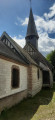
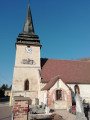
Park in the car park near the church in Connelles on the RD19.
(S/E) With your back to the church, head left along the RD19 for 1 km, until you reach the signpost for Herqueville.
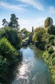
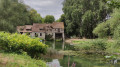
(1) Turn right onto the narrow lane Chemin de la Plage, passing the ‘No Entry’ sign. Walk through the pretty hamlet, with the River Seine on your right, then cross the log bridge to continue along the path into the woods. You’ll reach a road at the Moulin d’Andé, situated on the banks of the River Seine.
(2) Walk up this street, then turn right at the junction. Carry on straight ahead until you reach a junction with a ‘Stop’ sign, then head straight on into Rue du Moulin
(3) Pass Rue des Bleuets on your left and continue until you reach the county road. Cross it to discover the Château d’Andé.
(4) Retrace your steps, heading back along Rue du Moulin in the opposite direction until you reach thefirst lane on the right, Rue des Bleuets.
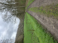
(3) Follow this lane until you reach the junction. Cross the road and follow the grassy path opposite, running alongside a wall; continue along this path, which becomes tarmac, heading towards the Church of Notre-Dame. At the road, turn right; you’ll see the castle on your right, then go through the gate to admire the church and exit via the gate on the opposite side, facing the schools.
(5) Cross the street, continue straight on, passing between the town hall on your left and the school on your right. Carry on along the tarmac path, following its zigzag course, go through the gate and you will reach a road.
(6) Cross the road, following the pedestrian path diagonally. Turn immediately right onto Rue des Prunus, ignore the side streets, and continue to the junction. Turn left onto Rue du Beau Soleil and follow it to the next junction.
(7) Turn right onto Rue de la Forêt, which, after passing the houses, continues as a track at the high-voltage substation on your right. Follow it as it bends to the right, pass under the high-voltage power line, then at the four-way junction, head straight ahead. Continue for 500 metres.
(8) Follow the bend in this wooded, downhill track until you reach a road. Take this road to the right for about twenty metres.
(9) Turn left onto the lovely forest lane, then walk along the edge of the woodland until you reach a small road.
(10) Follow it to the left for 2 km, passing the Château des Buspins on your left, continue on until you reach the Calvaire La Croix Des Buspins. Head straight ahead, following the direction of Daubeuf, until you come to a grassy path, set between two fields, directly in front of you.
(11) Take this path, then cross the lane opposite a farm shed. Go down the path running alongside a wall on your left. When you reach a road, follow it straight on towards the bridge. Cross the bridge and continue until you reach the junction with the Church of Saint-Martin in Daubeuf-près-Vatteville.
(12) Turn left at the VC7 signpost towards Connelles. Follow the road for 900 metres.
(13) Turn right onto thefirst path leading up towards the copse, then climb towards the plains, taking in the surrounding valleys. Reach the edge of a wood, turn right and follow the wood on your left.
After turning left at a 90° angle, leave the edge of the woodland, turn right and join a narrow lane.
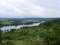
(14) Follow it to the left for 1.8 km, taking in the views – particularly of the Seine and the Étangs de Poses – then begin the descent to the crossroads.
(15) Take the right-hand fork, then, at the corner of a field, turn left onto a grassy path, with the Seine on your right. Walk down to the road.
(16) Turn right onto the road, pass the cave dwellings and reach Saint-Vaast Church. Walk round it on your left to return to your car (S/E).


 Tourist office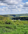
 Easy
Easy 
 Visorando Member

 Difficult