Country:
 City:


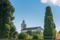
Car park at Saint-Hilaire Church, Rue des Palmiers in Cinais.
(S/E) Leave the car park on the right, keeping the church on your right, and head due north along a steep path. At the three-way junction, keep left onto the Chemin de la Garenne, which you should follow until you reach a junction of paths.
(1) Turn slightly right onto the path that descends towards Les Maussions, enters the Bois du Camp des Romains and climbs back up towards the ridge. You can also choose to cross the oppidum and avoid the Les Maussions–Camp des Romains section to reach the point (2).
(2) Turn right (due west) towards Le Grand Laid, following the path until you reach the clearing.
(3) Turn right onto the path heading due north, which descends into the Vallée de Bourg and leads to the Le Noisillet equestrian centre.
(4) Turn left towards the south-west onto the path leading up to the edge of the wood, then leave this edge by turning right.
(5) Take the path on the left, heading due south, which leads into the Bois Clos. Follow it to the junction with the D363 road.
(6) Cross it carefully and continue to the edge of the Bois Ragot.
(7) At the T-junction, take the left-hand branch (south-west), which leads towards the Petite Gaudrée, reach the Haute Pierre clearing and come to the edge of the woodland. At the three-way junction, take the path heading due south (do not enter the woodland) and head up towards the Maligratte.
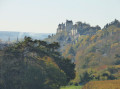
(8) Continue along the southern branch of the path to reach the marshland. Continue uphill on the path on the right until you reach the edge of the Grand Parc woodland, walking alongside a long, high tuffeau wall. This leads to the hamlet of La Rouillière and the entrance to the Château de Chavignynon, which is open to the public.
(9) Turn left, heading due east, onto the uphill Avenue des Marronniers; leave this at the first street, Rue de la Roche Thibault, then take Rue du Haut Midi as far as Saint-Martin Church in Lerné.
(10) Turn left in front of the church, follow Rue de la Grande Cour, then turn right onto Rue de Saint Martin and left onto Rue des Acacias to reach Place d’Armes.
(11) To avoid the Route de Thizay (D363), keep slightly to the left onto the path which climbs and branches off to the right towards the D363.
(12) Cross it carefully and continue straight ahead, heading due east towards Les Cruches, Bois Chabert and the Trotte-Loup path junction.
(13) Carry on straight ahead along the path, heading downwards to a junction of paths.
(14) Take the path on the right, heading south towards Les Gruches, or on the left towards Le Coteau de Seuilly.
(15) At the junction with the Chemin du Moulin à Vent, turn right, cross the Rue du Coteau (D117) with care and reach Seuilly at the abbey.
(16) Turn left into the abbey grounds to visit, then follow the Sentier Rabelais and the path running parallel to Rue du Coteau, which you must cross to reach Rue de la Devinière (D324).
(17) Follow this road to the left, passing Rabelais’s house (La Devinière) on your left and then the Cinais cemetery. Continue on to the car park at Saint Hilaire Church (S/E).
 Visorando Member
 Easy