Country:

 City:
City:


Set off from the Trégastel-Sainte-Anne bus stop (line E, which runs between Lannion and Trégastel).
(S) From the bus stop, head north-west, away from the roundabout. At the next junction, turn right onto Boulevard de Coz-Porz. Walk past the conference centre.
Red and white markings for the GR®34
(1) Turn right onto Quai de Sainte-Anne, which runs alongside the bay of the same name.
(2) Leave the quay and turn left to follow the coastal path. You’ll rejoin the tarmac road when you reach the end of a cul-de-sac.
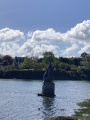
(3) Turn left to continue along the coast. Pass the sports ground and the Étang des Cygnes on your right and carry on to Tourony Beach.
(4) Cross the beach to the picnic area. Then turn right at a 90° angle. Next, turn left onto the Chaussée du Port, then take the second right, still on the Chaussée du Port. Follow the coast until you reach a bridge.
(5) Turn left, cross the bridge and pass an old tide mill. At the end of the bridge, follow the coastal path to the left. Cross another inlet.
(6) Turn left onto the Quai de Bellevue. Keep to the coast, ignoring all turn-offs on the right.
(7) After a 90° right-hand bend, continue along the coastal path until you reach the Chapelle Saint-Guirec.
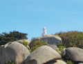
(8) Continue along the coast, following the red and white markings. Pass the Maison du Littoral and you’ll soon reach a junction with the Men Ruz Lighthouse on your left.
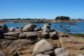
(9) Carry on straight ahead (east) along the coastal path. Pass a fountain on the right-hand side and, at the next junction, take the path on the left. This path is circular and climbs, then descends and heads south-southeast. As you pass, take in the famous rocks of Ploumanac’h.
(10) At a car park, continue south-east along the coastal path. Pass a viewpoint and walk alongside Grève Saint-Pierre below on your left. After a 90° right-hand bend, you’ll come out onto Rue de la Clarté.
(11) Follow this street to the left. At the roundabout, take the second left onto Boulevard Joseph Le-Bihan and walk along Trestraou Beach. Pass the thermal baths and the casino on your left. At the end of the beach, turn left onto Rue du Maréchal Foch and head up towards Pointe du Château.
(12) When Rue du Maréchal Foch bends to the right, carry straight on into Rue des Sept Îles. You’ll come to a junction with Rue Anatole France.
(13) Then follow Chemin de la Messe northwards. Walk along the cliff top overlooking the sea and ignore all turn-offs to the right. Walk down to Trestignel Beach.
(14) Turn left, walk along the beach and pass a car park. Continue to Pointe du Château.
(15) Turn right and continue along the coastal path. Keep as close to the sea as possible and ignore any turn-offs to the right.
(16) You’ll come out onto Boulevard Yvon Bonnot (D788); follow it to the left until you reach the eco-museum.
(17) Continue along the D788, passing between a small basin and a marina. Walk along the harbour on your left.
(18) When you reach the traffic lights at the entrance to the marina, carry straight on along the Esplanade de la Douane.
End of red and white signposting
(19) Let the GR® veer off to the left. Continue along the Esplanade de la Douane and you’ll soon reach a roundabout. Go round it on the right, cross Rue Ernest Renand and follow it to the left (south-south-west).
(20) At the Fork in the road shortly afterwards, turn left onto Rue de la Vieille Côte. Cross a stream and continue along Rue de la Vieille Côte, ignoring the dead-ends and side streets. You’ll come out onto Rue des Hortensias; follow it to the left until you reach Saint-Quai-Perros Town Hall (E).


 Visorando Member
 Easy
Easy