Collado del Bozo – Aisa Valley

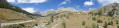
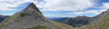
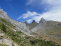
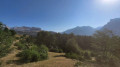
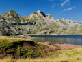
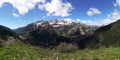
A very pleasant, easy walk in the Cirque d’Igüer (Sierra d’Aisa), with splendid views of the area’s main peaks: Pic de Mesola, Pic Lecherin, Pic d’Aspe and Pic de la Magdalena.

Details

25917510
Creation:
Last update:
Last review:
  • Walking
    Activity: Walking
  • ↔
    Distance: 6.17 mi
  • ◔
    Average duration: 4h 25 
  • ▲
    Difficulty: Moderate

  • ⚐
    Back to start: Yes
  • ↗
    Ascent: + 1,860 ft
  • ↘
    Descent: - 1,857 ft

  • ▲
    Highest point: 6,598 ft
  • ▼
    Lowest point: 4,865 ft

Photos

Description of the walk

Start from the Cleta car park, at the end of the road coming from Aisa: it is not possible to drive any further. Please note that the area is busy in summer, so it is best to arrive before 10.00.

(S/E) After the gate marking the end of the road from Aisa, continue along the track leading to the Igüer Valley until you reach a three-way junction.

(1) Keep left onto the main path, heading towards the Ibon (lake) de Izagra. The path is relatively flat and winds its way down towards the bottom of the valley.

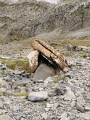
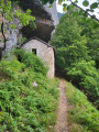
(2) At the fork, turn right, heading towards the Izagra Ibon dolmen. The path climbs gently up the mountainside and leads to the Izagra dolmen.

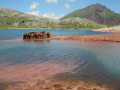
(3) Turn left again towards the lake. The slope levels out considerably; the lake was dry on the day of the hike (late August) but its presence can be guessed at by a series of depressions in the ground and a small stream trickling timidly along.

(4) As you leave the lake, the path climbs abruptly towards the Col de Bozo, which you can see. The slope becomes considerably steeper over the last kilometre until you reach the pass (1,995 m).

(5) The walk can continue on to the Refuge de Lizara (1 hr 15 mins) or, in the opposite direction, to the Col d’Esper (1 hr 10 mins) and then on to the town of Candanchu (4 hr 45 mins). The return journey begins by following the same route in the opposite direction.

(3) To avoid retracing the entire outward route, take an alternative route to the Cleta car park by heading straight on towards the Collado de Rigüelo. The path runs along the mountainside and offers stunning views of Pic Lecherin.

(6) At the junction for the Rigüelo Refuge, head down to the right and rejoin the ascent route.

(1) Continue to the left. Before reaching the car park, you can take a dip in a lovely natural pool (pozas) in the Barranco d’Igüer. Return to the car park (S/E).

Waypoints

  1. S/E : mi 0 - alt. 4,865 ft - La Cleta car park
  2. 1 : mi 0.38 - alt. 5,089 ft - Three-way junction, signpost 1
  3. 2 : mi 1.55 - alt. 5,387 ft - Ascent to Lake Izagra
  4. 3 : mi 1.91 - alt. 5,669 ft - Junction
  5. 4 : mi 2.78 - alt. 5,932 ft - Start of the ascent to the Col de Bozo
  6. 5 : mi 3.25 - alt. 6,578 ft - Collado del Bozzo
  7. 6 : mi 5.13 - alt. 5,659 ft - Signpost back to La Cleta car park
  8. S/E : mi 6.17 - alt. 4,869 ft - La Cleta car park

Reviews and comments

4.7 / 5
Based on 2 reviews

Reliability of the description
4.5 / 5
Ease of following the route
4.5 / 5
Route interest
5 / 5
Protee26
Protee26

Overall rating : 4.3 / 5

Date of your route : Sep 23, 2025
Reliability of the description : ★★★★☆ Good
Ease of following the route : ★★★★☆ Good
Route interest : ★★★★★ Very good
Very busy route : Yes

a really lovely walk – take the time to visit the dolmen. Once you reach the Bozo Pass, I recommend following the GR11 for at least a kilometre towards Barranco de Igüer for a complete change of scenery (at an altitude of around 2,100 metres). it took us 3 hours and 40 minutes. Once back at the starting point, it's nice to go down into the canyon for a dip!

Machine-translated

Emea
Emea

Overall rating : 5 / 5

Date of your route : Aug 26, 2024
Reliability of the description : ★★★★★ Very good
Ease of following the route : ★★★★★ Very good
Route interest : ★★★★★ Very good
Very busy route : Yes

A lovely walk with not too much of an incline, offering the chance to enjoy beautiful scenery from above and spot plenty of birds of prey.

Machine-translated

Other walks in the area

For more walks, use our search engine .

The GPS track and description are the property of this route's author. Please do not copy them without permission.