Refine your search for walks in Col du Varo (2151m)
Col du Varo (2151m) walks


 La Tournette
 Visorando Member
 7.05 mi
 +4,177 ft
 -4,196 ft
 6h 55
6h 55
 Difficult
 Departure from Montmin (Haute-Savoie)
Hike offering superb views of the Massif des Bornes, Lake Annecy and Mont Blanc.
The Tournette loop
 8.44 mi
+3,921 ft
-3,930 ft
7h 20
Difficult
Departure from Montmin (Haute-Savoie)
8.44 mi
+3,921 ft
-3,930 ft
7h 20
Difficult
Departure from Montmin (Haute-Savoie)
A magnificent mid-mountain hike with views of Lake Annecy and a 360° panorama from the summit over the Northern Alps and Mont Blanc.
La Tournette loop from the village of Montmin
 8.15 mi
+4,446 ft
-4,426 ft
7h 35
Difficult
Departure from Montmin (Haute-Savoie)
8.15 mi
+4,446 ft
-4,426 ft
7h 35
Difficult
Departure from Montmin (Haute-Savoie)
This is a beautiful hike offering stunning views of Lake Annecy, the Aravis massif and Mont Blanc. I recommend doing this hike in late October or early November, as the route is very busy in July, August and September.
Please take into account the comments regarding the difficulties in the Practical Information section.
The Tournette circular loop starting from Montremont
 10.38 mi
+5,364 ft
-5,341 ft
9h 25
10.38 mi
+5,364 ft
-5,341 ft
9h 25
 Very difficult
Departure from Thônes (Haute-Savoie)
Very difficult
Departure from Thônes (Haute-Savoie)
Starting from Montremont, I suggest you follow a lovely route on the Montagne de la Tournette, taking in numerous viewpoints: the ascent is via the Col de Frêtes de Rosairy, where you are unlikely to encounter many people, then the return via the classic route from the Chalet de l’Aulp – which can be quite busy – before reaching the Col des Nantets. The challenges lie in the elevation gain and distance, but above all in certain exposed sections requiring caution: ⚠️ Please take full note of the explanations and warnings in the ‘Practical Information’ section.
Walks near Col du Varo (2151m)
Combe refuge - Le Reposoir
 6.84 mi
+2,021 ft
-3,307 ft
4h 55
6.84 mi
+2,021 ft
-3,307 ft
4h 55
 Moderate
Departure from Chevaline (Haute-Savoie)
Moderate
Departure from Chevaline (Haute-Savoie)
Second day of the hike: Around Charbon Mountain with a stop at Dent des Portes.
Parmelan loop from Dingy via the Col du Perthuis
5.71 mi
+3,005 ft
-3,091 ft
5h 15
Difficult
Departure from Dingy-Saint-Clair (Haute-Savoie)
Le Parmelan, via a slightly less traditional route.
At the summit, sharp limestone pavement, Grotte de l'Enfer (and other caves), Mont Blanc range.
Chalets de l’Eau Froide – Stream Fourchu car park
10.52 mi
+2,142 ft
-4,190 ft
6h 40
Difficult
Departure from Giez (Haute-Savoie)
The second day of a two-day route around the Pointe d’Arcalod, the highest point in the Bauges, passing through wild areas, valleys and along rivers. The proposed route mainly follows the western section of the GR® de Pays Tour de l’Arcalod, marked in yellow and red. Spectacular views of the mountains and Lake Annecy. This wild and little-used route is situated mainly within a sensitive, regulated area. The terrain is good and presents no particular difficulties.
The Semnoz
 9.24 mi
+2,513 ft
-3,406 ft
6h 25
Moderate
Departure from Leschaux (Haute-Savoie)
9.24 mi
+2,513 ft
-3,406 ft
6h 25
Moderate
Departure from Leschaux (Haute-Savoie)
Crossing the Semnoz between the villages of Leschaux and Machevaz.
Le Reposoir - Refuge de la Combe
 3.14 mi
+1,719 ft
-436 ft
2h 55
Moderate
Departure from Bellecombe-en-Bauges (Savoie)
3.14 mi
+1,719 ft
-436 ft
2h 55
Moderate
Departure from Bellecombe-en-Bauges (Savoie)
This hike can be done either:
- as a day trip,
- or as part of a longer hike (first stage of the circular route: Around Charbon Mountain). It was during this tour that it was completed.
From the Baraque de l'Abbaye to the Chalet de l'Alpettaz
 9.20 mi
+3,583 ft
-2,201 ft
7h 20
Difficult
Departure from Seythenex (Haute-Savoie)
9.20 mi
+3,583 ft
-2,201 ft
7h 20
Difficult
Departure from Seythenex (Haute-Savoie)
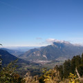
This hike takes you to the heart of the Faverges-Seythenex valley, following the Lac d'Annecy with the Torrent de Saint-Ruph, which is the lake's main source of water, ending with a view of Albertville and Mont Blanc at the Col de l'Alpettaz (alt. 1,580 m).
Aiguille des Calvaires and Combe de Borderan
4.54 mi
+1,762 ft
-2,923 ft
3h 35
Moderate
Departure from La Clusaz (Haute-Savoie)
A great pointy summit with a cross on top and good views followed by a descent of Borderan Combe. This could easily be done in reverse and/or without the use of the cable cars.
 From Chaucisse to the Col des Aravis via the Chalet du Curé
 9.45 mi
+2,146 ft
-1,463 ft
5 hrs
Difficult
Departure from Saint-Nicolas-la-Chapelle (Savoie) (Savoie)
9.45 mi
+2,146 ft
-1,463 ft
5 hrs
Difficult
Departure from Saint-Nicolas-la-Chapelle (Savoie) (Savoie)
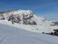
Starting from the hamlet of Chaucisse, this walk, with Mont Blanc as a backdrop, takes you into a magnificent landscape at the foot of the Étalle, then past the well-known Chalet du Curé, before descending gently towards the Col des Aravis.
The Col de la Forclaz from Entremont to Le Petit Bornand
 7.27 mi
+3,100 ft
-3,707 ft
6h 05
Difficult
Departure from Entremont (Haute-Savoie)
7.27 mi
+3,100 ft
-3,707 ft
6h 05
Difficult
Departure from Entremont (Haute-Savoie)
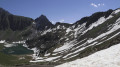
In the commune of Glières-Val-de-Borne, in the Bargy massif, Lac de Lessy is a true gem at the foot of the Pic de Jalouvre. The walk takes you through forests and mountain pastures. It features a short rocky section. The start from La Joux and the return via Montagne de Paradis and Cocogne are what make this walk unique. You pass the two-hundred-year-old hamlet of Les Chalets de Mayse. The Chalet de Lessy is nestled on the lakeside after the Col de la Forclaz.