Monte Bullaccia

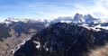
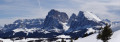
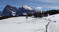
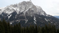
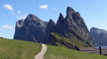
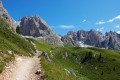
During this circular walk around Monte Bullaccia, you’ll come across several vantage points where you can admire the beauty of the Val Gardena Dolomites and the neighbouring mountain ranges. An orientation board will help you identify the best-known peaks, including the Langkofel, the Schlern, the Piz Boe and the Saas Rigais. You are in the Italian South Tyrol, where place names are given in two or even three languages: Bullaccia in Italian, Puflatsch in German and Bulacia in Ladin (the local dialect).

Details

1897757
Creation:
Last update:
Last review:
  • Walking
    Activity: Walking
  • ↔
    Distance: 5.59 mi
  • ◔
    Average duration: 3h 35 
  • ▲
    Difficulty: Moderate

  • ⚐
    Back to start: Yes
  • ↗
    Ascent: + 1,181 ft
  • ↘
    Descent: - 1,181 ft

  • ▲
    Highest point: 7,113 ft
  • ▼
    Lowest point: 6,076 ft

Photos

Description of the walk

To reach Castelrotto: Take the Brenner motorway and exit at Ponte Gardena if approaching from the north, or Bolzano Nord if coming from the south.

To get to Compatsch, the starting point for the hike, there are two options:
- by bus from Castelrotto;
- by bus from Castelrotto to Siusi, then the cable car.

(S/E) From the top station of the cable car, head north along the road, pass behind the “Alpina Dolomites” hotel, go past the top station of a chairlift and arrive at the start of a footpath.

(1) Follow the path, which rejoins the road after about 400 metres.

(2) Turn right and head back towards the start of another chairlift.

(3) Continue along the track, heading north-east, until you reach the ‘Puflatsch’ mountain restaurant.

(4) Walk past the restaurant, reach the top station of the “Puflatsch” chairlift, continue eastwards and climb the small hill where there is an orientation table (Puflatsch Engelrast). Take stock of your knowledge of the major peaks of the Dolomites.

(5) Descend the promontory via the north-west path. After 200 metres, at the junction, take the northern path called “Pu Putflasch Umrundung”, meaning the Puflatsch circuit (on this circular path, you will also find signs in Italian reading “Giro del Bullaccia”). Continue to a panoramic viewpoint overlooking the Val Gardena and, in particular, the village of Ortisei/St Ulrich.

(6) Staying on the “Pu” trail (or No. 24 on some maps), reach the day’s summit: Monte Bullaccia (in Italian), Piza de Bulacia (in Ladin), Puflatschspitz (in German).

(7) Continue along the “Pu” path or No. 24 to another vantage point. Views over the Alpe di Marinzen and Casterotto.

(8) Stay on this same path and head back down towards the Arnika Hütte.

(9) Turn right, stay on the “Pu” trail and rejoin the route you took on the way out to complete this circular route.

(2) Return to the Compatsch cable car via the route taken on the way there (S/E).

Waypoints

  1. S/E : mi 0 - alt. 6,076 ft - Compatsch: Cable car arrival point
  2. 1 : mi 0.47 - alt. 6,299 ft - Road–path junction
  3. 2 : mi 0.7 - alt. 6,526 ft - Intersection
  4. 3 : mi 0.99 - alt. 6,690 ft - Chairlift departure point
  5. 4 : mi 1.26 - alt. 6,854 ft - Puflatsch Restaurant
  6. 5 : mi 1.42 - alt. 6,913 ft - Orientation map
  7. 6 : mi 2.45 - alt. 6,903 ft - Panoramic viewpoint
  8. 7 : mi 2.71 - alt. 7,077 ft - Monte Bullaccia
  9. 8 : mi 3.16 - alt. 6,877 ft - Panoramic viewpoint
  10. 9 : mi 3.43 - alt. 6,772 ft - Arnika Hut
  11. S/E : mi 5.59 - alt. 6,076 ft - Compatsch: Cable car arrival point

Worth a visit

  • Castelrotto.
  • Schlern Massif.
  • Punta di Santner.
  • Alpe di Siusi.
  • Langkofel Group.
  • Sella Group.
  • Geisler Group.
  • Puez Group.

Reviews and comments

4.7 / 5
Based on 2 reviews

Reliability of the description
5 / 5
Ease of following the route
4.5 / 5
Route interest
4.5 / 5
pierka
pierka

Overall rating : 4.7 / 5

Date of your route : Jun 29, 2026
Reliability of the description : ★★★★★ Very good
Ease of following the route : ★★★★☆ Good
Route interest : ★★★★★ Very good
Very busy route : Yes

A wonderful walk which, in places, allows you to escape the tourist crowds in the area.

Machine-translated

Bouconne VTT
Bouconne VTT

Overall rating : 4.7 / 5

Date of your route : Sep 01, 2024
Reliability of the description : ★★★★★ Very good
Ease of following the route : ★★★★★ Very good
Route interest : ★★★★☆ Good
Very busy route : Yes

It’s a very enjoyable walk, with views almost everywhere along the route.
As for the walk itself, it’s rather average up to point 7, after which you really feel like you’re on a proper hike until you return to point 2. Mountain bikes can be ridden up to point 7.
The road is tarmacked up to point 4

We did the walk on a Sunday, so it was very busy. It’s not difficult at all; there’s no need for heavy, high-top hiking boots – light ones will do.

You can drive up to Compatsch; you’ll need to park in car park P2. It’s €26 for the day; if there are two of you, it works out cheaper to drive up. Be careful, though: the road is closed to traffic from 9.00 am to 6.00 pm for the ascent, unless you have special permission.

Machine-translated

Other walks in the area

For more walks, use our search engine .

The GPS track and description are the property of this route's author. Please do not copy them without permission.