Refine your search for walks in Col du Joly
Col du Joly walks


 Aiguille Croche and Mont Joly from the Col du Joly
 Visorando Member
 9.21 mi
 +2,769 ft
 -2,769 ft
 6h 40
 Difficult
 Departure from Hauteluce (Savoie)
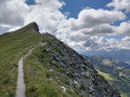
The ascent of Mont Joly, a unique viewpoint facing Mont Blanc, via the Aiguille Croche, which also offers superb panoramic views, with a long ridge walk between the two. A beautiful high mountain atmosphere.
From Col du Joly to Col de la Fenêtre
 4.07 mi
+1,010 ft
-988 ft
2h 45
 Moderate
Departure from Les Contamines-Montjoie (Haute-Savoie)
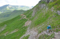
Hike on the trail separating the two passes. This hike offers views of the Mont Blanc massif from both passes. Not particularly difficult, but be careful on the slopes where the trail sometimes climbs quite steeply
Les Saisies - Roselette Chalet
10.55 mi
+2,303 ft
-1,647 ft
6h 50
Moderate
Departure from Hauteluce (Savoie)
Stage 1 of the Tour du Beaufortain, connecting Les Saisies resort to the Roselette chalet.
Tour du Beaufortain
 57.03 mi
+18,586 ft
-18,638 ft
7 days
Moderate
Departure from Hauteluce (Savoie)
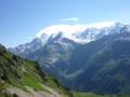
The Beaufortain, between Albertville and Bourg-Saint-Maurice, offers a 7-day tour that will take you on a journey through a landscape reminiscent of Switzerland.
Mont Joly from the Signal gondola lift
9.37 mi
+2,562 ft
-3,875 ft
6h 30
Difficult
Departure from Les Contamines-Montjoie (Haute-Savoie)
This hiking route provides access to Mont Joly via the south face, bypassing the ridge between Les Croches and Le Joly. From the summit of Mont Joly, you can enjoy a magnificent panorama. Please note that the return journey involves a steep descent.

Walks near Col du Joly
Chalet de Roselette - Refuge de la Croix du Bonhomme
6.16 mi
+3,261 ft
-1,358 ft
5h 40
Moderate
Departure from Les Contamines-Montjoie (Haute-Savoie)
From Roselette to the Croix du Bonhomme via a short section of the Tour du Mont Blanc variant.
Col de la Fenetre
7.73 mi
+1,296 ft
-3,596 ft
4h 40
Moderate
Departure from Les Contamines-Montjoie (Haute-Savoie)
This walk starts from the top of the gondola at Le Signal. It is an interesting walk, up to and through the Col de la Fenetre. The descent takes you back down through alpine pastures and into the valley leading back to Les Contamines-Montjoie.
⚠️ Please note that you need to park at (A) and not (D) for this walk ⚠️
Refuge Nant Borrant - Refuge des Mottets
 9.72 mi
+4,452 ft
-3,018 ft
8h 20
Difficult
Departure from Les Contamines-Montjoie (Haute-Savoie)
Stage2 of the Tour du Mont Blanc: from the Nant Borrant mountain hut (Contamines-Montjoie) to the Mottets mountain hut (Bourg-Saint-Maurice) via the Col des Fours route.
Les Contamines – Roselend
13.13 mi
+4,777 ft
-3,425 ft
8 hrs
 Very difficult
Departure from Les Contamines-Montjoie (Haute-Savoie)
Between heaven and earth on the old N202.
Refuge de La Balme - Bourg Saint Maurice
7.05 mi
+2,615 ft
-3,117 ft
5h 30
Moderate
Departure from Les Contamines-Montjoie (Haute-Savoie)
Itinéraire de la traversée des Alpes. Départ du Refuge de la Balme jusqu’aux Chapieux. Cette étape nous fait entrer dans un monde minéral (Col de la Croix du Bonhomme) et nous permet d'avoir un magnifique panorama sur la belle région du Beaufortain.
From the Refuge de la Balme Beaufortin to the Refuge de la Balme Tarentaise
 15.97 mi
+6,158 ft
-5,151 ft
12h 40
Very difficult
Departure from Les Contamines-Montjoie (Haute-Savoie)
This seventh stage of the GTA crosses the Beaufortain massif to reach the Tarentaise Valley.From the Balme Chalet-Refuge in Beaufortin, the GR®5 trail follows the Bon Nant stream, reaches the Plan des Dames and climbs to the Col du Bonhomme, before arriving at the Col de la Croix du Bonhomme Refuge, where it leaves the GR®TMB. The GR®5 descends and follows the Crête des Gittes to reach the Col de la Sauce, from where it drops down to the Refuge du Plan de la Lai. Following a track, it reaches the Plan Mya lodge, then enters a small valley and, hugging the hillside, climbs towards the hamlet known as La Petite Berge, passes a small pass at La Grande Berge before descending again above the hamlet of Tréicol. The path winds its way into the Vallon du Ruisseau de Treicol, reaches the ruins of Presset and climbs up to the Col du Bresson, overlooked by the Pierra Menta. From the pass, it descends to the Refuge de la Balme Tarentaise, the end point of this stage.
stage 2 of the TMB
6.74 mi
+4,278 ft
-157 ft
6h 50
Difficult
Departure from Les Contamines-Montjoie (Haute-Savoie)
stage2 of the TMB: from Les Contamines-Montjoie to the Refuge de la Croix du Bonhomme.
Les Contamines to Les Chapieux - Tour Mont Blanc
 Association / Club / Walk leader10.10 mi
+4,334 ft
-3,097 ft
8h 25
Difficult
Departure from Les Contamines-Montjoie (Haute-Savoie)
This 2nd stage of the Tour Mont Blanc (TMB) follows the river Le Bonnant upstream to climb over the Col du Bonhomme at 2,329m. Let's do it!
The TMB is a classic long-distance footpath that goes around Mont Blanc, passing from France into Italy and through Switzerland before returning to France.