Col des Pandours circular route from Wangenbourg

A simple circular route above Wangenbourg, passing via the Col des Pandours.

Details

n°70528148
Creation:
Last update:
Last review:
  • Walking
    Activity: Walking
  • ↔
    Distance: 7.68 mi
  • ◔
    Average duration: 4h 25 
  • ▲
    Difficulty: Moderate

  • ⚐
    Back to start: Yes
  • ↗
    Ascent: + 1,001 ft
  • ↘
    Descent: - 1,001 ft

  • ▲
    Highest point: 2,247 ft
  • ▼
    Lowest point: 1,247 ft

Description of the walk

Park in the car park on Place de la Cinquième Armée, next to the tourist information office.

(S/E) Follow the road to the left. Pass the Route du Nideck (D218) on your left and continue to the junction with the Route du Panorama, near the Emergency Response Centre.

(1) Turn left and head back down Route du Panorama; pass Rue des Châtaigniers on your right and you’ll immediately come to a three-way junction; keep right and continue for a few metres.

(2) Take the path on the left (marked with a Yellow Rectangle), which runs parallel to Route du Panorama before joining it.

(3) Carry on in the same direction, negotiate the left-hand bend, then rejoin the path on the right whilst continuing to follow Route du Panorama. Keep left at the junction, then take a wide right-hand bend following the path, before returning to the road.

(4) Carry on straight ahead for about 500 m.

(5) Turn right onto a path that continues to run alongside Route du Panorama on higher ground, following the Yellow Rectangle markings.

(6) Turn right and continue to follow the signposted path, which follows the contour line before joining a forest track not far from the Carrefour des Pandours. Turn left and continue straight on to reach the D218 at the Col des Pandours, which marks the junction of all the walks in the area.

(7) Turn left and walk carefully alongside the departmental road: look out for the Blue Cross markings.

(8) Leave the road and follow a forest track to the right.

(9) Turn left, follow the ‘Red Saltire’ markings and continue on to Ameisenthal.

(10) Turn left again, following the ‘Red Saltire’ signposting. Join the Langenberg Forest Track and follow it, veering to the right.

(11) Leave this path and take a track on the left. Continue to the junction with a forest road running alongside the Loechelbach.

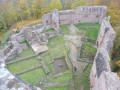
(12) Cross the stream by first turning right then left, and rejoin the path, following the ‘Red Saltire’ signposts. Cross a forest track near the Pont du Brocard, then continue straight ahead to reach Wangenbourg Castle.

(13) Turn left onto Rue du Château, which leads straight back to the car park (S/E).

Waypoints

  1. S/E : mi 0 - alt. 1,506 ft - Place de la Cinquième Armée
  2. 1 : mi 0.32 - alt. 1,493 ft - Panorama Route
  3. 2 : mi 0.55 - alt. 1,631 ft - Start of the trail
  4. 3 : mi 1.26 - alt. 1,670 ft - Return via the road
  5. 4 : mi 2.37 - alt. 1,785 ft - Return via the road
  6. 5 : mi 2.65 - alt. 1,854 ft - Start of the trail
  7. 6 : mi 3.46 - alt. 2,096 ft - Three-way junction
  8. 7 : mi 4.43 - alt. 2,172 ft - Col des Pandours (661m)
  9. 8 : mi 4.66 - alt. 2,129 ft - Forest track
  10. 9 : mi 4.97 - alt. 2,064 ft - Junction
  11. 10 : mi 5.65 - alt. 2,001 ft - Junction
  12. 11 : mi 6.17 - alt. 1,854 ft - Junction
  13. 12 : mi 6.78 - alt. 1,345 ft - Forest track
  14. 13 : mi 7.44 - alt. 1,526 ft - Chateau de WANGENBOURG
  15. S/E : mi 7.68 - alt. 1,506 ft - Place de la Cinquième Armée

Notes

The path may be muddy in wet weather.

A few junctions may lead to you taking a wrong turn, but these can be easily corrected by following the signposts.

Reviews and comments

4.2 / 5
Based on 2 reviews

Reliability of the description
3.5 / 5
Ease of following the route
4 / 5
Route interest
5 / 5
bernard_dorli
bernard_dorli

Overall rating : 4.3 / 5

Date of your route : Sep 05, 2026
Reliability of the description : ★★★★☆ Good
Ease of following the route : ★★★★☆ Good
Route interest : ★★★★★ Very good
Very busy route : No

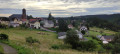
Stunning panoramic views of the Wangenbourg area, plus a tour of the castle.
The forest trails are very pleasant and the gradients are generally moderate.
A quick note: pay close attention to the CV signposting.
Due to a lapse in concentration on my part, I missed the 90° right-hand turn 300 metres after point 6, as well as a fork in the path after point 11.
The app alerts you if you stray from the route, which is a real bonus.

Machine-translated

Marc ECKERT
Marc ECKERT

Overall rating : 4 / 5

Date of your route : Jun 23, 2025
Reliability of the description : ★★★☆☆ Average
Ease of following the route : ★★★★☆ Good
Route interest : ★★★★★ Very good
Very busy route : No

A very beautiful hike with plenty of shade in hot weather. Some beautiful views of Wangenbourg and the Rhine plain. The final climb to the castle is very tough when you already have 12 km under your belt and it's very hot, but the reward is worth it.
A few inaccuracies in the route description; there is a discrepancy with the waypoints, particularly at points 6, 7, 8 and 9. For example, it is at point 8 and not point 9 that you leave the road to follow a forest track! Everything is fine when you can follow the route on the map, but otherwise it is confusing and should be corrected.
General comment applicable to the entire Vosges mountains: it is a shame that there are no benches or picnic areas along the route except in the immediate vicinity of Wangenbourg. You can walk for a good three hours without seeing a single bench, which is handy for eating a snack or taking a break.

Machine-translated

Other walks in the area

For more walks, use our search engine .

The GPS track and description are the property of this route's author. Please do not copy them without permission.