


Refine your search for walks in Col des Moucherolles (2086m)
Col des Moucherolles (2086m) walks


 Col des 2 Sœurs - Grande Moucherolle - Sophie - Pas de l'Œille circular
 Visorando Member
 10.08 mi
 +5,528 ft
 -5,531 ft
 8 hrs
 Extremely difficult
 Departure from Château-Bernard (Isère)
This magnificent figure-eight route combines the ascent of Grande Moucherolle, the second highest peak in the Vercors, with the crossing of two challenging passes and the discovery of the Rocher des Deux Sœurs ridges.
This hike includes two short climbing sections (less than 5 metres each), which are not particularly difficult but are exposed. A good quarter of the route is on poorly marked paths, requiring a good sense of direction even though orientation is easy.
Marmots and ibex are on the menu.
La Grande Moucherolle via its ridge
5.58 mi
+3,422 ft
-3,428 ft
5 hrs
 Very difficult
Departure from Corrençon-en-Vercors (Isère)
There are several ways to reach the foot of the Grande Moucherolle, which is really the main attraction of this hike. This route takes you along the fastest slopes.
A superb, aerial hike, but not very technical or dangerous, with an approach via the ski slopes and, at the top, a breathtaking panorama.
Please note: this hike is classified as Very Difficult for an average hiker (IBP = 111) due to steep slopes and some exposed sections.
Crossing the Grande and Petite Moucherolle, from the Deux Sœurs to La Balme
 8.39 mi
+4,259 ft
-4,239 ft
10 hrs
Very difficult
Departure from Château-Bernard (Isère)
A magnificent, fairly challenging traverse, taking in the Grande and then the Petite Moucherolle, ascending via the Col des Deux Sœurs and descending via the Pas de la Balme, starting from the Arzelier resort.
Several sections require caution, either due to the steepness of the rocky outcrops to be crossed or the deterioration of the historic path, but the views, both along the route and from the summits, more than make up for the effort required.
This hike is classified as very difficult for the reasons explained in the “Practical Information” section.
Walks near Col des Moucherolles (2086m)
Soldanelle Mountain Hut – Les Clôts
 10.07 mi
+3,061 ft
-3,865 ft
7h 20
 Difficult
Departure from Château-Bernard (Isère)
This second day is full of contrasts, from the narrow paths of the eastern ridges to the wide slopes of the Corrençon Villard ski area.
The Pas de l'Oeille and its ibexes
 5.89 mi
+1,056 ft
-2,900 ft
3h 40
 Moderate
Departure from Villard-de-Lans (Isère)
A hike in the heart of the Vercors to discover ibex (numerous and not shy in these mountains). And as a bonus on arrival, beautiful panoramic views of the surrounding mountains.
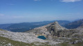
Lac de la Moucherolle
 7.18 mi
+1,280 ft
-3,136 ft
4h 25
Moderate
Departure from Villard-de-Lans (Isère)
This walk leads to Lac de la Moucherolle and the Fauge valley.
This hike allows you to discover a multitude of landscapes ranging from a mineral world to pastures and forests with beautiful panoramic views of the entire northern Vercors.
From Corrençon-en-Vercors to the Jasse du Play
 Association / Club / Walk leader
 10.84 mi
+2,224 ft
-682 ft
6h 55
Moderate
Departure from Corrençon-en-Vercors (Isère)
First stage of a 4-day crossing of the Vercors. It’s a long trek but the elevation gain isn’t excessive.
Crossing the Vercors Plateau
 32.40 mi
+4,354 ft
-5,358 ft
4 days
Difficult
Departure from Corrençon-en-Vercors (Isère)
This route describes a four-stage crossing of the Vercors Plateau, from Corrençon to Clelles station.
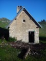
Fauge Shelter - Jasse du Play Shelter
 15.97 mi
+2,552 ft
-1,575 ft
9h 35
Difficult
Departure from Villard-de-Lans (Isère)
This is the longest stage of this traverse, but also the one that marks the entrance to the high plateaus.
Les Clôts – Refuge de la Soldanelle
 8.21 mi
+2,139 ft
-1,283 ft
5h 40
Moderate
Departure from Villard-de-Lans (Isère)
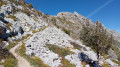
First stage of the hike. Set off from the Clôts car park towards the Refuge de la Soldanelle for an overnight stay.
Roybon Hut – La Peyrouse Hut
 10.88 mi
+2,182 ft
-1,719 ft
6h 55
Difficult
Departure from Villard-de-Lans (Isère)
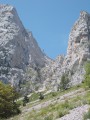
Day2 of a traverse of the Vercors via the balcony path.
Cabane de la Peyrouse - Cabane des Aiguillettes
 11.34 mi
+4,938 ft
-4,009 ft
9h 30
Difficult
Departure from Saint-Andéol (Isère) (Isère)
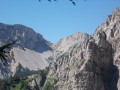
Day3 of our traverse: setting off from the Cabane de la Peyrouse to reach Gresse en Vercors. We go round the Grand Veymond to climb back up onto the plateau via the Col des Bachassons (water), then stop at the Cabane de l’Aiguillette.
From the Jasse du Play to the Baraque du Pison
 9.47 mi
+735 ft
-928 ft
5h 00
Moderate
Departure from Gresse-en-Vercors (Isère)
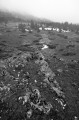
The second stage of the Vercors crossing. Less elevation gain than the previous day, but still a good distance. However, we’re now properly entering the Vercors plateau, and a map, a compass and a good sense of direction are essential, especially when it’s foggy!