La Clue du Chaudan

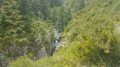
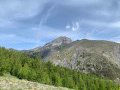
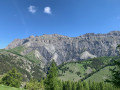
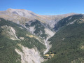
A lovely, short walk offering access to the Clue (gorges) du Chaudan whilst providing a lovely view over the valley. The climb is a bit steep but doesn’t last long.

Details

n°23590140
Creation:
Last update:
Last review:
  • Walking
    Activity: Walking
  • ↔
    Distance: 2.61 mi
  • ◔
    Average duration: 1h 50 
  • ▲
    Difficulty: Easy

  • ⚐
    Back to start: Yes
  • ↗
    Ascent: + 768 ft
  • ↘
    Descent: - 768 ft

  • ▲
    Highest point: 4,865 ft
  • ▼
    Lowest point: 4,091 ft

Photos

Description of the walk

When ascending from Saint-Martin d’Entraunes, the start is at the car park at the entrance to Entraunes, on the left just before crossing the Var. When descending from Estenc, the car park is on the right just after crossing the Var on the way out of Entraunes

(S/E) From the car park, walk 100 m downhill to marker 256.

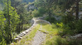
(1) Take the path leading uphill towards Clue du Chaudan. It is marked in red and white and forms part ofthe GR® 52A. When you reach marker 257, take the path uphill to the right as far as marker 258. At this junction, leave the tarmac road and take the wooded path on the left.

(2) At the viewpoint sign, take a short detour to the right to enjoy the view. Then continue uphill. At marker 259, carry on uphill towards the Clue du Chaudan.

(3) Just after a sort of bridge, you’ll reach a viewpoint offering a lovely view and a glimpse of the Clue du Chaudan. Continue along the path, which is now almost level.

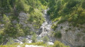
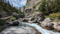
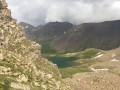
(4) Magnificent view of a series of pools and waterfalls where the Malevert flows into the Chaudan. Carry on to the bridge spanning the Chaudan.

(5) Once at the bridge, you can head down to the Chaudan. Then retrace your steps back to the viewpoint.

(3) Just before the viewpoint (and just before starting the descent), a path on the right allows you to walk down to the Chaudan. It begins with a few inconspicuous steps. Take care at certain points.
The return journey is then along the same path, downhill to the Entraunes car park (S/E).

Waypoints

  1. S/E : mi 0 - alt. 4,098 ft - Car park - Var (fleuve)
  2. 1 : mi 0.04 - alt. 4,104 ft - Marker 256
  3. 2 : mi 0.63 - alt. 4,531 ft - Viewpoint sign
  4. 3 : mi 1 - alt. 4,744 ft - Viewpoint
  5. 4 : mi 1.16 - alt. 4,852 ft - Waterfalls and pools
  6. 5 : mi 1.3 - alt. 4,846 ft - Bridge over the Chaudan
  7. S/E : mi 2.61 - alt. 4,098 ft - Car park

Always be cautious and plan ahead when you're outdoors. Visorando and the author of this route cannot be held responsible for any accidents occurring on this route.

The GR® and PR® markings are the intellectual property of the Fédération Française de Randonnée Pédestre.

Reviews and comments

4.2 / 5
Based on 2 reviews

Reliability of the description
3.5 / 5
Ease of following the route
5 / 5
Route interest
4 / 5
Bja
Bja

Overall rating : 4.3 / 5

Date of your route : Aug 30, 2024
Reliability of the description : ★★★★☆ Good
Ease of following the route : ★★★★★ Very good
Route interest : ★★★★☆ Good
Very busy route : Yes

Stop off at the viewpoint to enjoy the view over the village.

Machine-translated

calade
calade

Overall rating : 4 / 5

Date of your route : Aug 19, 2024
Reliability of the description : ★★★☆☆ Average
Ease of following the route : ★★★★★ Very good
Route interest : Not used / Not applicable
Very busy route : No

The route starts with a 23 per cent gradient!!!
And it keeps going up, up and up, with gradients of almost the same steepness… It’s no walk in the park, and the route climbs monotonously through the woods, rising 200 metres over less than 2 kilometres, with gradients of around 20 per cent or even 30 per cent in places…
Is that any reason to say it doesn’t last long?
We turned back.

Machine-translated

Other walks in the area

For more walks, use our search engine .

The GPS track and description are the property of this route's author. Please do not copy them without permission.