Country:

 City:
City:


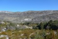
(S) Start: La Garussière.
(1) From La Garussière, take the track that climbs above the ranch (north-west) for over 2 km along the Combe Moutonne.
(2) At marker 142, carry on straight ahead (west) under the high-voltage power lines.
(3) At the pass between Point d’Areno and Pey Subert, head down to the right towards Coursegoules
(north-west). The track turns into a road.
(4) After marker 150, take the D2 on the right (north-west).
(5) Then cross the River La Cagne (north) to reach the village of Coursegoules via the D8.
(6) Head back down from the village via the same route and walk back up to marker 150.
(7) Head straight on (south-west) towards the Garavagne woods, then turn right at marker 151.
(8) A slightly steep and technical climb above the Bois de Garavagne before reaching a flat section which descends towards marker 152 (south-west).
(9) Turn left (south-east) onto the track towards Saint-Barnabé (follow the yellow markings).
(10) Descend to the left before crossing a gas pipeline and heading into the woodland opposite, followed by a fairly steep climb towards marker 153.
(11) Continue left (east) along the track leading to the Saint-Barnabé plateau.
(12) At marker 155, head down to the right (south) across the plateau towards the Puy de Tourettes via theGR®51.
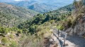
(13) Take in the view of the Gorges du Loup and the sea in the distance, then head off to the left (east) along the red-earth track which leads back to the car park.
(14) Continue to the right (south-east) along the same dirt track.
(15) Walk to and from the hamlet of Saint-Barnabé via the road.
(16) Join the D2 via the D302.
(17) At the pony club, turn left (north) to return to the starting point at La Garussière.


 Visorando Member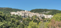

 Easy
Easy