


Refine your search for walks in Col de Roue (Coll de la Rua)
Col de Roue (Coll de la Rua) walks


 The Sant-Guillem Refuge via Coll de Rua - Cortal d'Allosat from La Llau
 Visorando Member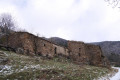
 6.94 mi
 +1,631 ft
 -1,654 ft
 4h 35
4h 35
 Moderate
 Departure from Le Tech (Pyrénées-Orientales)
A hike in the Haut Vallespir along a small road, forest tracks and a PR® trail.The route takes in beautiful pastures, a sheepfold, the Sant Guillem mountain hut and chapel, and an arboretum.See the section ‘During the hike or nearby’.This hike is the shorter version of my hike ‘The St-Guillem refuge via the Coll de Rua and the Estanyol from La Llau’
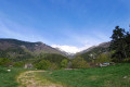
Coll de la Rua – Font Brigader – Sant Guillem Refuge – Cortal Allosat
 10.78 mi
+2,785 ft
-2,789 ft
7h 25
10.78 mi
+2,785 ft
-2,789 ft
7h 25
 Difficult
Departure from Montferrer (Pyrénées-Orientales)
Difficult
Departure from Montferrer (Pyrénées-Orientales)
A variation on my previously published hike. It allows you to start higher up, passing by the Font del Brigader and the Coll de l’Estanyol. From the Sant Guillem Refuge: a return route via the semi-underground sheepfold, which is nearly sixty metres long. Beautiful scenery all along the way and lovely spots for breaks. A warm welcome at the refuge.
⚠️ Warning: observed on 3 September 2026 => The track from Coll de la Rua (S/E) to the Atri del Brigarder (2) has not been cleared. Following several storms, a large number of fir trees are completely blocking the track as soon as it enters the forest. => This circular route cannot be completed until further notice.
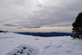
Coll de la Rua, from Estanyol – El Brigader – Pla de Rodes – Sant Guillem
 10.45 mi
+2,930 ft
-2,930 ft
7h 20
Difficult
Departure from Le Tech (Pyrénées-Orientales)
10.45 mi
+2,930 ft
-2,930 ft
7h 20
Difficult
Departure from Le Tech (Pyrénées-Orientales)
From La Llau, the ascent via the Coll de la Roua, the Haut Vallespir State Forest, La Fontaine and the Abri del Brigader is steady. After that, the climb is steep until you reach the Pla de Rodes and the Coll de l’Estanyol, where there are still large areas of active pastureland. Finally, the last climb from the Coll de l’Estanyol is magnificent. This is followed by the descent to the Sant-Guillem refuge and chapel, nestled in a beautiful pasture.
⚠️ Warning: observed on 3 September 2026 => The track from the Coll de la Rua (3) to the Abri del Brigader (6) has not been cleared. Following a series of storms, a large number of fir trees are completely blocking the track as soon as it enters the forest. => This circular route cannot be completed until further notice.
Walks near Col de Roue (Coll de la Rua)
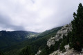
The Sant Guillem refuge via the Coll de la Rua - La Soca - l'Estanyol
 9.23 mi
+3,323 ft
-2,041 ft
7h 10
Difficult
Departure from Le Tech (Pyrénées-Orientales)
9.23 mi
+3,323 ft
-2,041 ft
7h 10
Difficult
Departure from Le Tech (Pyrénées-Orientales)
First day of: Two days exploring the Sant Guillem Refuge, including the ascent to the Sant Guillem Refuge.Do not underestimate this day. The estimated time is accurate.From the La Llau hikers’ car park, head up to the Coll de la Rua.Continue along a narrow grassy track to the shelter and the Font del Brigadier.Then climb up a very steep path to La Soca.Then head for the Coll de l’Estanyol.Further on, begin a lovely descent to the Sant Guillem Refuge.Vast landscapes on this first day of your exploratory hike.
⚠️ Warning: observed on 3 September 2026 => The track from Coll de la Rua (3) to the Abri del Brigader (4) has not been cleared. Following a series of storms, a large number of fir trees are completely blocking the track as soon as you enter the forest. => This section cannot be completed until further notice. This section from (3) can be adapted by using one of my walks: The Sant-Guillem Refuge via Coll de Rua – Cortal d’Allosat from La Llau
Refuge Sant Guillem - Chemin d'els Troncassers - Puig Sarraïns - La Llau
 9.33 mi
+1,847 ft
-3,104 ft
5h 55
Moderate
Departure from Le Tech (Pyrénées-Orientales)
9.33 mi
+1,847 ft
-3,104 ft
5h 55
Moderate
Departure from Le Tech (Pyrénées-Orientales)
Second day of: Two days of discovery at the Sant Guillem Refuge, from the Sant Guillem Refuge.Between (8) and (12), a GPX track is strongly recommended or a very good sense of direction, despite the signposting and cairns being in very good condition. Observed at the end of July 2023.Coll de Serre Vernet via a magnificent balcony path in very good condition. The same applies to Puig dels Sarraïns.Return to the refuge via a beautiful path, then pleasant tracks through the woods.After a break at the refuge, return to the car park at La Llau via the usual route.
Sant Guillem to Prats-de-Mollo via Serre Vernet - Comella - Lloses - Miracle
9.45 mi
+1,775 ft
-3,609 ft
5h 55
Moderate
Departure from Le Tech (Pyrénées-Orientales)
Thissecond stage, almost entirely in the forest, is therefore possible in summer, setting off early.Discovery hike along marked paths, little or not used, requiring a sense of direction and the GPX track. Beautiful places to stop and enjoy the scenery.
Prats-de-Mollo to Sant Guillem via Puig Fabra - Les Sarraïns - Serre Vernet
9.38 mi
+4,183 ft
-2,326 ft
7h 55
Difficult
Departure from Prats-de-Mollo-la-Preste (Pyrénées-Orientales)
Thisfirst stage, almost entirely in the forest, is therefore possible in summer, if you set off early. A challenging hike with 1,275 metres of elevation gain on marked trails that are rarely used, requiring a good sense of direction and the GPX track.There are some beautiful spots to stop and enjoy the scenery. The highest point (altitude 1,830 m) at Puig dels Sarraïns is a perfect place to stop for lunch, for example.
From the Batère Refuge to the Sant-Guillem Refuge
 10.44 mi
+3,346 ft
-3,898 ft
7h 45
Difficult
Departure from Corsavy (Pyrénées-Orientales)
10.44 mi
+3,346 ft
-3,898 ft
7h 45
Difficult
Departure from Corsavy (Pyrénées-Orientales)
Second stage of the clockwise Tour du Canigou in 8 days.A fairly long hike that starts with a descent.This route follows old paths connecting pastures and valleys.
Lamanère to Notre Dame du Coral
 Association / Club / Walk leader2.48 mi
+1,115 ft
-105 ft
2h 05
Moderate
Departure from Lamanère (Pyrénées-Orientales)
Association / Club / Walk leader2.48 mi
+1,115 ft
-105 ft
2h 05
Moderate
Departure from Lamanère (Pyrénées-Orientales)
A lovely walk up through the forest to the Ermitage de Notre Dame du Coral followed by lunch at the Auberge and the same walk back down to Lamanère.
Pic du Canigou - Los Masos at the Refuge des Cortalets
4.01 mi
+3,825 ft
-157 ft
5h 10
Difficult
Departure from Valmanya (Pyrénées-Orientales)
First stage of this two-day route around Pic du Canigou.
From the Refuge des Conques to the Refuge de Mariailles
 9.37 mi
+2,628 ft
-2,352 ft
6h 35
Difficult
Departure from Prats-de-Mollo-la-Preste (Pyrénées-Orientales)
9.37 mi
+2,628 ft
-2,352 ft
6h 35
Difficult
Departure from Prats-de-Mollo-la-Preste (Pyrénées-Orientales)
First stage of the: Loop from the Refuge des Conques to the Refuge de Mariailles
Mountain hike with beautiful scenery, particularly from Coll de Bise to Collada de la Roqueta.
Classified as difficult: exposed, steep slopes in places. See practical information.
Allow 6 hours of sustained walking.
Following the River Tech from Amélie-les-Bains to Arles-sur-Tech
3.38 mi
+358 ft
-190 ft
1h 50
Moderate
Departure from Amélie-les-Bains-Palalda (Pyrénées-Orientales)
Following the GRP® Ronde du Canigou trail, you’ll follow the River Tech. There are fords along the route, as well as wash houses and chapels. You’ll enjoy views of Fort les Bains and Annibal Waterfall. You’ll find a few picnic tables along the way, and the walk ends at Arles-sur-Tech Abbey.
Refuge des Cortalets - Refuge de Mariailles via Canigou
 8.50 mi
+2,425 ft
-3,832 ft
6h 00
Difficult
Departure from Taurinya (Pyrénées-Orientales)
8.50 mi
+2,425 ft
-3,832 ft
6h 00
Difficult
Departure from Taurinya (Pyrénées-Orientales)
This day is devoted to the ascent of Pic du Canigou from the Refuge des Cortalets, and the descent via the chimney to the Refuge Arago, then to Mariailles, the starting point of the hike.