Tour and ascent of the Alpion

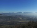
Ascent to Alpion, from where you can see the summit of Mont Ventoux on a clear day, followed by a circular route.

Details

n°1642637
Creation:
Last update:
Last review:
  • Walking
    Activity: Walking
  • ↔
    Distance: 3.97 mi
  • ◔
    Average duration: 2h 35 
  • ▲
    Difficulty: Easy

  • ⚐
    Back to start: Yes
  • ↗
    Ascent: + 837 ft
  • ↘
    Descent: - 820 ft

  • ▲
    Highest point: 1,289 ft
  • ▼
    Lowest point: 581 ft

Description of the walk

Park at the side of the village road a few metres past the Croix de Boussier.

(S/E) Take the track heading due north and continue to a junction of tracks near a water reservoir. Go round the Alpion on the left.

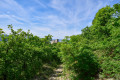
(1) Carry on straight ahead, then turn left. Follow the yellow PR® markings and ignore any side paths. Stay on this track, skirting the summit of the Alpion to the north. You will then come to a crossroads of tracks.

(2) At the fork in the road, continue uphill along the right-hand branch. Head south and reach a crossroads.

(3) Turn right onto a path that winds through the oak trees to reach a junction at the foot of the Albion.

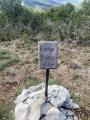
(4) Turn right and climb to the summit of the Alpion, marked by a triangulation point.

(5) Turn back to return to the previous junction.

(4) Turn left to head back down, following the route in the opposite direction to the way out, until you reach the crossroads.

(3) Take the track on the right.

(6) At the end, follow a PR®-marked path to the right. You’ll rejoin the tarmac road at the cemetery and continue along it.

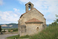
(7) At the junction, veer left. Immediately afterwards, go round the church on the right. Then turn right, cross a road and carry on straight ahead.

(8) At the T-junction, turn right. At the Fork in the road that appears immediately afterwards, keep left. Follow the road, which winds a few times, back to the starting point (S/E).

Waypoints

  1. S/E : mi 0 - alt. 614 ft - Croix de Boussier car park
  2. 1 : mi 0.07 - alt. 676 ft - Water reservoir
  3. 2 : mi 1.41 - alt. 751 ft - Fork in the road
  4. 3 : mi 1.89 - alt. 1,004 ft - Crossroads
  5. 4 : mi 2.08 - alt. 1,204 ft - Junction
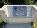
  6. 5 : mi 2.35 - alt. 1,276 ft - Alpion (396 m)
  7. 6 : mi 3.07 - alt. 912 ft - T-junction
  8. 7 : mi 3.51 - alt. 633 ft - Junction - Église Saint-François-Régis (Lachamp)
  9. 8 : mi 3.59 - alt. 591 ft - T-junction
  10. S/E : mi 3.97 - alt. 630 ft - Croix de Boussier car park

Notes

There are no water points along the route.

Worth a visit

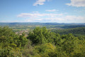
(5) Summit of the Alpion: looking south-east, you can see Mont Ventoux in the distance and, to the west, the Ardèche Mountains.

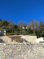
(7) Lachamp: wander through the narrow streets to admire the old church and the paved slanting streets with their arched passageways.

Always be cautious and plan ahead when you're outdoors. Visorando and the author of this route cannot be held responsible for any accidents occurring on this route.

The GR® and PR® markings are the intellectual property of the Fédération Française de Randonnée Pédestre.

Reviews and comments

4 / 5
Based on 2 reviews

Reliability of the description
4.5 / 5
Ease of following the route
4.5 / 5
Route interest
3 / 5
wh 26
wh 26

The Dfci paths were about thirty years old; they had become overgrown due to a lack of maintenance, which had turned them into lovely wooded paths. This winter they were completely resurfaced (since my walk was published), which means they’ve lost all their charm.

Machine-translated

Sandrine.B
Sandrine.B

Overall rating : 4 / 5

Date of your route : Mar 31, 2026
Reliability of the description : ★★★★★ Very good
Ease of following the route : ★★★★★ Very good
Route interest : ★★☆☆☆ Disappointing
Very busy route : No

I was a bit disappointed with this walk – nothing but wide tracks, apart from a single path leading up to the summit and back down again. With all the trees, there weren’t really any views, just a small patch at the top. The village itself, however, is magnificent.
It was a weekday, so I only came across one person; I asked him about it and he told me it’s quite popular for walking dogs.

Machine-translated

Claire-Lis
Claire-Lis

Overall rating : 4 / 5

Date of your route : Oct 07, 2025
Reliability of the description : ★★★★☆ Good
Ease of following the route : ★★★★☆ Good
Route interest : ★★★★☆ Good
Very busy route : No

A lovely walk that's not too long. Once you reach the summit, you have to walk back a bit, and the grass was quite tall there. Not all walkers make it to the summit. Thank you

Machine-translated

Other walks in the area

For more walks, use our search engine .

The GPS track and description are the property of this route's author. Please do not copy them without permission.