Refine your search for walks in Col de Pelouse
Col de Pelouse walks


 Cime Gardoria and Pointe de Paumont
 Tourism professional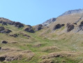
 11.66 mi
 +5,230 ft
 -5,226 ft
 9h 55
9h 55
 Very difficult
 Departure from Avrieux (Savoie)
On the Italian border, two twin peaks lie deep within a wild valley, the sort that the Maurienne region keeps well hidden. The challenge lies in the length of the hike and the elevation gain, but the reward awaits at the very top.
Walks near Col de Pelouse
 The Sentier des Sources snowshoe trail from the cable car
 Visorando Member1.97 mi
+236 ft
-801 ft
1.5 hrs
Visorando Member1.97 mi
+236 ft
-801 ft
1.5 hrs
 Easy
Departure from Villarodin-Bourget (Savoie)
Easy
Departure from Villarodin-Bourget (Savoie)
A lovely, easy walk in the peaceful forest, starting at the top of the gondola lift and returning by chairlift.
From the Bramanette Refuge to the Ambin Refuge
 Association / Club / Walk leader
 8.50 mi
+4,186 ft
-3,665 ft
7h 35
8.50 mi
+4,186 ft
-3,665 ft
7h 35
 Difficult
Departure from Bramans (Savoie)
Difficult
Departure from Bramans (Savoie)
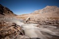
A beautiful route, sometimes off the beaten track or on poorly marked paths. From the top of the passes, you can see both the peaks of the Vanoise (the Dent Parachée) and the Barre des Ecrins.This hike follows on from the "Le refuge de Bramanette" route.
From Valfréjus to Modane via the GR®5
 4.40 mi
+10 ft
-1,654 ft
2h 00
Easy
Departure from Modane (Savoie)
4.40 mi
+10 ft
-1,654 ft
2h 00
Easy
Departure from Modane (Savoie)
This is an easy, downhill hike from Valfréjus to Modane. The route follows the GR®5. It is a gentle slope, passing near the pretty Notre-Dame du Charmaix chapel, and there are many oratories in different styles along the way. Take the shuttle bus between Modane station and Valfréjus, but be sure to check the timetable.
Valfrejus - Lac des Méandes
8.66 mi
+4,816 ft
-1,306 ft
8h 10
Difficult
Departure from Modane (Savoie)
A challenging hike starting from Valfréjus resort, the first stage to reach Lac des Méandes (below Col des Méandes). The view is incredible all along the route.Be careful, there is very little shade and at an altitude of 2,700 metres, it is always a little chilly.
Valfréjus – Thabor mountain hut
 3.37 mi
+1,952 ft
-0 ft
3h 15
3.37 mi
+1,952 ft
-0 ft
3h 15
 Moderate
Departure from Modane (Savoie)
Moderate
Departure from Modane (Savoie)
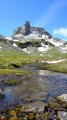
An easy route to reach the Thabor refuge and spend a good night’s sleep before heading over to Mont Thabor and the Chalets de Laval.
This section is accessible by mountain bike.
Valfréjus – Alpe du Lauzet
22.33 mi
+8,278 ft
-8,930 ft
3 days
Difficult
Departure from Modane (Savoie)
A journey between the Maurienne and the Guisane Valley.
Chatalamia–Aussois traverse via the Col du Barbier
 6.01 mi
+3,658 ft
-2,700 ft
4 hrs
Very difficult
Departure from Villarodin-Bourget (Savoie)
6.01 mi
+3,658 ft
-2,700 ft
4 hrs
Very difficult
Departure from Villarodin-Bourget (Savoie)
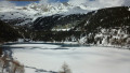
From the Chatalamia rock, you’ll be able to see the female ibex and their kids; the chamois aren’t far away. After stopping to look at the cup-marked stone, you’ll continue the ascent through the forest, emerging onto the balcony path that leads to Le Barbier and then to the pass of the same name. During the descent to Le Plan d’Aval, you’ll be able to admire the resort of Aussois with its ski runs, but above all the magnificent panorama of the Dent Parrachée and Le Plan d’Aval.
The Refuge de Bramanette
 2.24 mi
+1,575 ft
-138 ft
2h 25
Moderate
Departure from Bramans (Savoie)
2.24 mi
+1,575 ft
-138 ft
2h 25
Moderate
Departure from Bramans (Savoie)
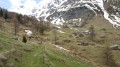
This short hike is the starting point for a magnificent three-day trek between Haute Maurienne and Val de Suze (Italy), with beautiful lakes and numerous small glaciers.But the setting and the welcome at the Refuge de Bramanette are such that they alone justify spending the night there and descending back down to the valley the next day!
From the Ambin Refuge to Le Planey
 11.65 mi
+3,363 ft
-5,233 ft
8h 15
Difficult
Departure from Bramans (Savoie)
11.65 mi
+3,363 ft
-5,233 ft
8h 15
Difficult
Departure from Bramans (Savoie)
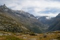
A very beautiful route amongst glaciers and lakes, which crosses the Italian border (beautiful view of the Val di Suza) and returns to France via the Col Clapier, which Hannibal and his elephants probably passed through.
This route follows on from the hike “From the Bramanette Refuge to the Ambin Refuge”, but can easily be done starting from the Ambin Refuge alone.