Country:

 City:
City:


Access via the Maurienne; after Modane, head towards Val Cenis. After Villarodin, take a small road on the right which leads to the Chapelle Sainte-Anne via numerous hairpin bends and stony sections. Above the chapel, take the path that descends to the 1759-metre mark, the start of the hike. Park without obstructing forestry workers during timber extraction. If timber extraction is taking place, park further back by the side of the road.
(S/E) Take the track that climbs south-southeast towards l’Eurette.
(1) Continue along the track which goes round the chalets on the right. It becomes a footpath a little further up. Take care – the slopes on the left are vertiginous. Carry on to the dam, which you’ll reach after a short descent.
(2) Cross over and head back up the opposite side.
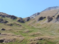
(3) Shortly afterwards, at a junction on the edge of the Montonaz forest, take a path that heads right into the Vallon; it is not always very visible. Between the Eulètes chalets, watch out for dogs. Pass close to the ruins of the Chalets du Vallon and reach the Vallon.
(4) Head towards the Col de Pelouse. The slope begins to steepen as the track disappears, replaced by animal tracks.
(5) Then keep to the left and reach the stream flowing down from Lac du Vallon.
(6) Further up, you’ll find a track leading to the Col de Pelouse.
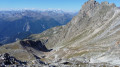
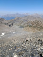
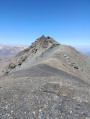
The view is magnificent, overlooking Italy and Lac de Rochemolles. The Aiguille de Scolette is nearby, as is the Belle Plinier. Head right along the ridge. The start of the climb is easy; to the left, on a promontory, around twenty ibex may be lounging about and may not move. Continue along the ridge, which turns from south-west to north-west to reach the secondary summit of Cima Gardoria. Avoid the secondary summit by staying at the base of the rocks on the north side. Here, the slope is not too steep. Reach the summit of Cima Gardoria.
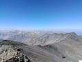
(8) The view is magnificent, taking in the Vanoise, Italy, the Écrins and all the surrounding peaks. Continue along the ridge towards the Pointe de Paumont, which turns out to be further away than expected. Cross a sandy pass and resume the ascent along the ridge or on the northern side to the Pointe de Paumont.
(9) The landscape is practically the same as before; you never tire of it. Now it’s time to head back down. Descend the ridge towards the south-south-west, taking great care, and, once you reach 3,100 metres, look out for Lac des Sables and switch to the north-facing slope.
(10) It’s good crampon terrain. You’ll arrive near a cairn.
(11) Veer slightly to the right to find the best slopes, return to the vegetation, pass to the left of the point with an altitude of 2,714, then to the right of the point with an altitude of 2,587.
(12) From here, head east then south-east up steep grassy gullies, following animal tracks, to reach the Plan Fleuri, which you cross in a north-easterly direction to rejoin the ascent route.
(5) Return to the left, following the route you took on the way up in reverse, to reach the car park (S/E).
 Visorando Member
 Moderate
 Difficult
  Association / Club / Walk leader