


Refine your search for walks in Col de Napremont (2150m)
Col de Napremont (2150m) walks


 Napremont
 Visorando Member
 4.63 mi
 +2,523 ft
 -2,520 ft
 4h 20
4h 20
 Difficult
 Departure from Pralognan-la-Vanoise (Savoie)
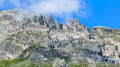
Beautiful promontory facing Pralognan, with stunning views of the entire area, including the Portetta breach and the Aiguille d'Août, which dominate the route. Unfortunately, this is now a round trip since the path (still shown on the map) through the Bois de Chollière is closed. (2008, order renewed every year since then, given the danger).
Le Napremont
 6.34 mi
+2,526 ft
-2,539 ft
5h 05
6.34 mi
+2,526 ft
-2,539 ft
5h 05
 Moderate
Departure from Pralognan-la-Vanoise (Savoie)
Moderate
Departure from Pralognan-la-Vanoise (Savoie)
This circular route offers beautiful views and 360° panoramas of the surrounding area and peaks. In terms of difficulty: there is a difference in altitude in the undergrowth; there is a passage through a chimney, but this has been made easier by the installation of steps and a handrail.
A trail with beautiful flora dominated by the Dents de Portetta and the Aiguille d'Août.
A pleasant descent in the sunshine before returning to the undergrowth. A very beautiful route, even in hot weather.
Walks near Col de Napremont (2150m)
Pralognan - Leisse Refuge
11.34 mi
+4,908 ft
-1,391 ft
9h 30
Difficult
Departure from Pralognan-la-Vanoise (Savoie)
Day1 of the Grande Casse circular route, from Pralognan to the Refuge de la Leisse, passing close to the impressive Grande Casse, all in a wild setting dotted with lakes.
Refuge de la Vallette via the Pas de l’Âne
 5.80 mi
+3,789 ft
-2,989 ft
6h 00
Difficult
Departure from Pralognan-la-Vanoise (Savoie)
5.80 mi
+3,789 ft
-2,989 ft
6h 00
Difficult
Departure from Pralognan-la-Vanoise (Savoie)
A challenging hike that passes through the Cirque du Petit Marchet, crosses the Roc du Tambour to reach the Refuge de la Vallette and ends at the hamlet of Le Prioux.
Tip: only undertake this hike when there is no snow and in dry weather.
The Col de Leschaux circular route
 5.42 mi
+2,113 ft
-3,996 ft
4h 20
Moderate
Departure from Pralognan-la-Vanoise (Savoie)
5.42 mi
+2,113 ft
-3,996 ft
4h 20
Moderate
Departure from Pralognan-la-Vanoise (Savoie)
An exposed hike requiring caution, offering a stunning view over the entire southern sector of Pralognan-la-Vanoise.
From Les Fontanettes to Les Prioux via the Col du Grand Marchet and La Valette
7.07 mi
+4,245 ft
-4,045 ft
6h 55
Difficult
Departure from Pralognan-la-Vanoise (Savoie)
A very beautiful high-altitude hike, a bit challenging but probably one of the most stunning. It passes through several little-visited cirques and offers high-mountain views throughout the route.
This is a one-way hike, so you’ll need to organise your return journey (see practical information).
Valette Refuge - Col de la Vanoise Refuge
 7.67 mi
+3,901 ft
-4,154 ft
6h 55
Difficult
Departure from Pralognan-la-Vanoise (Savoie)
7.67 mi
+3,901 ft
-4,154 ft
6h 55
Difficult
Departure from Pralognan-la-Vanoise (Savoie)
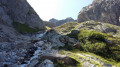
The 4th stage of this route, which will take you from the Valette refuge to the Col de la Vanoise refuge. One of the most challenging stages, featuring the ascent of the Col du Grand Marchet and its highly technical descent.
A balcony-like route above Pralognan, the Petit Marchet, the Grand Marchet cirque, and the pass of the same name, leading to the Lac des Vaches and its ford, with the Grande Casse and the Col de La Vanoise refuge in the background. A technical stage, but one of the most beautiful.
From the hamlet of Les Prioux to Lac du Rateau
 6.02 mi
+4,019 ft
-1,617 ft
6h 15
Difficult
Departure from Pralognan-la-Vanoise (Savoie)
6.02 mi
+4,019 ft
-1,617 ft
6h 15
Difficult
Departure from Pralognan-la-Vanoise (Savoie)
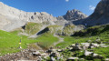
First day of a 4-day route in the Vanoise massif.
A very pleasant climb along the ‘100-bend’ path to reach the summit of the Petit Mont Blanc and its orientation table. A lovely end to the day in the Combe du Rateau.
From the Lacs Merlet refuge to the Péclet-Polset refuge
 9.96 mi
+3,438 ft
-3,232 ft
7h 35
Difficult
Departure from Saint-Bon-Tarentaise (Savoie)
9.96 mi
+3,438 ft
-3,232 ft
7h 35
Difficult
Departure from Saint-Bon-Tarentaise (Savoie)
After the long stages of the previous days, this one is more leisurely.The climb to the Col du Soufre is gradual until you reach the edge of the Gébroulaz glacier.The beauty of the Col du Soufre (the day’s highest point), with its ochre and white colours, more than makes up for the day’s efforts.
Refuge des Lacs Merlets – Refuge de la Valette
 10.22 mi
+4,514 ft
-3,917 ft
8 hrs
10.22 mi
+4,514 ft
-3,917 ft
8 hrs
 Very difficult
Departure from Saint-Bon-Tarentaise (Savoie)
Very difficult
Departure from Saint-Bon-Tarentaise (Savoie)
This third stage will take you from the Refuge des Lacs Merlets to the Refuge de la Valette.
This stage is undoubtedly the most challenging, with 1,400 metres of elevation gain. The ascent of the Petit Mont Blanc, a difficult descent to Les Prioux, followed by another beautiful and long climb (900m of elevation gain) to the Col de la Valette and its refuge, will make for a memorable day.
From Chalet Clou to Les Prioux
 9.11 mi
+2,710 ft
-4,144 ft
6h 35
Difficult
Departure from Pralognan-la-Vanoise (Savoie)
9.11 mi
+2,710 ft
-4,144 ft
6h 35
Difficult
Departure from Pralognan-la-Vanoise (Savoie)
Fourth day of a four-day route in the Vanoise massif.
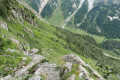
A very beautiful mountain route passing through the Petit and Grand Cirques du Marchet.
From Lac du Rateau to the Refuge du Saut
 7.95 mi
+2,743 ft
-3,753 ft
8 hrs
Very difficult
Departure from Saint-Bon-Tarentaise (Savoie)
7.95 mi
+2,743 ft
-3,753 ft
8 hrs
Very difficult
Departure from Saint-Bon-Tarentaise (Savoie)
Second day of hiking on a 4-day route in the Vanoise massif.
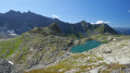
A wonderful mountain experience as you cross the Col du Rateau and the Passage des Eaux Noires, which are rarely visited. Views of Mont Blanc.