


Refine your search for walks in Col de la Pisse
Col de la Pisse walks


 Le Vieux Chaillol from Chaillol 1600
 Visorando Member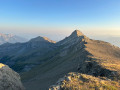
 14.63 mi
 +5,338 ft
 -5,338 ft
 8 hrs
8 hrs
 Very difficult
 Departure from Saint-Michel-de-Chaillol (Hautes-Alpes)
This is a long hike to reach the Pic du Vieux Chaillol (3,163 m), a landmark peak in the southern Hautes-Alpes landscape.
Please note that the elevation gain is only 1,530m and not 1,706m as stated on the information sheet.
Col de la Pisse from Chaillol 1600
 9.42 mi
+2,766 ft
-2,743 ft
6h 45
9.42 mi
+2,766 ft
-2,743 ft
6h 45
 Difficult
Departure from Saint-Michel-de-Chaillol (Hautes-Alpes)
Difficult
Departure from Saint-Michel-de-Chaillol (Hautes-Alpes)
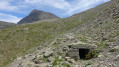
A hike mostly along a balcony path in a sort of cirque, before reaching the foot of the Vieux Chaillol with a lovely panorama. This hike also offers the chance to discover the remains of the Malcros Canal. A somewhat crazy project which, from 1881 to 1923, ensured the water supply to the valleys from a... glacier! Despite the elevation gain, the route involves ascending and descending fairly gentle and very even slopes.
Le Vieux Chaillol from Les Borels
 18.93 mi
+7,776 ft
-7,776 ft
15h 30
Very difficult
Departure from Champoléon (Hautes-Alpes)
18.93 mi
+7,776 ft
-7,776 ft
15h 30
Very difficult
Departure from Champoléon (Hautes-Alpes)
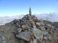
Overlooking the Champsaur valley and the southern Valgaudemar, the Vieux Chaillol offers a fantastic rocky setting and a dazzling panorama of a large group of mountains: Dévoluy, Vercors and Écrins. The view even extends as far as Mont Ventoux and the Lure mountain.
The ascent to the Col de Côte Longue is made from the east, starting from the Champoléon valley.
This hike is reserved for experienced and trained mountain hikers.
Walks near Col de la Pisse
From Chaillol 1600 to Chantaussel
 3.05 mi
+121 ft
-1,138 ft
1h 30
3.05 mi
+121 ft
-1,138 ft
1h 30
 Easy
Departure from Saint-Michel-de-Chaillol (Hautes-Alpes)
Easy
Departure from Saint-Michel-de-Chaillol (Hautes-Alpes)
A short walk, with very little uphill climb and no difficulty, starting from Chaillol 1600 to the hamlet of Chantaussel (municipality of Saint-Julien-en-Champsaur).
Round-trip walk: you’ll need at least two cars.
Up the Gap Canal: from Pont de Frappe to Les Ricous
 6.71 mi
+328 ft
-489 ft
3h 20
Easy
Departure from Chabottes (Hautes-Alpes)
6.71 mi
+328 ft
-489 ft
3h 20
Easy
Departure from Chabottes (Hautes-Alpes)
A lovely, idyllic walk with virtually no elevation gain, easy and shaded. Ideal for families. You can walk part of the route and turn back, or tackle it in short sections. Of course, it’s possible to do this walk in the opposite direction.
The canal is always covered, so you can’t see the water.
Please note that between the start and point 2 there is a steep descent through the woods.
Sebeyras Lakes – Les Prés de Lauplat
 7.56 mi
+3,369 ft
-3,970 ft
6h 25
Difficult
Departure from La Chapelle-en-Valgaudemar (Hautes-Alpes)
7.56 mi
+3,369 ft
-3,970 ft
6h 25
Difficult
Departure from La Chapelle-en-Valgaudemar (Hautes-Alpes)
This stage takes you from the Sebeyras Lakes to the Lauplat Meadows via the Col de Pétarel and the Col de la Béranne. The route then descends towards the hamlet of Navette and the Buchardet Waterfall, before a long climb along a more rugged path.
Lakes of Sebeyras - Le Lauvet
 11.28 mi
+5,371 ft
-6,191 ft
9h 50
Very difficult
Departure from La Chapelle-en-Valgaudemar (Hautes-Alpes)
11.28 mi
+5,371 ft
-6,191 ft
9h 50
Very difficult
Departure from La Chapelle-en-Valgaudemar (Hautes-Alpes)
From the Sebeyras Lakes, the route will first take you to the Col de Pétarel. From there, you will descend towards Saint-Maurice-en-Valgodemar. You will then follow the old transhumance paths to reach the Six Cabanes, then climb the Col de Menoux to Lauvet.
Les Prés de Lauplat – Les Naizets
 6.38 mi
+2,762 ft
-3,547 ft
5h 20
6.38 mi
+2,762 ft
-3,547 ft
5h 20
 Moderate
Departure from La Chapelle-en-Valgaudemar (Hautes-Alpes)
Moderate
Departure from La Chapelle-en-Valgaudemar (Hautes-Alpes)
This stage takes you from the Prés de Lauplat to the Naizets bivouac, passing through the village of La Chapelle-en-Valgaudémar. The route follows the Oulles du Diable before climbing via the GR®54, passing the Combefroide Waterfall to reach a grassy plateau.
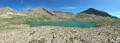
The six lakes of Orcières-Merlette, including Les Estaris
 4.13 mi
+299 ft
-1,447 ft
2h 10
Easy
Departure from Orcières (Hautes-Alpes)
4.13 mi
+299 ft
-1,447 ft
2h 10
Easy
Departure from Orcières (Hautes-Alpes)
This hike has been suitable for all ages since 2020. Using the chairlifts (Drouvet 1 and 2 for the outward journey and Roche Rousse for the return journey) makes it easy. The six large lakes are visited on the way down. A variant towards the Col de Freissinières is possible. The landscapes are magnificent, especially at the starting point at the top of Drouvet. The lakes are all very beautiful and diverse.
La Chapelle-en-Valgaudemar - Refuge des Souffles
 6.40 mi
+4,393 ft
-1,496 ft
7 hrs
Very difficult
Departure from La Chapelle-en-Valgaudemar (Hautes-Alpes)
6.40 mi
+4,393 ft
-1,496 ft
7 hrs
Very difficult
Departure from La Chapelle-en-Valgaudemar (Hautes-Alpes)
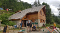
Thefirst stage begins with a variant ofthe GR® 54 and takes you to the Refuge des Souffles via the Col de Colombes, Lac Lautier and the Col des Clochettes, avoiding the route through Villar-Loubière.
A challenging route with a 1,400-metre climb and steep gradients right from the start. A good way to get your legs going for thefirst stage and a good warm-up for the rest of the route.
The scenery is already exceptional, promising some fabulous stages ahead.
A 13-day grand tour of the Parc des Ecrins via the GR® 54
 105.16 mi
+37,625 ft
-39,075 ft
13 days
Very difficult
Departure from La Chapelle-en-Valgaudemar (Hautes-Alpes)
105.16 mi
+37,625 ft
-39,075 ft
13 days
Very difficult
Departure from La Chapelle-en-Valgaudemar (Hautes-Alpes)
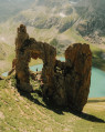
A very challenging 180 km route with 12,000 metres of elevation gain, requiring excellent physical fitness. Stages offering spectacular scenery, steep mountains, passes, wildlife, flora and colours. The most beautifulGR® route we have ever done. We completed the route in August, the ideal time to tackle the most difficult passes, which are likely to be snow-covered early in the season, such as La Muzelle, l’Aup Martin, the Pas de la Cavale, de la Valette, Vallonpierre and de La Vaurze.
From Roche Rousse to Prapic via the lakes of Orcières and Les Pisses
 7.85 mi
+978 ft
-3,373 ft
4h 30
Moderate
Departure from Orcières (Hautes-Alpes)
7.85 mi
+978 ft
-3,373 ft
4h 30
Moderate
Departure from Orcières (Hautes-Alpes)
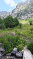
A magnificent hike taking you to discover the lakes of Orcières, Lac des Pisses and the pretty village of Prapic
Vallonpierre Refuge - La Chapelle-en-Valgaudemar
 8.45 mi
+112 ft
-3,999 ft
4h 00
Moderate
Departure from La Chapelle-en-Valgaudemar (Hautes-Alpes)
8.45 mi
+112 ft
-3,999 ft
4h 00
Moderate
Departure from La Chapelle-en-Valgaudemar (Hautes-Alpes)
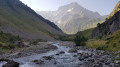
Here we are at the final stage of this 13-day route around the magnificent Écrins National Park. A downhill stage that takes you to La Chapelle-en-Valgaudemar, where this journey began 13 days earlier. A splendid start to the stage, all the way down to the glacial torrents. The panorama is breathtaking, surrounded by the most beautiful peaks of the southern part of the Écrins, already leaving us with a sense of nostalgia for the past 13 days. A route with no technical difficulty.