


Start from the CS-101 road, at the Val del Madriu bus stop. Paid parking.
Maiana Pass circular loop starting from Les Escaldes


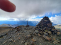
A lovely circular route passing through the Maiana Pass. The final climb up to the pass is quite challenging. Magnificent. Unobstructed views, high-altitude grasslands, marmots! A picturesque descent towards the Perafita refuge, followed by the final descent alongside the Riu de Claror i Perafita in a mountain-western setting.
Details
Creation:
Last update:
Last review:
–
–
-
 Activity: Walking
 -
 Distance: 8.93 mi
 -
 Average duration: 7h 30
 -
 Difficulty: Difficult
 -
-
 Back to start: Yes
 -
 Ascent: + 3,911 ft
 -
 Descent: - 3,911 ft
 -
-
 Highest point: 7,992 ft
 -
 Lowest point: 4,081 ft
-
 Country:
Andorra
Country:
Andorra
-
 Area: Pyrenees
 -
 City:
Escaldes-Engordany
City:
Escaldes-Engordany -
 Start/End: N 42.504026° / E 1.55129°
 -


 Hour-by-hour weather
Description of the walk
Waypoints
- S/E : mi 0 - alt. 4,081 ft - Val del Madriu
- 1 : mi 0.72 - alt. 4,820 ft - Junction of the circular route – Estremesaigües
- 2 : mi 3.84 - alt. 6,706 ft - Junction
- 3 : mi 5.11 - alt. 7,989 ft - Colle de la Maiana (2426 m)
- 4 : mi 6.23 - alt. 7,224 ft - Junction - Refugi de Perafita
- S/E : mi 8.93 - alt. 4,081 ft - Val del Madriu
Notes
Make sure you take plenty of water with you; we haven’t spotted any visible sources of drinking water along the route.
Other walks in the area
Monturull ridge to Coma Extremera peak via the Madriu Valley
 Visorando Member17.10 mi
+7,231 ft
-7,224 ft
14h 10
Visorando Member17.10 mi
+7,231 ft
-7,224 ft
14h 10
 Average
 Departure from Escaldes-Engordany (Andorra)
You have to be curious enough to venture far south of the Principality of Andorra to have heard of the Monturull peak, the Tossal Bovinar or the Colilla peak; names that are not as famous as the great peaks of the West. However, these peaks are well over 2,700 metres, even reaching 2,800 metres, and are located in eastern Catalonia.
The ridge on today's itinerary is located just south of the Principality of Andorra. It marks the southern border with Spain. The southern slope of this ridge is gentle and accessible, while the northern slope is made up of ravines and steep cliffs. Naturally, the southern route is the most popular, but I decided to tackle this journey by looping around the north. I will therefore start this loop from the Madriu Valley in Andorra.
Prat Primer path and the Caülla forest
 4.99 mi
+3,084 ft
-3,084 ft
5h 00
Average
Departure from Escaldes-Engordany (Andorra)
4.99 mi
+3,084 ft
-3,084 ft
5h 00
Average
Departure from Escaldes-Engordany (Andorra)
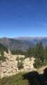
This route offers the chance to discover Andorra’s high-mountain landscape and vegetation and to visit one of the Principality’s many self-catering mountain huts.
The Pic de Casamanya from the Col d'Ordino
4.55 mi
+2,415 ft
-2,415 ft
4h 10
Average
Departure from Ordino (Andorra)
A different side of Andorra if you want to get away from the shopping centres!
A demanding hike (it’s a tough climb) without being difficult, but offering sublime 360° views of the surrounding Pyrenean peaks and valleys.
At the start and finish, in the shade of mountain pines, and if you’re hiking in late August, there are raspberries to enjoy all along the way.
Cami del Toll Bullidor
1.10 mi
+387 ft
-361 ft
0h 50
 Easy
Departure from Canillo (Andorra)
Easy
Departure from Canillo (Andorra)
A very short, easy hike to see a beautiful waterfall. There is only one path and it is very easy to follow.
Ensagents Refuge and Lakes
 6.08 mi
+2,192 ft
-2,192 ft
4h 40
Average
Departure from Encamp (Andorra)
6.08 mi
+2,192 ft
-2,192 ft
4h 40
Average
Departure from Encamp (Andorra)
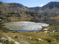
A fairly demanding hike through mountain pines and rhododendrons to reach the refuge and then the Étangs d'Ensagents, set in a predominantly mineral environment. The calm, the omnipresent water and the beauty of the landscapes more than compensate for the considerable effort required to negotiate a few very steep passages. A breath of fresh air just a few kilometres from the consumer frenzy of Pas de la Case.
From Sant Julia de Loria to the Perafita Refuge
 11.95 mi
+6,309 ft
-2,064 ft
10 hrs
11.95 mi
+6,309 ft
-2,064 ft
10 hrs
 Very difficult
Departure from Sant Julià de Lòria (Andorra)
Very difficult
Departure from Sant Julià de Lòria (Andorra)
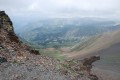
Set amongst forests and mountain pastures, this stage will take you to the Perafita Refuge, the perfect spot to rest.
La Volta a Andorra – a variation of the GRP® to avoid Bony de la Pica
 4.70 mi
+3 ft
-2,838 ft
2h 10
Easy
Departure from les Valls de Valira (Spain)
4.70 mi
+3 ft
-2,838 ft
2h 10
Easy
Departure from les Valls de Valira (Spain)
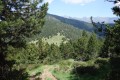
If you suffer from vertigo and wish to walk the section from the Coma Pedrosa Refuge to Sant Julia de Loria whilst avoiding the vertiginous stretch at Bony de la Pica and its difficult iron-railed descent, follow this alternative route from the Col de Montaner.
Pic de L'Estanyo from Canillo (Andorra)
 Association / Club / Walk leader
 11.32 mi
+4,754 ft
-4,760 ft
9h 20
Difficult
Departure from Canillo (Andorra)
11.32 mi
+4,754 ft
-4,760 ft
9h 20
Difficult
Departure from Canillo (Andorra)
Pic de l'Estanyo is the second highest peak in Andorra (2,915 m). The view of the other peaks in Andorra is magnificent. It is accessible from Sorteny or Ransol for the most well-known routes. It can also be accessed from Canillo, which is the subject of this guide.
This is a long hike with a significant elevation gain. The trail is generally well marked up to Estany Gran, then you have to follow the cairns and the trail where it exists.
For more walks, use our search engine .
The GPS track and description are the property of this route's author. Please do not copy them without permission.

