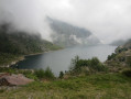
Prat Primer path and the Caülla forest

This route offers the chance to discover Andorra’s high-mountain landscape and vegetation and to visit one of the Principality’s many self-catering mountain huts.

Details

1425101
Creation:
Last update:
Last review:
  • Walking
    Activity: Walking
  • ↔
    Distance: 4.99 mi
  • ◔
    Average duration: 5h 00 
  • ▲
    Difficulty: Moderate

  • ⚐
    Back to start: Yes
  • ↗
    Ascent: + 3,084 ft
  • ↘
    Descent: - 3,084 ft

  • ▲
    Highest point: 7,326 ft
  • ▼
    Lowest point: 4,403 ft

Photos

Description of the walk

Park near the Comella picnic area.

(S/E) Head south-east along the path which leads to the junction at Font de la Rua.

(1) Head up to the left towards the Prat Primer refuge. Follow the left bank of the Riu de Comella at a distance. Reach the junction with the Chemin de l’Avier.

(2) Continue straight ahead, climbing up the track marked with yellow dots. Reach the source of the Tartera Grande.

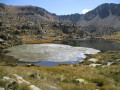
(3) Cross the stream and continue straight on along the right bank. Alternate between the two banks until you reach the Prat Pimer Refuge. It is situated on a hillock on the right.

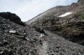
(4) Descend from the hillock and take a small path with loose stones; the mountainside slopes down to your right. Reach the hamlet of Obaga de l’Avier and continue westwards along an almost flat path to emerge at the Col de la Caülla.

(5) Head north to reach the Grotte du Rec, hidden behind some trees.

(6) Follow the path marked with yellow dots until you reach another crossroads.

(7) Head down to the right, cross the Riu de l’Arier and, a little further on, you’ll reach the junction with the Chemin de l’Avier.

(2) Turn right and follow the same route as on the way out to return to the car park where you started (S/E).


Waypoints

  1. S/E : mi 0 - alt. 4,403 ft - La Comella picnic area
  2. 1 : mi 0.17 - alt. 4,695 ft - Junction at Font de la Ruta
  3. 2 : mi 0.59 - alt. 5,325 ft - Junction with the Avier path
  4. 3 : mi 0.84 - alt. 5,604 ft - Source de la Tartera Grande
  5. 4 : mi 2 - alt. 7,316 ft - Prat Primer mountain refuge
  6. 5 : mi 3.21 - alt. 7,021 ft - Caülla Pass
  7. 6 : mi 3.56 - alt. 6,572 ft - Rec Cave
  8. 7 : mi 3.99 - alt. 5,696 ft - Crossroads
  9. S/E : mi 4.99 - alt. 4,403 ft - La Comella picnic area

Notes

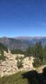
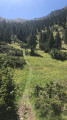
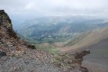
This circular route of nearly 9 km on the north-facing slope allows us to explore the Caülla Forest, a majestic black pine forest situated in the town of Andorra la Vella. This forest lies on the northern slope of the Calm Claror peak, on schist terrain. It is a relatively steep and shady slope, covered by a dense forest of black pines with a few firs, birches and rowan trees, and undergrowth dominated by rhododendrons. The proposed route involves a significant change in altitude, allowing us to observe the Scots pine forest surrounding the Comella picnic area, the dense tall-herb vegetation growing near the Comella stream, the rhododendrons covering the north-facing slope, the meadows of Prat Primer and the splendid black pine forest of La Caülla.
And with a bit of luck, you might spot a herd of roe deer in the highest areas, or even marmots living in the rocky terrain near the refuge.
(4) Prat Primer mountain hut: it is well-equipped, with accommodation available; it has 6 iron beds and a fireplace.
Total walking time (excluding stops): 3 hours 50 minutes in total: 2 hours from the starting point to the Prat Pimer refuge and 1 hour 50 minutes to return to the Comella picnic area via the Caülla forest and the Avier path.

Difficulty: High. Although the path is well signposted and presents no technical difficulties, it requires considerable physical effort as it involves a significant elevation gain over just a few kilometres.
Best time of year: Spring, summer and autumn.
Notes: In the Caülla forest, snow may still be present until quite late in the spring.

Reviews and comments

4.2 / 5
Based on 4 reviews

Reliability of the description
4.3 / 5
Ease of following the route
4 / 5
Route interest
4.3 / 5
Domi za
Domi za

Overall rating : 4 / 5

Date of your route : Jan 02, 2024
Reliability of the description : ★★★★☆ Good
Ease of following the route : ★★★★☆ Good
Route interest : ★★★★☆ Good
Very busy route : No

A steady climb requiring a good level of fitness. There was little snow for early January, which meant
us to complete the route without snowshoes. A pleasant walk with beautiful panoramic views; we spotted two chamois higher up the route
which watched us from a distance. The mountain hut is open, has a small first-aid kit and facilities for lighting a fire.

Machine-translated

GRILLERESJeanLuc
GRILLERESJeanLuc

Overall rating : 4.7 / 5

Date of your route : Jul 24, 2023
Reliability of the description : ★★★★★ Very good
Ease of following the route : ★★★★☆ Good
Route interest : ★★★★★ Very good
Very busy route : No

A short but challenging hike. Half of the route is uphill and the other half downhill.
Magnificent views over the valley.

Machine-translated

kamaan
kamaan

Hello,
Thank you for rating my hike!
I hope you have some wonderful hikes ahead!
Long live the mountains!
Kind regards

Machine-translated

miro34160
miro34160

Overall rating : 4 / 5

Date of your route : Sep 07, 2020
Reliability of the description : ★★★★☆ Good
Ease of following the route : ★★★★☆ Good
Route interest : ★★★★☆ Good
Very busy route : No

Machine-translated

kamaan
kamaan

Hello and thank you for your feedback; it’s true that the climb at the start is long – I’ll see if I can add this comment.
How sad that you found the lodge full of rubbish; this lack of respect for the mountains disappoints me. That wasn’t the case when I was hiking there.
I wish you many more wonderful hikes to come! Long live the mountains!
Kind regards

Machine-translated

randocre
randocre

Overall rating : 4 / 5

Date of your route : Jul 20, 2019
Reliability of the description : ★★★★☆ Good
Ease of following the route : ★★★★☆ Good
Route interest : ★★★★☆ Good

We were clearly lacking in training. But the difficulty of the first section of the climb took us by surprise, as the ascent is steep and relentless for a good couple of hours. Perhaps worth noting. The views were lovely, and the stream and the water collection point – with perfectly cool water – were charming.
We were disappointed by the rubbish left behind at the first mountain hut.
Kind regards,

CRe

Machine-translated

Other walks in the area

For more walks, use our search engine .

The GPS track and description are the property of this route's author. Please do not copy them without permission.