


Refine your search for walks in Col d'Ares
Col d'Ares walks


 Camí de La Retirada - Col d'Ares - Ronde du Canigó - Tour de Mir
 Visorando Member
 11.11 mi
 +3,127 ft
 -3,117 ft
 7h 50
7h 50
 Difficult
 Departure from Prats-de-Mollo-la-Preste (Pyrénées-Orientales)
This is a fairly strenuous hike up to Coll d'Ares.Pass via the La Retireda path, theGRP®® Ronde du Canigó and theGRP®® Tour du Vallespir.This hike is classified as difficult due to its length, elevation gain and the need for good orientation skills.The entire hike is marked and there are no difficult sections. See practical information (¹).Accessible by public transport, see practical information (²).
Notre Dame du Coral – Mont Falgars – Coll d’Ares from Prats-de-Mollo
 11.10 mi
+3,747 ft
-3,734 ft
8h 20
Difficult
Departure from Prats-de-Mollo-la-Preste (Pyrénées-Orientales)
11.10 mi
+3,747 ft
-3,734 ft
8h 20
Difficult
Departure from Prats-de-Mollo-la-Preste (Pyrénées-Orientales)
A signposted walk (PR®,GR® T,GRP®) with signposts, mostly through woodland. Do not underestimate the elevation gain or the length of the walk. Some sections are obstructed by fallen trees.
You’ll need to set off early in the morning from Prats. The Coll d’Ares is very popular during the summer. It will be busy and noisy...
Please note: you’ll be crossing the D115 on numerous occasions. Take care.
The map and GPX tracks may prove useful given the numerous changes of direction.
Accessible by bus for €2 from Perpignan *.
Possible alternatives to adjust the difficulty and duration of the walk. See practical information.
An interesting route with little snow if you follow alternative route 2.
Walks near Col d'Ares
Prats-de-Mollo to Sant Guillem via Puig Fabra - Les Sarraïns - Serre Vernet
9.38 mi
+4,183 ft
-2,326 ft
7h 55
Difficult
Departure from Prats-de-Mollo-la-Preste (Pyrénées-Orientales)
Thisfirst stage, almost entirely in the forest, is therefore possible in summer, if you set off early. A challenging hike with 1,275 metres of elevation gain on marked trails that are rarely used, requiring a good sense of direction and the GPX track.There are some beautiful spots to stop and enjoy the scenery. The highest point (altitude 1,830 m) at Puig dels Sarraïns is a perfect place to stop for lunch, for example.
Lamanère to Notre Dame du Coral
 Association / Club / Walk leader2.48 mi
+1,115 ft
-105 ft
2h 05
Association / Club / Walk leader2.48 mi
+1,115 ft
-105 ft
2h 05
 Moderate
Departure from Lamanère (Pyrénées-Orientales)
Moderate
Departure from Lamanère (Pyrénées-Orientales)
A lovely walk up through the forest to the Ermitage de Notre Dame du Coral followed by lunch at the Auberge and the same walk back down to Lamanère.
From the Refuge des Conques to the Refuge de Mariailles
 9.37 mi
+2,628 ft
-2,352 ft
6h 35
Difficult
Departure from Prats-de-Mollo-la-Preste (Pyrénées-Orientales)
9.37 mi
+2,628 ft
-2,352 ft
6h 35
Difficult
Departure from Prats-de-Mollo-la-Preste (Pyrénées-Orientales)
First stage of the: Loop from the Refuge des Conques to the Refuge de Mariailles
Mountain hike with beautiful scenery, particularly from Coll de Bise to Collada de la Roqueta.
Classified as difficult: exposed, steep slopes in places. See practical information.
Allow 6 hours of sustained walking.
The Sant Guillem refuge via the Coll de la Rua - La Soca - l'Estanyol
 9.23 mi
+3,323 ft
-2,041 ft
7h 10
Difficult
Departure from Le Tech (Pyrénées-Orientales)
9.23 mi
+3,323 ft
-2,041 ft
7h 10
Difficult
Departure from Le Tech (Pyrénées-Orientales)
First day of: Two days exploring the Sant Guillem Refuge, including the ascent to the Sant Guillem Refuge.Do not underestimate this day. The estimated time is accurate.From the La Llau hikers’ car park, head up to the Coll de la Rua.Continue along a narrow grassy track to the shelter and the Font del Brigadier.Then climb up a very steep path to La Soca.Then head for the Coll de l’Estanyol.Further on, begin a lovely descent to the Sant Guillem Refuge.Vast landscapes on this first day of your exploratory hike.
⚠️ Warning: observed on 3 September 2026 => The track from Coll de la Rua (3) to the Abri del Brigader (4) has not been cleared. Following a series of storms, a large number of fir trees are completely blocking the track as soon as you enter the forest. => This section cannot be completed until further notice. This section from (3) can be adapted by using one of my walks: The Sant-Guillem Refuge via Coll de Rua – Cortal d’Allosat from La Llau
Sant Guillem to Prats-de-Mollo via Serre Vernet - Comella - Lloses - Miracle
9.45 mi
+1,775 ft
-3,609 ft
5h 55
Moderate
Departure from Le Tech (Pyrénées-Orientales)
Thissecond stage, almost entirely in the forest, is therefore possible in summer, setting off early.Discovery hike along marked paths, little or not used, requiring a sense of direction and the GPX track. Beautiful places to stop and enjoy the scenery.
Refuge Sant Guillem - Chemin d'els Troncassers - Puig Sarraïns - La Llau
 9.33 mi
+1,847 ft
-3,104 ft
5h 55
Moderate
Departure from Le Tech (Pyrénées-Orientales)
9.33 mi
+1,847 ft
-3,104 ft
5h 55
Moderate
Departure from Le Tech (Pyrénées-Orientales)
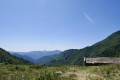
Second day of: Two days of discovery at the Sant Guillem Refuge, from the Sant Guillem Refuge.Between (8) and (12), a GPX track is strongly recommended or a very good sense of direction, despite the signposting and cairns being in very good condition. Observed at the end of July 2023.Coll de Serre Vernet via a magnificent balcony path in very good condition. The same applies to Puig dels Sarraïns.Return to the refuge via a beautiful path, then pleasant tracks through the woods.After a break at the refuge, return to the car park at La Llau via the usual route.
Refuge de Mariailles - Refuge des Cortalets
 10.14 mi
+3,497 ft
-2,090 ft
7h 45
Difficult
Departure from Casteil (Pyrénées-Orientales)
10.14 mi
+3,497 ft
-2,090 ft
7h 45
Difficult
Departure from Casteil (Pyrénées-Orientales)
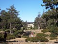
This stage is the first part of a two-day circular around the Canigou Massif. This first stage takes you around the peak to the west, from the Mariailles Refuge to the Cortalets Refuge, via the Bonne Aigue Refuge. It's a good warm-up before the next day's climb.
Mariailles - Cortalets
8.05 mi
+3,871 ft
-2,349 ft
7h 05
Difficult
Departure from Casteil (Pyrénées-Orientales)
The fourth stage features the ascent of Canigou as its highlight.Please take note of the following warnings regarding this route:''Info 2023: The route linking the Pic du Canigó and passing via the chimney is no longer signposted. The Conflent Canigó Tourist Office is unable to provide information on its accessibility. It is strongly advised to follow the Barbet ridges (PR®®8) or the GR®10 if you are coming from the Mariailles refuge to reach the Cortalets refuge.Furthermore, please note: as the ascent of the peak constitutes high-mountain hiking, it is important to be prepared, well-informed and properly equipped.”See also this link
From the Refuge de Mariailles to the Refuge des Cortalets
 9.65 mi
+3,451 ft
-1,939 ft
7h 25
Difficult
Departure from Casteil (Pyrénées-Orientales)
9.65 mi
+3,451 ft
-1,939 ft
7h 25
Difficult
Departure from Casteil (Pyrénées-Orientales)
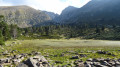
Sixth stage of the 8-day clockwise Tour du Canigou.A fairly long, undulating stage.The path is mostly on a ridge.The day ends with a difficult climb from the Bonne Aigue refuge.
⚠️ Renovation work at the Cortalets Refuge in 2026, 2027 and 2028. The Cortalets Refuge is closed for renovation work.
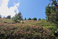
The Pic des Sept Hommes as seen from the Mariailles Refuge
 10.47 mi
+3,317 ft
-5,161 ft
7h 40
Difficult
Departure from Casteil (Pyrénées-Orientales)
10.47 mi
+3,317 ft
-5,161 ft
7h 40
Difficult
Departure from Casteil (Pyrénées-Orientales)
A second challenging day’s hiking in the mountains to the Pic dels Set Homes or Pic des Sept Hommes.
Set off early as the ascent from Pla Guillem is in open country. This walk passes through a sensitive area subject to specific regulations.