Country:

 City:




From Perpignan, head towards Le Boulou, then take the D115 via Céret, Amélie-les-Bains, Prats-de-Mollo and La Preste.
Cross the River Tech at Prats; at the roundabout, turn right towards La Preste via the D115A and immediately turn right into the large car park.
(S/E) From the car park below near the River Tech, walk back up towards the roundabout across the grassy terraces. Turn left onto the pavement to cross the D115 at the pedestrian crossing. Then head straight ahead into the cul-de-sac. There is a signpost.
Very soon, head up to the right onto a badly damaged track, ravaged by the rain. You’ll come out onto the D115.
Alternatively, from the roundabout, you will need to follow the D115 with caution, keeping to the left-hand side, for approximately 150 metres.
Red and white markings forthe GR® T83 + yellow and white markings for thePR®
Leave the D115 immediately and turn left. Pass an oratory. Then head straight ahead to the right onto the Cami de la Retirada. Cross the long footbridge and arrive at a four-way junction. Signposts.
Red and white markings forthe GR® T83
(1) Turn left, heading uphill along theGR® T83. Further up, a new track has been opened. Look out for the markings and follow the signs for Notre-Dame du Coral. You’ll come out onto the D115 (altitude 911).
(2) Cross the road carefully and continue straight ahead. Signpost for Notre-Dame du Coral.
Cut across a track (elevation 988). Continue uphill and you’ll emerge into a recently redeveloped area.
Take care: fortunately, there are yellow and white markings. You’ll reach a track that leads to a farm.
(3) Do not go there under any circumstances. The IGN and OSM maps are incorrect. There is no longer a right of way.
Head up to the right beneath a power line. Look out for theGR® T markings and signposts for Notre-Dame du Coral on the right, just before the farm buildings. The path you should follow climbs and overlooks the pig farm buildings.
Follow the signs for Notre-Dame du Coral, indicated by the signposts and theGR® T markings. Pass a tapped spring. Continue slightly uphill to reach the Coll de la Guilla. Opposite you is a large gate.
(4) Cross the road carefully and go through this gate via a small wooden wicket. Keep strictly to the right as you descend along a lovely grassy track. Pass a tapped spring.
Please note: you will need to leave this track in about 1.1 km. The IGN base map is accurate, unlike the two OSM maps. Under no circumstances should you head towards Mas Can Molins. If you do: you must turn back immediately and find the path described here. There is no longer a right of way.
(5) The path descends steadily to the Ribera del Corral (at around 945 m).
Take the lovely wooden footbridge and head back up the opposite side to reach the junction of three signposted paths.
Red and yellowGRP® markings + yellow and whitePR® markings
(6) Signpost. Ignore theGR® T heading towards Lamanère straight ahead and continue to the right now along theGRP® Tour du Canigó et du Vallespir. You’ll emerge below the Nostra Senoyra del Corral (Our Lady of the Coral) building. This lodge operates rather strangely: see: During the hike or nearby **. Carry on a little further until you reach a three-way junction.
Red and yellowGRP® markings
(7) Signpost. See Variation 1 and Practical Information.
Leave the track on your left and thePR® on your right, which leads to a fountain, and head up into the forest opposite. Join a track. Signpost. Continue to the right along this wide track.
(8) Elevation 1218. Signpost. See alternative route 2 and Practical information.
Head completely to the left, climbing up another track. There is a steel chain across the path. Before reaching the Casa d’Amunt (house up above), follow the signposting carefully. The recorded route is accurate. The walk along this track through the pastures is very pleasant.
The OSM base maps are accurate. It is the IGN base map that is incorrect.
TheGRP® signposting is clearly visible. You’ll emerge into a clearing in a pasture area.
(9) Elevation 1409. First turn left then right as you climb up through the pasture towards the boundary fence.
From here, the path climbs very steeply: a significant gradient of 20 per cent. Follow the fence on your left.
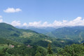
Don’t hesitate to take a few breaks, as the view behind you is absolutely stunning.
After this final stretch of the walk, you’ll emerge at a triangulation point belonging to the Spanish National Geographic Institute, marking the location of Mount Falgars. The view is obstructed by the forest.
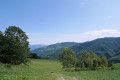
(10) Elevation 1,612. Turn right at a 90° angle towards the marker (concrete post), heading due north. Descend through the forest to emerge into a grazing area crossed by a very high-voltage power line. The 180° view is magnificent at this point.
Head back to the car park, the commemorative stele at Coll d’Ares and the hustle and bustle. Keep to the right-hand side.
Note: a beautiful panoramic view can be reached on the Spanish side via a 150-metre round trip to the left.
Yellow and white markings ofthe PR® Cami de la Retirada
(11) Find a gap in the fence right next to the information board about the Retirada.
Descend at a leisurely pace along this good path which winds along the mountainside below the D115.
(12) Elevation 1,440. Cross the D115 with care, go through the electric fence – make sure you close it behind you. Follow the path through the pasture and join a track further down.
Please note: if there is a herd of livestock, walk down the road for 500 metres and join the track.
Cross the track and turn right towards the Chapel of Santa Margarida.
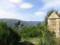
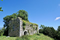
(13) This chapel has still not been restored. The interior stone vault is still in place, though the elements are taking their toll; the door is missing and the roof is overgrown with grass...
Turn back to rejoin the Cami de la Retirada and head right, going downhill. Signpost. You’ll reach an area with several paths and the track at Pla de l’Espinàs. The D115, on your right, is very close by.
(14) The Camí de la Retirada is obstructed in places: trees, a small landslide. Observed on 19 February 2023
Turn left as you continue downhill along the Camí de la Retirada. This path leads onto a track.
(15) Elevation 1016. Continue to the right along the track for approximately 600 m. You will need to leave it. Signpost.
(16) Turn sharply left, still following the Cami de la Retirada, and you will reach the D115.
(17) Cross the road carefully and continue straight ahead along the Cami de la Retirada until you reach a spot above an old wooden building.
(18) Turn right, still following the Cami de la Retirada, and ignore the path on the left and the track on the right.
Red and white markings forthe GR® T83 + yellow and white markings for thePR®
(1) Continue straight ahead towards the footbridge, following the path in the opposite direction to the way out, and return to the car park on the banks of the Tech (S/E).

 Visorando Member

 Moderate