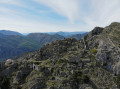
Rocca Sparviera, starting from Coaraze

It’s an old route that we’ve rediscovered

Details

2969741
Creation:
Last update:
Last review:
  • Walking
    Activity: Walking
  • ↔
    Distance: 7.84 mi
  • ◔
    Average duration: 5h 55 
  • ▲
    Difficulty: Difficult

  • ⚐
    Back to start: Yes
  • ↗
    Ascent: + 2,654 ft
  • ↘
    Descent: - 2,641 ft

  • ▲
    Highest point: 3,852 ft
  • ▼
    Lowest point: 2,021 ft

Photos

Description of the walk

(S/E) Set off from the school towards the Chapelle Bleue along the tarmac road that runs behind a sports ground. Once you reach Lamourier, take the track on the left.

(1) At the start of the circular route, do not follow the signs opposite but head towards the water tower just above on the left. Walk alongside it on a path, leaving the track. Further on, rejoin the track.

(2) Do not take the path directly opposite, but continue along the track to the left until you reach a hairpin bend to the right (several hundred metres further on).

(3) The start of the path isn’t very well signposted, but there are blue and yellow markings which you should follow until you come across the yellow markings again. It’s quite a steep climb from there.

(4) You’ll come across a sign for “Baisse de la Minière” and should carry on to the pass, keeping to the right.

(5) Once you reach the track, follow it to the right as far as the Col Saint Michel (it’s all downhill from there).

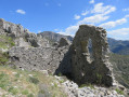
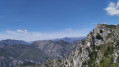
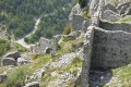
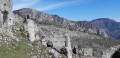
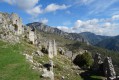
(6) Climb up to Rocca Sparviera (it’s magnificent), passing in front of the Saint-Michel Chapel.

(7) Head back down to the Col Saint-Michel and take the return route, following the sign for Coaraze (this time it’s all downhill). You’ll find yourself at the junction by the water tower.

(1) Return by road, taking the opposite route to the way out (S/E).

Waypoints

  1. S/E : mi 0 - alt. 2,021 ft - Coaraze School
  2. 1 : mi 0.56 - alt. 2,270 ft - Crossroads at the end of the circular loop
  3. 2 : mi 0.76 - alt. 2,497 ft - Path on the left
  4. 3 : mi 1.55 - alt. 2,881 ft - Path on the left
  5. 4 : mi 1.87 - alt. 3,419 ft - Path on the right
  6. 5 : mi 2.64 - alt. 3,852 ft - Path on the right
  7. 6 : mi 4.22 - alt. 3,179 ft - Col Saint-Michel
  8. 7 : mi 4.6 - alt. 3,556 ft - Ruins of Rocca Spavièra
  9. S/E : mi 7.84 - alt. 2,021 ft - Coaraze School

Worth a visit

Reviews and comments

5 / 5
Based on 2 reviews

Reliability of the description
5 / 5
Ease of following the route
5 / 5
Route interest
5 / 5
jjG
jjG

Overall rating : 5 / 5

Date of your route : Apr 26, 2023
Reliability of the description : Not used / Not applicable
Ease of following the route : ★★★★★ Very good
Route interest : ★★★★★ Very good
Very busy route : No

A lovely route, enjoyed in glorious spring sunshine
A few comments:
Even with a few detours, I managed a maximum elevation gain of 850 m, completed in under 4 hours.
I climbed directly from marker 200 to marker 207 along a good path (in my opinion, there’s little point in taking the detour via the road and track).
After descending from the mine, I went via the Pointe de la Sérèna along a well-marked path (superb views and more pleasant than the track). I’d recommend following this ridge as far as the Col St Michel.
To avoid the return trip to the ruins, I descended via the dotted-line path above Rocca Sparviéra (this easy path joins the track leading down to L’Engarvin via the Routas ravine).

Machine-translated

Chupa06
Chupa06

Overall rating : 5 / 5

Date of your route : Feb 24, 2020
Reliability of the description : ★★★★★ Very good
Ease of following the route : ★★★★★ Very good
Route interest : ★★★★★ Very good

Well worth doing again and again!!!!
A lovely route – thank you so much for introducing us to these beautiful paths.

Machine-translated

Other walks in the area

For more walks, use our search engine .

The GPS track and description are the property of this route's author. Please do not copy them without permission.