Cime de Rocca Sièra and Rocca Sparvièra, starting from Duranus

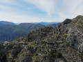
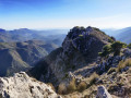
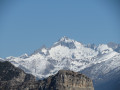
The route forms a figure-of-eight to minimise the round-trip distance. It offers beautiful panoramic views of the Mercantour peaks and the summit of Rocca Sièra, as well as a view of the sea stretching from Mont Agel to Cap d’Antibes.
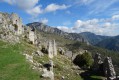
A visit to the abandoned village of Rocca Sparvièra is a must, both from a historical and geographical perspective.
Long but not technically demanding, it includes a few sections with relatively steep gradients and is suitable for experienced walkers.

Details

n°63272727
Creation:
Last update:
Last review:
  • Walking
    Activity: Walking
  • ↔
    Distance: 10.57 mi
  • ◔
    Average duration: 8h 05 
  • ▲
    Difficulty: Very difficult

  • ⚐
    Back to start: Yes
  • ↗
    Ascent: + 3,678 ft
  • ↘
    Descent: - 3,645 ft

  • ▲
    Highest point: 5,089 ft
  • ▼
    Lowest point: 1,762 ft

Photos

Description of the walk

Coming from the Vésubie Valley via the RD19, at the entrance to the village, before passing under a stone footbridge, the Duranus cemetery car park is on the right. Opposite, above the drinking fountain, marker 440 marks the starting point of the walk.

(S/E) Cross the road at the bend. Take care here, as visibility is poor. Follow a stony path, taking the steps to the left of the fountain. Follow the yellow markings past the houses and along the olive groves until you reach Marker 441.

(1) Turn right onto the lovely track, pass a water reservoir for the DFCI and continue uphill. Take two hairpin bends – there is an aerial atthe second one – then reach Marker 442.

(2) Leave the track here and turn left onto the path climbing up to the Crête de Saint-Antoine until you reach Marker 446.

(3) Turn left towards the Collet de la Boièra. Pass through the pine forest, initially on a gentle slope then climbing more steeply after passing the Ravin de Caussinière. Continue to Marker 123, which marks the Collet de Boièra.

(4) Turn right towards the Col de l’Autaret. The slope is gentle as far as the Baisse de Briquet (no signposting), then the path becomes steep with hairpin bends. Continue to Marker 448 at the Col de l’Autaret.

(5) Turn left towards the Col de Lobe along a lovely, almost flat path through the woodland until you reach Plat Liberte, where some ruins remain. Cross the small ridge on the left. A few cairns mark the start of the descent into the valley to Marker 449 at the Col de Lobe.

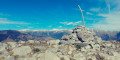
(6) Head right towards the Cime de Rocca Sièra. The path becomes very steep and some rocky sections feature fairly high steps where you may need to use your hands. Follow the abundant yellow markings to the summit of Rocca Sièra, marked by an old wooden cross.

(7) Now heading downhill, follow the ridge southwards to the secondary summit. Then head west, taking care not to slip on the pine cones and/or limestone rocks if the ground is damp. Continue to Marker 448, the one at the Col de l’Autaret which you passed on the way up.

(5) Climb off-trail across the grassy slope heading south-west to the small summit of the Cime de l’Autaret.

(8) Head due south and descend along the grassy slopes to Marker 447, Les Routas.

(9) Continue straight on along the Crête des Graus to the ruins of Rocca Sparvièra (literally ‘the rock of the sparrowhawks’). Proceed to Marker 444.

(10) Take the path straight ahead leading to the Saint-Michel Chapel. Return to marker 444, turn left, follow a gentle climb then a descending traverse beneath the Crête de Graus, and reach marker 445.

(11) Take the path on the left; a hundred metres further on, you’ll reach the junction marked by marker 446. Note: watch out for small pine cones rolling underfoot. Reach marker 446, which you passed on the way out.

(3) Turn left here and retrace your steps along the route you took on the way there to return to the car park at Duranus Cemetery (S/E).

Waypoints

  1. S/E : mi 0 - alt. 1,762 ft - Car park at Duranus Cemetery, B440
  2. 1 : mi 0.28 - alt. 2,034 ft - Marker 441: DFCI water tank
  3. 2 : mi 1.48 - alt. 2,713 ft - Marker 442
  4. 3 : mi 1.88 - alt. 3,176 ft - Marker 446, junction of the lower circular loop
  5. 4 : mi 2.79 - alt. 3,458 ft - Marker 123 Small Pass de la Boièra
  6. 5 : mi 3.48 - alt. 4,324 ft - Marker 448. Junction of the upper circular loop - Col de l'Autaret (1270m)
  7. 6 : mi 5.28 - alt. 4,196 ft - Marker 449 Col de Lobe
  8. 7 : mi 5.8 - alt. 5,089 ft - Cime de Rocca Sièra
  9. 8 : mi 7.05 - alt. 4,442 ft - Cime de l'Autaret (1308m)
  10. 9 : mi 7.31 - alt. 4,117 ft - Marker 447 Les Routas
  11. 10 : mi 7.91 - alt. 3,704 ft - Marker 444 - Chapelle Saint-Michel (Roccasparviera)
  12. 11 : mi 8.43 - alt. 3,458 ft - Marker 445
  13. S/E : mi 10.57 - alt. 1,772 ft - Car park at Duranus Cemetery, B440

Notes

There are no technical difficulties on this long walk.
Between (3) and (4), a fig tree indicates the presence of water; nearby, on the right, brambles conceal the entrance to a water-filled cave which serves as a drinking spot for wild boars (traces on the ground).
Good walking shoes are essential and walking poles are recommended.
There is no facility for replenishing water supplies.
(10) Shelter is available on the return journey at the Chapelle Saint-Michel.

Worth a visit

(S/E) The Saut des Français viewpoint near the car park.
Between (4) and (5): the view opens up and, to the west, you can see the very flat Crête de la Madone, with the sanctuary of the Madone d’Utelle to its right.
(7) Cime de Rocca Sièra: this served as a resting place for sheep; the migon (sheep dung) is abundant and pungent. Superb 360° view, with:
- to the north, the peaks of the Mercantour,
- to the east, Peïra Cava, the slopes of Camp d’Argent and the Authion;
- to the south, the sea is clearly visible from Mont Agel to Cap d’Antibes.
(10). The ghost village of Rocca Sparvièra: this ghost village was abandoned in 1723 when the spring ran dry. At its peak, it had up to 350 inhabitants and around fifty houses; the community had its own administration, a seigneury, a notary and even a parish priest.
Next (10). Saint-Michel Chapel: this is the only building to have been restored, and it is open to the public. From this beautiful vantage point above the chapel, one can appreciate the village’s strategic location. Situated directly below the Col Saint-Michel, it allowed control of the passage between the Vésubie and Paillon valleys.

Reviews and comments

5 / 5
Based on 1 review

Reliability of the description
5 / 5
Ease of following the route
5 / 5
Route interest
5 / 5
Bessillon
Bessillon

Overall rating : 5 / 5

Date of your route : Jan 01, 2025
Reliability of the description : ★★★★★ Very good
Ease of following the route : ★★★★★ Very good
Route interest : ★★★★★ Very good
Very busy route : No

A really lovely solo ride. A beautiful climb up the Col de Lobe to the summit of Rocca Siėra… reached the top… couldn’t see the hill, but there was a breathtaking sea of clouds. A lovely stop at the ruined village.

Machine-translated

Other walks in the area

For more walks, use our search engine .

The GPS track and description are the property of this route's author. Please do not copy them without permission.