


Refine your search for walks in Citadelle de Mont-Louis
Citadelle de Mont-Louis walks


 La Llagonne – Lac d’en Calvet – Pla de Barrès – Mont-Louis
 Visorando Member
 10.22 mi
 +778 ft
 -787 ft
 5h 25
5h 25
 Moderate
 Departure from La Llagonne (Pyrénées-Orientales)
This pleasant walk through woodland, along the banks of the River Têt and through the fortifications is a synthesis of the walks in the Catalan Pyrenees that follow thePR®®10,PR®®19andPR®®20routes. This route starts from the village of La Llagonne but could just as easily begin at the Citadel of Mont-Louis or Lac d’en Calvet.
Chemin Vauban from Mont-Louis to La Llagonne
2.00 mi
+344 ft
-72 ft
1h 15
 Easy
Departure from La Cabanasse (Pyrénées-Orientales)
Easy
Departure from La Cabanasse (Pyrénées-Orientales)
This section of the Chemin Vauban links Mont-Louis to La Llagonne via an easy and pleasant route. After skirting the ramparts of the fortified town of Mont-Louis, the route crosses the River Têt before reaching the village of La Llagonne. One-way walk: leave a car at La Llagonne (car park near the post office) to return to Mont-Louis.
Ovansa Tower
0.86 mi
+164 ft
-167 ft
0h 30
Easy
Departure from Mont-Louis (Pyrénées-Orientales)
A pleasant walk to discover the Ovansa Tower, an iconic site where the location of the Mont-Louis citadel – now a UNESCO World Heritage Site – was decided.
The walk starts at the Mont-Louis Tourist Information Office.
Walks near Citadelle de Mont-Louis
The Balcons de la Têt and the Yellow Train
 6.59 mi
+873 ft
-2,398 ft
3h 45
Moderate
Departure from La Cabanasse (Pyrénées-Orientales)
6.59 mi
+873 ft
-2,398 ft
3h 45
Moderate
Departure from La Cabanasse (Pyrénées-Orientales)
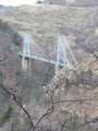
A climb on the Train Jaune from Fontpédrouse to La Cabanasse, followed by a beautiful, tree-lined descent along the River Têt.A lovely walk, partly through the forest; this is a different route from La Cabanasse to Planès suggested by PO Express, with the chance to find a few porcini mushrooms depending on the season, and to pass under the Gisclard Bridge, a true engineering marvel for its time.
Chemin Vauban: From Sauto to Formiguères
14.63 mi
+1,112 ft
-1,401 ft
7h 40
 Difficult
Departure from Sauto (Pyrénées-Orientales)
Difficult
Departure from Sauto (Pyrénées-Orientales)
This section of the Chemin Vauban links Sauto and Formiguères, passing through La Llagonne, the Col de la Quillane, Lake Matemale and the village of Matemale. The route, which is generally easy and accessible to all, alternates between balcony paths, woodland trails and sections along the shores of Lake Matemale, offering beautiful panoramic views of the surrounding peaks and providing an opportunity to explore the Tour de Creu.Please note that the route passes through the La Quillane ski resort, which means it is impassable whilst the resort is open for the winter season. The final section between Lake Matemale and Formiguères, which mainly follows a forest track, offers little shade and should therefore be avoided in very hot weather.
Superbolquère to Planès
 12.77 mi
+1,952 ft
-2,749 ft
7h 35
Difficult
Departure from Bolquère (Pyrénées-Orientales)
12.77 mi
+1,952 ft
-2,749 ft
7h 35
Difficult
Departure from Bolquère (Pyrénées-Orientales)
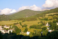
The final stage of the Capcir route.
This stage follows the Train Jaune route.
Thués-Entre-Valls – Fillols Route
 34.29 mi
+14,088 ft
-14,383 ft
5 days
Moderate
Departure from Thuès-Entre-Valls (Pyrénées-Orientales)
34.29 mi
+14,088 ft
-14,383 ft
5 days
Moderate
Departure from Thuès-Entre-Valls (Pyrénées-Orientales)
A 5-day route in the Catalan Pyrenees, offering the chance to explore the stunning Carença Gorges before finishing with an ascent of the Catalan giant: the Canigou.
Thués-Entre-Valls - Carança refuge
5.40 mi
+3,832 ft
-653 ft
5h 50
Moderate
Departure from Thuès-Entre-Valls (Pyrénées-Orientales)
This is the first stage of the Thués - Fillols loop, which takes you up the Carença Gorge to the refuge of the same name.
Crossing from Balcère to Les Angles
4.84 mi
+489 ft
-755 ft
2h 40
Easy
Departure from Les Angles (Pyrénées-Orientales) (Pyrénées-Orientales)
An easy, two-thirds shaded route suggested by a Year 3 class. Superb views to help children from the countryside discover the mountains: lake, forests.
Refuge de la Carença - Mantet
7.47 mi
+2,881 ft
-3,720 ft
5h 55
Moderate
Departure from Fontpédrouse (Pyrénées-Orientales)
Deuxième étape du circuit catalan pour rejoindre le village de Mantet.
From Err to Núria via the Col des Finestrelles
 9.35 mi
+4,177 ft
-2,356 ft
7h 55
Difficult
Departure from Err (Pyrénées-Orientales)
9.35 mi
+4,177 ft
-2,356 ft
7h 55
Difficult
Departure from Err (Pyrénées-Orientales)
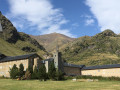
A superb hike that takes you from the French Cerdagne to the splendid Sanctuary of Nuria in Spain, via the Col de Ségalère and the Col des Finestrelles. Once you arrive in Nuria, you can spend the night at the Xanascat hostel if you’ve booked in advance and enjoy the area, which is the starting point for numerous walks; or you can return to France by train: Ribes de Freser, then on to Puigcerdà and finally the Yellow Train to Err, or the LiO buses.
Barrage des Bouillouses - Camporells Refuge
 7.75 mi
+3,028 ft
-2,241 ft
6h 10
Difficult
Departure from Angoustrine-Villeneuve-des-Escaldes (Pyrénées-Orientales)
7.75 mi
+3,028 ft
-2,241 ft
6h 10
Difficult
Departure from Angoustrine-Villeneuve-des-Escaldes (Pyrénées-Orientales)
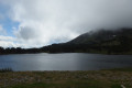
Modification on 12 September 2022: addition of the Petit Péric ascent validated on Thursday 8 September 2022.This first stage of the Tour des Pérics is enhanced by beautiful landscapes.It offers a taste of the mountain scenery that will be encountered during these four days.Vehicles must be left in the free car park. See the practical information section*.In summer, you must take a paid shuttle bus to Lac des Bouillouses. See the practical information section **.
Please note: from (8), you must have the GPX track or a very good sense of direction to attempt the ascent of Petit Peric.
From Les Bouillouses to Le Carlit, then on to the Cabane du Rouzet
8.29 mi
+3,248 ft
-2,434 ft
6h 40
Difficult
Departure from Les Angles (Pyrénées-Orientales) (Pyrénées-Orientales)
Le Carlit is the highest peak in the Pyrénées-Orientales at 2,921 m. It’s a site visited by hundreds of people every summer, but generally most are content to do the Bouillouses–Carlit round trip.
This first stage invites you to include this summit and to finish the stage in the area around the Cabane du Rouzet after walking alongside the large Étang de Lanoux.
Classified as difficult due to the ascent of Puig Carlit and its steep descent on the Étang de Lanoux side.