Route along the ridge starting from the Col de la Croix Perrin

Set off from the Col de la Croix Perrin to climb the ridges overlooking Lans-en-Vercors. 

Details

70363796
Creation:
Last update:
Last review:
  • Walking
    Activity: Walking
  • ↔
    Distance: 5.01 mi
  • ◔
    Average duration: 3h 35 
  • ▲
    Difficulty: Moderate

  • ⚐
    Back to start: Yes
  • ↗
    Ascent: + 1,470 ft
  • ↘
    Descent: - 1,493 ft

  • ▲
    Highest point: 5,318 ft
  • ▼
    Lowest point: 3,937 ft

Description of the walk

Park in the car park at the Col de la Croix Perrin near the inn.

(S/E) With your back to the departmental road, take the path opposite marked in yellow and green. Join another path coming from the left and heading up the Combe de Rui.

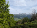
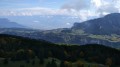
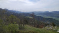
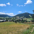
(1) Continue the ascent until you emerge onto the ridges above Lans-en-Vercors, with views stretching from the Gorges du Furon to the Villard mountains.

(2) Turn left to follow the ridge northwards and reach the junction with the descent path.

(3) Turn left to begin the descent, which is less steep than the climb. Join a forest track and follow it straight ahead. You’ll reach a junction with another track at a bend.

(4) Take the hairpin bend to the left and continue the descent. Further down, the track becomes a path and leads out onto the Route Forestière Barthélémy above the quarry.

(5) Cross it and take the path opposite, which curves to the left and winds its way through the Lauze and Besses valleys.

(6) Ignore the path on the right leading to the nearby D106, make one final climb to the left and return to the car park at the Col de la Croix Perrin (S/E).

Waypoints

  1. S/E : mi 0 - alt. 3,993 ft - Col de la Croix Perrin
  2. 1 : mi 0.49 - alt. 4,285 ft - Path junction
  3. 2 : mi 0.96 - alt. 4,656 ft - Arrival at the ridge
  4. 3 : mi 2.26 - alt. 5,312 ft - Junction with the downhill track
  5. 4 : mi 3.03 - alt. 4,885 ft - Crossroads of tracks
  6. 5 : mi 3.71 - alt. 4,354 ft - Forest Road
  7. 6 : mi 4.5 - alt. 3,937 ft - Junction
  8. S/E : mi 5.01 - alt. 3,990 ft - Col de la Croix Perrin

Reviews and comments

4.2 / 5
Based on 3 reviews

Reliability of the description
4.7 / 5
Ease of following the route
4.3 / 5
Route interest
3.7 / 5
madydou
madydou ★

Hello
Thank you for your vigilance.
The altitude corrections have just been made.

Machine-translated

Sardine*
Sardine*

Overall rating : 4.3 / 5

Date of your route : Aug 11, 2025
Reliability of the description : ★★★★★ Very good
Ease of following the route : ★★★★★ Very good
Route interest : ★★★☆☆ Average
Very busy route : Yes

The elevation gain is listed as 821 m, but it is only 454 m.

Machine-translated

Bram
Bram
• Edited:

Overall rating : 4.3 / 5

Date of your route : Aug 03, 2025
Reliability of the description : ★★★★★ Very good
Ease of following the route : ★★★★☆ Good
Route interest : ★★★★☆ Good
Very busy route : No

pleasant hike, very shaded. Next time, we will return to Croix Perrin via the small road (often closed to traffic) from point 5, as the path through the woods is quite steep and, above all, very stony.

Machine-translated

nanarounet
nanarounet

Overall rating : 4 / 5

Date of your route : Jun 20, 2025
Reliability of the description : ★★★★☆ Good
Ease of following the route : ★★★★☆ Good
Route interest : ★★★★☆ Good
Very busy route : No

Hike done on 3 June. For my part, I only climbed 513 metres.

Machine-translated

Other walks in the area

For more walks, use our search engine .

The GPS track and description are the property of this route's author. Please do not copy them without permission.