Route nature and lake in Lescheroux

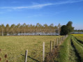
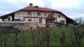
A 14 km walk that will take you to Pontremble Pond, which alone is worth the trip, but you’ll also discover pretty half-timbered houses and plenty more.

Details

n°15803851
Creation:
Last update:
Last review:
  • Walking
    Activity: Walking
  • ↔
    Distance: 8.40 mi
  • ◔
    Average duration: 3h 55 
  • ▲
    Difficulty: Average

  • ⚐
    Back to start: Yes
  • ↗
    Ascent: + 36 ft
  • ↘
    Descent: - 36 ft

  • ▲
    Highest point: 728 ft
  • ▼
    Lowest point: 669 ft

Photos

Description of the walk

Park in the car park near the church in Lescheroux, which will be your starting point.

(S/E) Stand with your back to the sundial opposite the church and head downhill towards the centre.

(1) At the ‘Chez Delphine’ restaurant, turn left, follow the yellow markings and walk past the sewage treatment works.

(2) Continue straight ahead along the Route du Devet.

(3) At the hamlet, follow the tarmac path on your left, which will take you to a dirt track through the woodland. Pass through the hamlet of Le Mont and you’ll come out onto a road.

(4) Follow the road to the right until you reach the next junction.

(5) Turn right onto the Chemin du Bois Charmet, which joins a road at the hamlet of Belfort. Follow it to the junction at Petit Villard.

(6) Turn right, then much further on turn left after La Carronnière towards the hamlet of Grand Villard, then turn right.

(7) Follow the dirt track on your left, which will take you to the ponds.

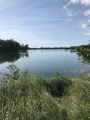
(8) Facing the main Pontremble pond, turn left to walk partly around the pond. Please note: keep dogs on a lead; the estate is open to the public but remains private. At the picnic area, leave the pond’s edge and follow the road leading to the farm buildings in the hamlet of Les Thiêtres.

(9) Turn slightly to the right to follow the tarmac path to the hamlet known as La Rivière.

(10) Pass the farm and turn onto the dirt track on the left. Go past the Péfay farm, then cross a stream and join the D1 road, also known as the Route de Beaupont.

(11) Take care of traffic here: turn right onto this road and follow it to return to the original junction.

(1) Follow the same route back as on the way there to return to the car park at Lescheroux church (S/E).

Waypoints

  1. S/E : mi 0 - alt. 705 ft - Church car park. Cross the - Sâne Vive (rivière)
  2. 1 : mi 0.13 - alt. 696 ft - Restaurant
  3. 2 : mi 0.69 - alt. 722 ft - Route du Devet
  4. 3 : mi 1.08 - alt. 722 ft - Le Devet
  5. 4 : mi 2.23 - alt. 679 ft - Road junction
  6. 5 : mi 2.37 - alt. 686 ft - Chemin du Bois Charmet
  7. 6 : mi 3.67 - alt. 715 ft - Petit Villard crossroads
  8. 7 : mi 4.29 - alt. 719 ft - The hamlet of La Grand Villard
  9. 8 : mi 4.62 - alt. 669 ft - Étang de Pontremble
  10. 9 : mi 6.34 - alt. 709 ft - Thiêtres
  11. 10 : mi 7.13 - alt. 709 ft - A place known as La Rivière
  12. 11 : mi 7.71 - alt. 719 ft - D1 junction
  13. S/E : mi 8.4 - alt. 702 ft - Church car park

Notes

(S/E) Yellow signposting.

Worth a visit

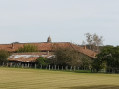
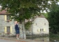
(7) Pretty half-timbered houses and an imposing restored manor house.
(8) Pontremble Pond.
(S/E) As you enter the village of Lescheroux, you’ll pass a clog maker’s workshop – you can’t miss it, as there are two enormous wooden clogs on display. You can go inside.

Reviews and comments

4.3 / 5
Based on 2 reviews

Reliability of the description
5 / 5
Ease of following the route
5 / 5
Route interest
3 / 5
AscleKef
AscleKef

Overall rating : 4.3 / 5

Date of your route : Apr 10, 2023
Reliability of the description : ★★★★★ Very good
Ease of following the route : ★★★★★ Very good
Route interest : ★★★☆☆ Average
Very busy route : No

A pleasant walk, typical of the Bresse region, with hamlets dotted along the route. Some sections are charming, but it lacked that little something extra to really captivate me.

Machine-translated

MCP34
MCP34
• Edited:

Overall rating : 4.3 / 5

Date of your route : Mar 29, 2023
Reliability of the description : ★★★★★ Very good
Ease of following the route : ★★★★★ Very good
Route interest : ★★★☆☆ Average
Very busy route : Yes

WARNING: between point 1 and point 2, at the junction leading to the ‘Ferme des Bruyères’, my dog and I were attacked by their dog (a Patou-type breed) even though we had already passed their house by a considerable distance (and the walking route didn’t even go past their house). It chased us along the road running perpendicular to ‘its own’; I had to quickly unclip my dog’s lead to give him a chance to escape before he was bitten, so please be very careful in this area. None of the owners bothered to come out despite my screams.:!(!)!:

Machine-translated

Other walks in the area

For more walks, use our search engine .

The GPS track and description are the property of this route's author. Please do not copy them without permission.