Country:

 City:
City:


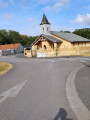
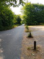
Start from the Védrel car park, Allée du Train de Loos.
(S/E) Leave the car park by first turning right then left, then cross the D57E3 road and continue straight ahead.
(1) Just before the house, take the path on the right; then, at the forester’s cottage, keep to the right and carry on straight ahead.
(2) Turn left at the junction, then take Rue des Roses on the right. At the roundabout, take the second left and carry on straight ahead.
(3) Turn right onto Rue Jean Jaurés (D57), then follow the first path on the right and carry on straight ahead.
(4) At the Y-junction, turn left to continue straight ahead. At the four-way crossroads, take the left-hand path and carry on straight ahead until you reach the junction after the bend.
(5) Turn right, then take the second left. Further on, cross the D57E3 road and continue straight ahead. Carry on straight ahead, ignoring the paths to the left and right, until you reach the junction for the alternative route.
(6) Carry on straight ahead until you reach the junction with the Route Forestière des Terrils.
(7) First turn left then right, and carry on straight ahead along the track, which bends to the right a little further on and rejoins the Route Forestière des Terrils.
(8) Turn left and carry on straight ahead until you reach the roundabout. Take the second exit on the right and immediately turn left onto the path running parallel to the road. Carry on straight ahead.
(9) Turn right at the junction, then take the path on the left. Take the second path on the right and carry on straight ahead until you reach the D57E2.
(10) First turn left then right, then take the first left. At the end, turn left to return to the starting point (S/E).
 Visorando Member

 Association / Club / Walk leader
 Easy
Easy 
 Difficult