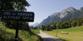
The Plan du Salève route from Cruseilles

Starting from Lac des Dronières in Cruseilles, follow a steady climb to reach the Plan du Salève. Continue to the Col des Pitons, then descend to the small resort of La Croisette. There is then a short climb before beginning a 10 km descent to Monnetier. At Murraz, you then climb back up towards La Croisette, and at Chez Tournier, you turn off onto the D215 towards Le Sappey, before continuing at a leisurely pace to the lake car park.

Details

n°103051334
Creation:
Last update:
Last review:
–
  • Road cycling
    Activity: Road cycling
  • ↔
    Distance: 31.66 mi
  • ◔
    Duration according to the author: 3 hrs 
  • ▲
    Difficulty: Difficult

  • ⚐
    Back to start: Yes
  • ↗
    Ascent: + 3,579 ft
  • ↘
    Descent: - 3,586 ft

  • ▲
    Highest point: 4,400 ft
  • ▼
    Lowest point: 1,795 ft
  • ⚐ Country: France
  • ⚐
    Area: Salève
  • ⚐ City: Cruseilles (74350)
  • ⚑
    Start/End: N 46.040571° / E 6.121725°
  • ❏
    IGN map(s): Ref. 3429OT, 3430OT

  • ◶
    Type of surface: Not specified
  • Hour-by-hour weather

Description of the route

In Cruseilles, follow the Route des Dronières (the D15) towards the Parc de Loisirs des Dronières. Park in the car parks by the lake.

(S) From the car park, head back towards Cruseilles.

(1) At the four-way junction, take the D41A on the right, towards l’Abergement. This road, with a steady gradient, climbs to the Plan du Salève (the highest point) for 10 km with an average gradient of 5 per cent.

(2) Continue along this road for a further 2 km, on a gentle incline, to reach the Col des Pitons.

(3) From the pass, continue down the road to the Croisette resort (viewpoint).

(4) From La Croisette, take the second road on the left, the Route des Rochers de Faverges. Climb a 100-metre rise to reach the Rochers de Faverges site.

(5) Continue along the D41A, beginning the descent towards Monnetier.

(6) During this descent, you may wish to stop at the cable car station. Pass above Monnetier, staying on the D41A until it ends, where it joins the D15.

(7) Turn right onto the D15, towards Muraz. Pass through Naz and reach the church at La Muraz.

(8) Turn right onto the D48 towards La Croisette, pass through the hamlet known as “Chez Joindet” and reach a junction in the hamlet of Le Tournier.

(9) Ignore the road on the right which leads back to La Croisette and turn left onto Route de Chez Jacquet (D215), heading for the village of Le Sappey. Drive through the village until you reach the junction with the D15.

(10) Keep to the right and follow the D15 towards Cruseilles. Pass through Vovray-en-Bornes and continue along the D15. This descent leads directly to Lac des Dronières (S/E).

Waypoints

  1. S/E : mi 0 - alt. 2,575 ft - Car park at the - Lac des Dronières
  2. 1 : mi 0.67 - alt. 2,539 ft - D41A, towards l’Abergement
  3. 2 : mi 6.73 - alt. 4,275 ft - Plan du Salève
  4. 3 : mi 8.15 - alt. 4,396 ft - Col des Pitons (1336 m)
  5. 4 : mi 10.76 - alt. 3,852 ft - Route des Rochers de Faverges - Col de la Croisette (1174 m)
  6. 5 : mi 12.14 - alt. 4,245 ft - Start of the descent - Rochers de faverges
  7. 6 : mi 14.61 - alt. 3,596 ft - Téléphérique du Salève
  8. 7 : mi 18.94 - alt. 1,795 ft - D15, towards Muraz
  9. 8 : mi 21.86 - alt. 2,110 ft - La Murraz – D48, towards La Croisette
  10. 9 : mi 24.83 - alt. 3,087 ft - Le Tournier – Route de Chez Jacquet, D215
  11. 10 : mi 27.53 - alt. 2,779 ft - D15, towards Cruseilles
  12. S/E : mi 31.66 - alt. 2,575 ft - Car park at the - Lac des Dronières

Worth a visit

Rest areas just before the Col des Pitons and at the Rochers de Faverges site.

The Salève cable car.

Other walks in the area

For more walks, use our search engine .

The GPS track and description are the property of this route's author. Please do not copy them without permission.