Country:
 City:


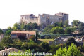
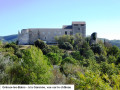
The walk starts at a place called Château Laval, accessible from the Valensole road. Take the road on the right to enter the estate and carry on straight ahead. After the first building on the right, you’ll find the car park at the start of the walk, marked by the “Château Laval” signpost.
(S/E) Take the track alongside the building towards the ‘Laval’ signpost. At the ‘Laval’ signpost, continue straight on towards Gréoux.
(1) At the “Peyresse” signpost, turn right, then left, and carry on straight ahead. At the end of the path, turn right, cross the Notre-Dame stream, then take the road by turning left.
(2) Turn right into Rue Paradis, then right again when you reach the Route de Valensole. At the roundabout, turn left into Chemin des Riayes.
(3) At the next junction, turn right onto Impasse des Riayes, then carry on straight ahead along the road. At the Y-junction, follow the road to the left towards Pierrisnard; the road turns into a track.
(4) At a bend, continue along the track to the right, following the yellow markings. Near the Route de Valensole, turn left.
(5) At the fork, follow the yellow markings, turn right and follow the path along the edge of the field. When you reach the “Pierrisnard” signpost, take the track on the left towards La Fare and continue straight on. At the Y-junction (elevation 453), follow the track on the left.
At the end of the track, at the ‘La Fare’ signpost, turn right towards Valensole. You’ll soon reach another junction at the ‘Fare Est’ signpost.
(6) Ignore the track on the right – you’ll take that on the way back – pass the “Fare Est” and “Jauffret” signposts and head straight on to Saint-Grégoire via the Ancienne Draye des Troupeaux d’Arles.
(7) At the entrance to Saint-Grégoire, at the signpost, carry on straight ahead, cross the hamlet and take the small road towards the D8.
(8) When you reach the junction with the D8, turn right before the small wood, follow the edge of the field for 20 metres and turn left onto a track. Head down into the wood. At the first junction, carry on straight ahead to reach the Chapelle de la Trinité.
After the chapel, turn right and continue along the track, passing between the greenhouses to reach the wash house.
(9) Turn right onto the Ravin de la Forge track, marked with mountain bike signs, and carry on straight ahead to join the D8 at the ‘Route Départementale’ signpost.
(10) Turn right towards Gréoux, follow the road for 50 metres and turn right onto a track marked with orange signs. Carry on straight ahead, following the fence.
(11) At the next junction, carry on straight ahead, passing between the two fences (the track on the left leads nowhere), and continue along this track. You’ll reach the “Saint-Grégoire” signpost
(7) Turn left and carry on straight ahead. Pass the “Jauffret” signpost and carry on straight ahead towards “Fare Est”, retracing your steps along the route you took on the way there
(6) Turn left towards “Chemin de la Laoupi” and, at the fire hydrant, continue along the track on the left.
(12) At the next junction, take the track on the right to head back down towards the D8.
(13) At the junction with the D8, in front of the “Chemin de la Laoupi” signpost, turn right, follow the road for 100 metres (take care) and turn left onto “Chemin de la Javi”.
(14) At the edge of the woods, turn right and take the path between the forest and the field. Pass the “La Bouscole” signpost, continue along the narrow path, passing between the box trees and past the archery range.
(15) At the entrance to the campsite, at the first bungalow, take the small path on the left (yellow markings), pass in front of the cave and head up above the campsite. At a bend, turn left to follow the yellow markings and pass above the “tree-top adventure course”. Walk alongside the residential buildings on the hillside and continue on to reach the car park.
When you reach the road, turn right to return to the starting point in front of the “Château Laval” signpost (S/E).

 Visorando Member

 Moderate

 Easy