Route du patrimoine Vouzinois

A discovery trail, ideal for families or heritage enthusiasts, which takes in the city’s must-see buildings and a few lesser-known gems.

Details

10360108
Creation:
Last update:
Last review:
  • Walking
    Activity: Walking
  • ↔
    Distance: 1.41 mi
  • ◔
    Average duration: 0h 40 
  • ▲
    Difficulty: Easy

  • ⚐
    Back to start: Yes
  • ↗
    Ascent: + 43 ft
  • ↘
    Descent: - 39 ft

  • ▲
    Highest point: 374 ft
  • ▼
    Lowest point: 328 ft
  • ⚐ Country: France
  • ⚐ City: Vouziers (08400)
  • ⚑
    Start/End: N 49.398274° / E 4.700586°
  • ❏
    IGN map(s): Ref. 3011SB
  • Hour-by-hour weather

Photos

Description of the walk

Along the route, a series of road studs will guide you through the town. Studs marked with an arrow indicate the direction to take. Numbered studs suggest you stop for a moment to admire the building and take the opportunity to learn more about it.
The route booklet is available from the Tourist Office, or at: https://www.argonne-en-ardenne.fr

(S/E) From Place Carnot, head towards the Town Hall to start the route. Places to see:
- Town Hall
- Place Carnot
- The Carnot Galleries
Then continue straight on along Rue Colson.

At the end of this street, turn left onto Rue Chervin. Places of interest:
- Art Nouveau house

(1) Turn left onto Rue Bara, then stay on this street. Things to see:
- Ardennes-style façade
- Le Stella

A little further on, turn left onto Rue Traversière.
Then head up Rue Bournizet (D 946) on the left. Places of interest:
- Former Caisse d’Épargne
- Thomas Masaryk High School
- Former Boys’ Boarding School

Then turn right onto Rue Gambetta. Places of interest:
- The Sub-Prefecture

(2) Admire the former Courthouse and take a short walk to and from the famous Tourelles, a little further down Rue Gambetta. Then retrace your steps and turn right onto Rue Henrionnet. Places of interest:
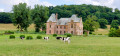
- The Tourelles
- Cultural Centre

At the end of the street, turn left onto Rue Désiré Guelliot.

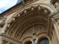
Take in the view of Sainte-Maurille Church and continue left along Rue Chanzy to Place Carnot. Places to see:
- Sainte-Maurille Church
- Post Office

Turn right onto Place Carnot and head towards the Town Hall (S/E).

Waypoints

  1. S/E : mi 0 - alt. 367 ft - Place Carnot, Vouziers
  2. 1 : mi 0.11 - alt. 371 ft - Rue Bara
  3. 2 : mi 0.78 - alt. 338 ft - Rue Gambetta and Rue Henrionnet
  4. 3 : mi 1.24 - alt. 358 ft - Rue Chanzy - Église Saint-Maurille (Vouziers)
  5. S/E : mi 1.41 - alt. 371 ft - Place Carnot, Vouziers

Notes

Vouziers, via the D946, D982, D983 and D977.

Recommended car park: Fairground car park

This route is mainly urban, so watch out for traffic.

Worth a visit

Notable buildings along the route:
Town Hall
Place Carnot
The Carnot Galleries
Art Nouveau house
Ardennes-style façade
The Stella
Former Caisse d’Epargne
Thomas Masaryk Secondary School
Former Boys’ Boarding School
The Sub-Prefecture
Les Tourelles
Cultural Centre
Sainte-Maurille Church
Post Office

Other nearby points of interest:
Ardennes Canal
Other walking trails
Le Clos de Gobu, Falaise
Argonne Découverte Park, Olizy Primat
City treasure hunt: In Search of Roland Garros’s Aeroplane, available from the Tourist Office
Chestres Cemetery
Cynthia Dormeyer’s Street Art Trail
Argona Aquatic Centre

Other walks in the area

For more walks, use our search engine .

The GPS track and description are the property of this route's author. Please do not copy them without permission.