Chambre aux Loups circular loop

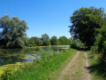
Starting from Place Carnot, in the heart of Vouziers, the circular Boucle de la Chambre aux Loups invites you on a pleasant escape between town and country. Easy and accessible to the whole family, this hiking trail winds peacefully through the fields, offering beautiful open views and a breath of fresh air just a stone's throw from the houses. Ideal for an easy nature walk, this circular route combines simplicity, relaxation and the chance to discover the local heritage.

Details

92166663
Creation:
Last update:
Last review:
  • Walking
    Activity: Walking
  • ↔
    Distance: 5.97 mi
  • ◔
    Average duration: 2h 55 
  • ▲
    Difficulty: Easy

  • ⚐
    Back to start: Yes
  • ↗
    Ascent: + 200 ft
  • ↘
    Descent: - 203 ft

  • ▲
    Highest point: 410 ft
  • ▼
    Lowest point: 318 ft
  • ⚐ Country: France
  • ⚐ City: Vouziers (08400)
  • ⚑
    Start/End: N 49.398351° / E 4.700798°
  • ❏
    IGN map(s): Ref. 2911E, 3011SB
  • Hour-by-hour weather

Photos

Description of the walk

Follow the yellow footpath markings no. 6.

(S/E) From Place Carnot, near the town hall, head south from the square towards Rue Gambetta, passing in front of the former Galeries Carnot. At the traffic lights, turn left and go down Rue Gambetta.

(1) Ignore Rue de Sainte-Marie on the right, which will be your return route, and continue straight ahead. Pass Les Tourelles and continue straight ahead. At the crossroads near the tax office, continue straight ahead until you reach Rue de Sainte-Maurille on the right.

(2) Turn onto this street, then turn left 80 metres further on to reach the grassy path. Continue straight ahead until you reach a crossroads, then keep left on the grassy path and you will arrive at the Come farm.

(3) Turn right towards Chambre aux Loups on a wide, semi-paved path.

(4) Before reaching this place, turn left, continue straight ahead on the grassy path and you will come to the D41.

(5) Cross the road carefully and continue straight ahead. Then turn right to return to Vouziers.

(6) Cross the roundabout and take a small grassy path 40 metres after the roundabout on the left. Follow this path, which leads to Rue de Sainte-Marie.

(7) Continue along this street, cross the junction with Rue des Marizys and you will come out onto Rue Gambetta.

(1) Turn left and, following the same route as on the way there, return to Place Carnot (S/E).

Waypoints

  1. S/E : mi 0 - alt. 371 ft - Place Carnot, Vouziers - Église Saint-Maurille (Vouziers)
  2. 1 : mi 0.18 - alt. 351 ft - Crossroads of the circular loop
  3. 2 : mi 0.65 - alt. 318 ft - Junction of Rue Gambetta and Rue Ste Maurille
  4. 3 : mi 2.04 - alt. 361 ft - Ferme de la Côme
  5. 4 : mi 2.7 - alt. 361 ft - Fork
  6. 5 : mi 3.24 - alt. 394 ft - RD41 junction
  7. 6 : mi 4.96 - alt. 367 ft - Blanc-Mont roundabout
  8. 7 : mi 5.45 - alt. 400 ft - Rue de Sainte-Marie
  9. S/E : mi 5.97 - alt. 371 ft - Place Carnot, Vouziers

Notes

Between October and February, check the hunting dates before setting off.

Reviews and comments

5 / 5
Based on 1 review

Reliability of the description
5 / 5
Ease of following the route
5 / 5
Route interest
5 / 5
User 30628025

Overall rating : 5 / 5

Date of your route : Sep 07, 2026
Reliability of the description : ★★★★★ Very good
Ease of following the route : ★★★★★ Very good
Route interest : ★★★★★ Very good
Very busy route : No

This route is really good. I was already familiar with part of it before doing the whole thing. Make sure you wear a cap and take some water with you, as the route runs through fields. There isn’t much shade.

Machine-translated

Other walks in the area

For more walks, use our search engine .

The GPS track and description are the property of this route's author. Please do not copy them without permission.