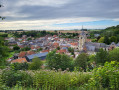
The Butterfly Route in Beauval

Discover the history of Beauval through its cultural and industrial heritage by following the Papillon route.

Details

n°2016447
Creation:
Last update:
Last review:
  • Walking
    Activity: Walking
  • ↔
    Distance: 6.70 mi
  • ◔
    Average duration: 3h 20 
  • ▲
    Difficulty: Moderate

  • ⚐
    Back to start: Yes
  • ↗
    Ascent: + 269 ft
  • ↘
    Descent: - 266 ft

  • ▲
    Highest point: 469 ft
  • ▼
    Lowest point: 259 ft
  • ⚐ Country: France
  • ⚐ City: Beauval (80630)
  • ⚑
    Start/End: N 50.108174° / E 2.334049°
  • ❏
    IGN map(s): Ref. 2307E, 2307O
  • Hour-by-hour weather

Photos

Description of the walk

The route starts from the village square (on the edge of Rue Charles Cagny) near the war memorial.

Markings: yellow only, or yellow with a pink butterfly to distinguish this route from other walking routes passing through the village.

(S/E) From the car park, take the street leading up towards the church and go round it on the right. At the junction, go straight on into Rue du Cimetière.

(1) Take the path on the left, then turn right at the end of it. After walking past the École du Valençon, turn right, walk past the cemetery and continue straight on (do not follow the Circuit des Saules to the right) to reach the Cité Quenot. At the end of this, turn left.

(2) On leaving the village, turn right and walk past the sewage treatment works. At the end of the road, turn right (leaving the Route des Saules on your left) and head back towards the village. Walk along the N25 – take care,as there is heavy traffic –via the service road of the Cité de Doullens. Cross the N25 at the pedestrian crossing halfway along the straight stretch and continue to the right until you reach the bend.

(3) Turn left onto Rue des Avesnes. Pass the Cité des Avesnes and continue straight on along the path until you reach Route de Terramesnil.

(4) Turn right to head back towards Beauval, leaving the Tortillard route on your left. Continue to the next path junction on the right.

(5) Take this path and join a road, passing under a power line. Continue to the left.

(6) At the Petit Bon Dieu crossroads, take the path opposite.
At the end of this, carry on to the right to head back towards the N25. Cross it at the pedestrian crossing – take care, as there is heavy traffic – and take Rue du Caffard opposite.

(7) Turn left onto Rue de Milly. At the end of the street, turn right onto Rue Commandeur, then left towards the village exit via Rue de Créqui (D77). Pass Rue du Rosel and Rue de Trilloy on your left.

(8) Turn right at the first road, Chemin d’Amiens, and follow it for about 600 metres, heading due north.

(9) At the three-way junction, head down to the right towards the village via Rue Minguet.

(10) At the end of the street, continue left onto Rue de Créqui to reach the village centre. Pass the former Beauval primary school and the town hall, and head for the village square (S/E).

Waypoints

  1. S/E : mi 0 - alt. 331 ft - Village square
  2. 1 : mi 0.19 - alt. 387 ft - Turn left at the start of the cemetery path
  3. 2 : mi 1.02 - alt. 289 ft - On leaving the village, take the road on the right
  4. 3 : mi 1.72 - alt. 282 ft - On the left, the road with the wayside cross
  5. 4 : mi 3.02 - alt. 308 ft - Turn right onto the road
  6. 5 : mi 3.3 - alt. 312 ft - Path on the right
  7. 6 : mi 4.3 - alt. 374 ft - Le Petit Bon Dieu
  8. 7 : mi 4.86 - alt. 440 ft - Rue de Milly on the left
  9. 8 : mi 5.6 - alt. 463 ft - Chemin d’Amiens on the right
  10. 9 : mi 5.98 - alt. 456 ft - Rue Minguet, on the right
  11. 10 : mi 6.34 - alt. 367 ft - Rue de Créqui, on the left
  12. S/E : mi 6.7 - alt. 331 ft - Village square

Notes

Alternative route:
(7) To shorten the route to 8.4 km, follow the ‘Abeille’ signposts straight ahead (Rue Caffard), then, at the bottom of this street, turn right and rejoin the ‘Circuit du Papillon’ to return towards the village centre.

(S/E) Nearby shops (mini-market, newsagent, café).

Worth a visit

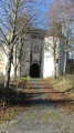
(S/E) The neo-Gothic Church of Saint-Nicolas, built thanks to the patronage of the Saint family at a cost of 400,000 gold francs. At its consecration on 6 August 1888, Charles Saint said, ‘We are delighted to have been able to offer this token of our love for our native land. We are from Beauval, and we shall remain from Beauval.’

As you walk up past the church, on the property to the right, you can see the bust of Charles Saint, and to the left, his statue, which marks the end of the grassy area beside the church. Charles Saint and his brother Jules-Abel were instrumental in the industrialisation of Beauval in the 19th century through the establishment of a jute fabric factory.

Beauval’s tree-lined cemetery. The entrance gate is adorned with four columns, each bearing a symbol: Alpha and Omega (the first and last letters of the Greek alphabet, symbolising the eternity of Christ), followed by the passing of time and equality in the face of death. At the end of the central avenue stands the Saint family’s funeral chapel.

Cité Quénot: like the three other housing estates (Cité de Doullens, Cité des Avesnes and Cité de la Gare), it dates from Beauval’s industrial era.

Near the sewage treatment works, several sequoias mark the crossing of the Méridienne Verte.

View of the former Saint-Frères factory and, opposite, the Prévoyance building, a cooperative set up for the benefit of the factory’s employees.

Before reaching the woodland that leads out onto the road, there is a substantial boundary stone on the left which, in the Middle Ages, marked the boundary of a religious entity’s territory (Corbie Abbey, according to local accounts).

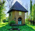
Pass the wayside shrine known as the ‘tchiot bon Diu’ (Little Good Lord).

Cross the Méridienne Verte, marked by a sequoia.

View of the former phosphate mine (a natural fertiliser produced from chalk with a high phosphate content), another of Beauval’s natural resources discovered in the 19th century.

Reviews and comments

5 / 5
Based on 1 review

Reliability of the description
5 / 5
Ease of following the route
5 / 5
Route interest
5 / 5
Yomgui80
Yomgui80

Overall rating : 5 / 5

Date of your route : Feb 26, 2024
Reliability of the description : ★★★★★ Very good
Ease of following the route : ★★★★★ Very good
Route interest : ★★★★★ Very good
Very busy route : No

A lovely walk, with no difficulties, a gentle climb and some lovely architectural sights along the way.

Machine-translated

Other walks in the area

For more walks, use our search engine .

The GPS track and description are the property of this route's author. Please do not copy them without permission.