Country:
 City:


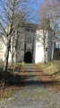
(S/E) Starting from Lucheux Town Hall, cross the D5 (with care, as visibility is restricted beneath the belfry) and head up Rue Raymond Dubois opposite to see the gate of Lucheux Castle, which has unfortunately been derelict for years.
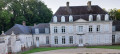
(1) Next, turn right onto Rue du Château, which continues Rue Raymond Dubois to the right, and, after the two pretty houses on the next bend (at No. 4), turn left into the grassy lane which climbs and then descends quite quickly onto Rue Jean-Baptiste Delecloy, just above the Bar de la Source.
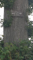
(2) Head left towards Avesnes until you reach the wayside cross and war memorial (second street on the right), then walk down past the ‘jeu de tamis’ (a traditional Picardy game better known as ‘ballon au poing’), taking in the ‘arbre des épousailles’ as you go.
(3) At the bottom of the square, turn right onto Rue du Petit Marais, which then curves to the left. Cross a small bridge over the Grouche.
(4) At the next fork, turn left onto a dirt track markedGR®. At the first junction, carry on straight ahead and continue in this direction until you reach the D1427. Turn left and head towards the junction with the D5, leaving the Route d’Humbercourt on your right.
(5) Take the D5 towards Avesnes, walking alongside the crash barrier.
(6) At the barrier by the old campsite, take the path below the road, which is still signposted GR®.
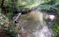
(7) Walk through a small wood and, as you emerge, look to your right below you for a small body of water similar to the ‘blue fountains’ or ‘spinning wells’. After an S-bend near a clump of trees, continue along a hedge to the left of the path until you reach a junction to the left.
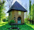
(8) Turn left and walk for about 250 metres to the Chapelle Saint-Léger, a place of pilgrimage
(9) Return to the fork.
(8) Turn left and carry on straight ahead along the same path, which curves to the left to rejoin the D5. Cross the road and follow a grassy path (GR®) alongside the market gardens. The path bends to the left, winds its way uphill through the trees and joins a stony track.
(10) At the end of this sunken path, take the stony path uphill to the right, then immediately left towards the forest across the plain (ignore the path branching off to the right towards Sus-Saint-Léger). You’ll come to a large, solitary oak tree.
(11) Continue straight on at a junction at the edge of the forest (GR®).
Enter the forest, still following the GR°°®°.
Please note: access to the forest is prohibited on hunting days for safety reasons (see practical information).
TheGR® is in very poor condition, but the route takes you past some very beautiful trees (beech and oak).
You need to leave the path on the right, follow it along the edge of the woodland, then cross through it and continue on the left. An orange marker was present recently (October 2023), which is very useful. In wet weather, watch out for slippery patches and mud (see alternative route in the practical information section).
(12) Turn left and head towards a perpendicular stony track.
(13) Take this on the left – this is the Allée Royale. Stay on this gravel track until the end, ignoring all junctions, and after a descent to the right, return to Lucheux via Ruelle Paquette (forestry house on the right), which joins Rue Jean-Baptiste Delecloy.
(14) Turn right onto this street.
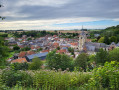
(2) Carry on straight ahead and return to the starting point towards the belfry (S/E).

 Visorando Member
 Difficult