Route du Moulin à Ver

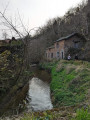
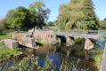
For a long time, the hydraulic power of watercourses was harnessed, and mills served as landmarks for water-related activities along the rivers. In Ver, on the River Sienne – a coastal river renowned for hosting large migratory fish (Atlantic salmon, sea lamprey and eel) – the weir at the Moulin de Ver was removed in 2010 to facilitate their passage.

Details

15883894
Creation:
Last update:
Last review:
  • Walking
    Activity: Walking
  • ↔
    Distance: 6.86 mi
  • ◔
    Average duration: 3h 40 
  • ▲
    Difficulty: Moderate

  • ⚐
    Back to start: Yes
  • ↗
    Ascent: + 594 ft
  • ↘
    Descent: - 600 ft

  • ▲
    Highest point: 351 ft
  • ▼
    Lowest point: 92 ft
  • ⚐ Country: France
  • ⚐ City: Ver (50450)
  • ⚑
    Start/End: N 48.893449° / W 1.392842°
  • ❏
    IGN map(s): Ref. 1314O
  • Hour-by-hour weather

Photos

Description of the walk

Park in the car park at the Salle des Fêtes in Ver.

Blue signposting

(S/E) Set off from the Ver Village Hall and walk alongside the cemetery. Turn right, then straight away left between the houses to reach La Clérotière. From there, follow the small path leading to the D236.

(1) Turn left, then take the first road on the right towards La Basserie.

(2) Go straight on and take the path. After about 150 metres, turn left and walk alongside the woodland to reach the D145. Follow the road to the right.

(3) Take the first track on the right before the village of Bailly. Follow this track straight on until you reach La Pinsonnerie. At this point, continue along the road.

(4) At the junction, carry on straight ahead towards La Hautmonière, then continue along the main road.

(5) At the next junction, carry on straight on towards Village Camus, where a small road gives way to a footpath.

(6) Keep left towards Grand Valencey.

(7) Follow the main road to reach Petit Valencey. Here, turn right to continue along the main road.

(8) Before reaching Petite Planche and L’Oiselière, take the road on the right (D541), pass Les Douity and La Bulnière, and return to the junction you passed on the way there.

(5) Turn left and cross La Hautmonière again.

(4) Leave the route you have already taken and turn right towards Dizeau.

(9) Cross the D145 and carry on straight ahead to join a footpath. Walk for about 200 metres and, at the first junction, take the path on the right. At the second junction, follow the path on the left towards La Hecquardière and carry on straight ahead, following the River Airou. You’ll come to a final junction; carry on straight ahead towards the Moulin d’Airou.

(10) At the Moulin d’Airou, carry straight on along the track towards the Pavé d’Airou on the D33.

(11) Once on this road, turn left and carry on straight ahead to reach the main street of the village of Ver. Once in the village, take the street on the left to go round the church and the cemetery, then turn right to reach the car park at the Salle des Fêtes (S/E).

Waypoints

  1. S/E : mi 0 - alt. 131 ft - Car park at the village hall
  2. 1 : mi 0.32 - alt. 141 ft - D236
  3. 2 : mi 0.5 - alt. 144 ft - La Basserie
  4. 3 : mi 0.81 - alt. 308 ft - D145
  5. 4 : mi 1.24 - alt. 344 ft - Towards La Hautmonière
  6. 5 : mi 1.46 - alt. 325 ft - Towards Le Village Camus
  7. 6 : mi 2.2 - alt. 302 ft - T-junction
  8. 7 : mi 2.71 - alt. 164 ft - Grand Valencey
  9. 8 : mi 3.42 - alt. 226 ft - Towards Les Douity
  10. 9 : mi 4.51 - alt. 344 ft - Dizeau
  11. 10 : mi 5.97 - alt. 138 ft - Airou Mill
  12. 11 : mi 6.29 - alt. 95 ft - Airou cobblestones
  13. S/E : mi 6.86 - alt. 131 ft - Car park at the village hall

Notes

Difficulty: none.

Public toilets.
Picnic area.
Water point in the cemetery.

Worth a visit

Interesting fact

The freshwater pearl mussel: a freshwater mollusc, the ‘mulette’ is known for its exceptional lifespan (over a century), yet is on the brink of extinction despite being protected (under the European Life+ programme; fewer than ten sites in France). This mussel also has the distinctive feature of producing pearls suitable for jewellery (roughly one in every thousand produces a pearl). A few can be found scattered along the lower reaches of the Airou, a river classified as a ‘Natura 2000’ site and the main tributary of the Sienne. This stretch of river lies within the municipalities of Ver, Le Mesnil-Amand and Le Mesnil-Rogues

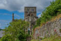
The church

This 13th-century complex is crowned by a massive square bell tower topped with a gable roof (two slopes). Of particular note are a remarkable altar frontal, a 14th-century Virgin and Child classified as a listed object under the Historic Monuments Act, and a magnificent bas-relief from the same period depicting twelve figures.

The Moulin d’Airou

Just upstream from the Moulin de Ver, at a place known as ‘le Moulin d’Airou’, lies the confluence of the Sienne and the Airou; the course of the Airou is designated as a Natura 2000 site and is the main tributary for salmon spawning grounds.

The mill (privately owned), built several centuries ago to harness water power, no longer served any economic purpose, and the weir associated with the mill, 1.70 m high, was in a poor state of repair. Fish passage structures had been installed in the 1990s. At the same time, the sluice gates at the Ver mill weir were opened in 1993, but even when raised, fish migration remained sporadic and dependent on water levels.

In agreement with the owner, the weir was ‘levelled’ in 2010. Its stone rubble was reused to create flood-redirection groynes on the right bank. The works were accompanied by maintenance of the riparian woodland upstream and the restoration of a nearby pond to replace the fire brigade’s pumping access point from the former reservoir in the event of a fire

The Ver bee

The village of La Bulnière on the D541.
A bee can store 500,000 grains of pollen on just one of its hind legs and visit 250 flowers in a single hour. For humans to produce one kilo of honey, the bee colony travels approximately … 40,000 km. As a champion of pollination, it plays a major role in the reproduction of 70 out of every 100 plant species. 35 per cent of our food resources depend on insects, and 80 per cent of these depend on bees.

Reviews and comments

3.9 / 5
Based on 3 reviews

Reliability of the description
4 / 5
Ease of following the route
4 / 5
Route interest
3.7 / 5
EmmaH
EmmaH
• Edited:

Overall rating : 3.7 / 5

Date of your route : Aug 18, 2025
Reliability of the description : ★★★★☆ Good
Ease of following the route : ★★★★☆ Good
Route interest : ★★★☆☆ Average
Very busy route : No

two pleasant green passages, but a bit too much road for my taste!

Machine-translated

Fred2250
Fred2250

Overall rating : 3.7 / 5

Date of your route : Aug 18, 2025
Reliability of the description : ★★★★☆ Good
Ease of following the route : ★★★★☆ Good
Route interest : ★★★☆☆ Average
Very busy route : No

Fairly well-maintained hiking trail
A bit too much road to reach the various sunken paths
The first part, where you walk along the river, is very nice
No difficulty walking

Machine-translated

Karsenti
Karsenti
• Edited:

Overall rating : 4.3 / 5

Date of your route : Mar 22, 2022
Reliability of the description : ★★★★☆ Good
Ease of following the route : ★★★★☆ Good
Route interest : ★★★★★ Very good
Very busy route : Yes

After leaving the car park, walk alongside the cemetery on the main road, turn left onto Rue de la Mairie, and then take the small path immediately on the right.

Machine-translated

Other walks in the area

For more walks, use our search engine .

The GPS track and description are the property of this route's author. Please do not copy them without permission.