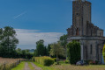
Walk along the banks of the Sienne near the Moulin Fouleur

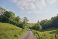
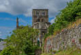
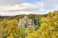
A walk through the bocage. You’ll start by following the River Sienne along a narrow forest track. You’ll then leave this track to climb up to the top of the small hill overlooking the river, reaching a little chalet at the highest point.

Details

20838489
Creation:
Last update:
Last review:
  • Walking
    Activity: Walking
  • ↔
    Distance: 2.41 mi
  • ◔
    Average duration: 1h 15 
  • ▲
    Difficulty: Easy

  • ⚐
    Back to start: Yes
  • ↗
    Ascent: + 187 ft
  • ↘
    Descent: - 184 ft

  • ▲
    Highest point: 285 ft
  • ▼
    Lowest point: 121 ft
  • ⚐ Country: France
  • ⚐ City: Gavray (50450)
  • ⚑
    Start/End: N 48.915211° / W 1.326862°
  • ❏
    IGN map(s): Ref. 1314O
  • Hour-by-hour weather

Description of the walk

Head towards the hamlet of Le Moulin Fouleur. Then turn right and cross the small bridge over the River Sienne. Park just beyond the bridge (take care not to obstruct traffic).

(S/E) Cross the bridge again and head towards the Moulin du Fouleur.

(1) Turn right onto a track that is initially wide enough for vehicles but quickly narrows. Follow this track, which runs alongside the river on your right at varying distances. Pass through the hamlet of Laval (you’ll come back onto the tarmac road).

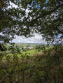
(2) As you leave the hamlet, at the start of a left-hand bend in the road, take a stony path on the left with a small fir tree at the entrance. At the junction that appears immediately, turn left. Then ignore a path branching off to the left and head down to the foot of the hill. Head back up to a lovely viewpoint and ignore a path coming from the right. Carry on to a poorly marked junction.

(3) Turn left onto the path which descends steeply. Note a slope on the left which is full of flowers in spring and some small houses on the right. At the bottom of the descent, rejoin the road.

(4) Follow the road to the left as far as the Moulin Fouleur.

(1) Turn right, cross the River Sienne and you’ll immediately reach the starting point (S/E).

Waypoints

  1. S/E : mi 0 - alt. 131 ft - Bridge over the - Sienne (fleuve)
  2. 1 : mi 0.09 - alt. 131 ft - Le Mouin Fouleur
  3. 2 : mi 0.79 - alt. 177 ft - Laval
  4. 3 : mi 1.73 - alt. 240 ft - Junction
  5. 4 : mi 1.99 - alt. 131 ft - Small road
  6. S/E : mi 2.41 - alt. 131 ft - Bridge over the - Sienne (fleuve)

Notes

You’ll frequently walk alongside the River Sienne, the same river that flows through Gavray. Make sure you wear sturdy footwear as some sections are quite muddy.

Worth a visit

You’ll be able to see: horses, sheep and a good number of local birds such as buzzards and sparrowhawks.
At certain times of year, there are beehives at the top of the walk offering a magnificent view across the whole valley. These beehives are located near the chalet, slightly below it.

Reviews and comments

4.7 / 5
Based on 2 reviews

Reliability of the description
4.5 / 5
Ease of following the route
5 / 5
Route interest
4.5 / 5
User 184600

Overall rating : 4.3 / 5

Date of your route : Jul 27, 2026
Reliability of the description : ★★★★☆ Good
Ease of following the route : ★★★★★ Very good
Route interest : ★★★★☆ Good
Very busy route : No

A short, easy and pleasant walk. Shady and idyllic. In this sweltering heat, it’s very welcome.

Machine-translated

planchu
planchu

Overall rating : 5 / 5

Date of your route : Apr 16, 2022
Reliability of the description : ★★★★★ Very good
Ease of following the route : ★★★★★ Very good
Route interest : ★★★★★ Very good
Very busy route : No

This short, 4-km route gives you a good idea of the beauty of this part of the Sienne Valley.
On the upper section of the path, we came across a stretch that was completely flooded.
We turned back to take the ridge path (antenna) further up and rejoined the route further on.
The rest of the walk went smoothly.
A lovely walk.

Machine-translated

Other walks in the area

For more walks, use our search engine .

The GPS track and description are the property of this route's author. Please do not copy them without permission.