Around L’Airou

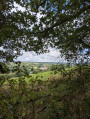
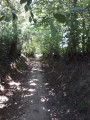
This walking trail winds through a steep-sided valley rich in architectural heritage: mills, a manor house, a castle, etc.
You’ll also be taken back in time as you discover traces of the writer Rémy de Gourmont’s time here.

Details

15890740
Creation:
Last update:
Last review:
  • Walking
    Activity: Walking
  • ↔
    Distance: 7.43 mi
  • ◔
    Average duration: 3h 55 
  • ▲
    Difficulty: Moderate

  • ⚐
    Back to start: Yes
  • ↗
    Ascent: + 607 ft
  • ↘
    Descent: - 600 ft

  • ▲
    Highest point: 404 ft
  • ▼
    Lowest point: 138 ft

Photos

Description of the walk

Park in the car park in the village centre.

Yellow signposting

(S/E) On leaving the car park, turn right, then at the junction, head straight on towards the church. Continue to the hamlet of La Patrie, then turn right onto a small road which quickly becomes a footpath leading to La Saulnerie and the D441. Follow this road to the right until you reach the junction.

(1) Take the path straight ahead towards La Croix Chesnot.

(2) At La Croix Chesnot, turn left and then left again. After about a hundred metres, cut across the field to the right to reach the Route des Villages. Turn left, then keep left at the T-junction towards Le Bois. Cross this area and follow a small path leading to Cauvrie.

(3) Before reaching the hamlet, take the path on the right towards La Conterie. At the end of the path, turn right onto the road, then left onto the new road ahead to reach Venisse. Ignore the various access roads to the buildings on the left and continue to a junction.

(4) Turn left onto a small road which then becomes a footpath. Follow this path round the castle until you reach a junction where it joins theGRP® ‘Sur les Traces des Fondeurs de Cloches’ trail (marked in yellow and red).

(5) Turn left and cross the Airou. Follow the path until you come out onto the Route de l’Airou on the outskirts of L’Escalerie. Continue straight on until you reach the D38.

(6) Turn left towards La Douve. Pass by La Bessinière, Les Landes and Le Plessis. Ignore a road on your right and continue for a few dozen metres until you reach a path on the left.

(7) Take this path, then at the first junction, follow the path on the right to head up towards La Coquerie.

(8) Once at La Coquerie, turn right onto the road, cut across to the right via a small track and head towards La Rossinière. Continuing straight on, take the path that appears and which soon splits into two.

(9) Take the left-hand branch to reach the outskirts of the Moulin de Rossinière. As you head uphill, join the first path and carry on straight ahead. Cross the Ruisseau Doinel and continue straight on until you reach the Route de la Forêt.

(10) Turn left to reach the Moulin de la Forêt and then the Pont Retoux.

(11) At the bridge, you’ll come to a path on the left. Follow it to the junction, then turn right towards La Motterie.

(1) Carry on straight ahead along the D441, past the wash house, and on to the car park in the village of Mesnil-Rogues (S/E).

Waypoints

  1. S/E : mi 0 - alt. 315 ft - Village car park
  2. 1 : mi 1.18 - alt. 308 ft - Junction of the circular loop
  3. 2 : mi 1.43 - alt. 381 ft - La Croix Chesnot
  4. 3 : mi 1.86 - alt. 358 ft - Heading towards La Conterie
  5. 4 : mi 2.23 - alt. 377 ft - Venisse
  6. 5 : mi 2.91 - alt. 194 ft - GRP junction°°®°°
  7. 6 : mi 3.82 - alt. 397 ft - D38
  8. 7 : mi 4.48 - alt. 404 ft - Path on the left
  9. 8 : mi 4.98 - alt. 374 ft - La Coquerie
  10. 9 : mi 5.32 - alt. 292 ft - Fork in the road, turn left
  11. 10 : mi 6.1 - alt. 171 ft - Turn left towards the Moulin de la Forêt
  12. 11 : mi 6.32 - alt. 151 ft - Retoux Bridge
  13. S/E : mi 7.43 - alt. 315 ft - Village car park

Notes

Difficulty: none

Mesnil-Rogues Inn.
Public toilets.
Water point in the cemetery.
Goat farm and cheese-making.

Worth a visit

Point of interest – The robin, the walker’s bird.

Very curious around people, even coming very close, it is highly territorial, puffs out its pretty orange and white breast and jealously defends its territory with a very distinctive, trilling song. Two broods a year (April/July). Often nests in hollows in the ground or on embankments amongst roots.

The Moulin de la Forêt (Le Mesnil-Amand)

Le Moulin de la Basse Forêt, so named on Cassini’s 1744 map, is dated to 1440 in archival records. It appears on the Napoleonic land register alongside 17 other mills on the River Airou. Many generations of grain millers have ground and sifted wheat here to produce flour for human and animal consumption. An exhibition provides information on the river’s habitat – a Natura 2000 site – and on the species found along its banks. The association ‘Les rencontres du Moulin de la Forêt’ welcomes you during your walk (by booking).

Houses in the Coutancienne style in the village

This small village features several buildings in the so-called “Coutancienne” style, dating from the late 18th and early 19th centuries. Built symmetrically, these houses can be extended in modules two or even three times over to form a spacious residence. They are often composed of a square plan with three bays and three storeys, constructed from Montmartin stone. Thethird storey is occupied by an attic and features at least one dormer window. The interior layout is practical and clearly separates the functions of the rooms on either side of a central staircase. This design principle was adopted for town halls and schools in the interwar period and for village houses during the post-war reconstruction. Montmartin stone is quarried from a limestone deposit stretching from Régneville-sur-Mer to Ouville (further north of Coutances, Cambernon stone is used).

Dragueville (Le Mesnil-Villeman)

On the alternative route, at a place known as Dragueville, stands the former 17th-century château of the family of Rémy de Gourmont (1858–1915), who was a novelist, journalist and art critic: ‘(a) small manor house surrounded by trees, including some rare specimens…a pond covered in green algae; a most curious dovecote, and above all an astonishing garden where everything blended together: flowers, fruit, vegetables...”

Reviews and comments

5 / 5
Based on 2 reviews

Reliability of the description
5 / 5
Ease of following the route
5 / 5
Route interest
5 / 5
Natacha91
Natacha91

Overall rating : 5 / 5

Date of your route : Aug 24, 2026
Reliability of the description : ★★★★★ Very good
Ease of following the route : ★★★★★ Very good
Route interest : ★★★★★ Very good
Very busy route : No

A brilliant walk with some significant ascents and descents. Lovely rural and woodland scenery

Machine-translated

Jean-Michel 50
Jean-Michel 50

Overall rating : 5 / 5

Date of your route : Nov 07, 2023
Reliability of the description : ★★★★★ Very good
Ease of following the route : ★★★★★ Very good
Route interest : ★★★★★ Very good
Very busy route : Yes

A lovely circular walk to do in the warmer months, thanks to the many springs along the route.
In fact, with the rain over the last few days, the streams and springs have made the paths very muddy, or even waterlogged with running water.

Machine-translated

Other walks in the area

For more walks, use our search engine .

The GPS track and description are the property of this route's author. Please do not copy them without permission.