The Frau de Lavercantière ENS route

You are now in a Sensitive Natural Area (ENS) managed by the Lot Department. The Frau route takes you on a 2.4 km walk to explore a number of attractions: forest habitats, ponds, flora and fauna.
An interpretive booklet is available from local tourist information offices.

Details

4410323
Creation:
Last update:
Last review:
  • Walking
    Activity: Walking
  • ↔
    Distance: 1.65 mi
  • ◔
    Average duration: 0h 55 
  • ▲
    Difficulty: Easy

  • ⚐
    Back to start: Yes
  • ↗
    Ascent: + 180 ft
  • ↘
    Descent: - 151 ft

  • ▲
    Highest point: 1,047 ft
  • ▼
    Lowest point: 886 ft

Description of the walk

Starting point: the Frau car park, on the edge of the D25.

(S/E) With your back to the D25, take the path opposite. Walk past the former site of a “loge” (a shelter with a heather roof) and continue straight on. Before a left-hand bend, take a path on the right towards the “Géants du Frau”. Pass between two trees, go down some steps and go round the ruins on the left (Maison de la Toun).

(1) Cross a footbridge, climb the steps to a junction with a path running at right angles. Turn left towards “la faune des étangs”. Go round the pond on the left. At the next crossroads, turn right towards “lande basse”. Cross a footbridge to climb back up onto the moor.

(2) Take the first path on the right at the top of the hill towards “la flore des étangs”. At the junction, turn right to view the pond flora. Continue straight on to join the Dégagnazès nature route.

(3) At the pond, turn back, head slightly to the right and continue along the path to the D25 via the Lande Haute. Cross the road to admire the panoramic view.

(4) Just before the road, turn left onto the path that runs alongside it and head for the Frau car park, on the edge of the D25 (S/E).


Waypoints

  1. S/E : mi 0 - alt. 968 ft - Frau car park
  2. 1 : mi 0.43 - alt. 886 ft - Maison de la Toun
  3. 2 : mi 0.71 - alt. 974 ft - Path on the right
  4. 3 : mi 0.82 - alt. 942 ft - Turn back
  5. 4 : mi 1.18 - alt. 1,047 ft - Panorama
  6. S/E : mi 1.65 - alt. 971 ft - Frau car park

Reviews and comments

4.5 / 5
Based on 3 reviews

Reliability of the description
5 / 5
Ease of following the route
4.5 / 5
Route interest
4 / 5
Rang d’Honneur
Rang d’Honneur

Overall rating : 5 / 5

Date of your route : Aug 13, 2026
Reliability of the description : ★★★★★ Very good
Ease of following the route : ★★★★★ Very good
Route interest : ★★★★★ Very good
Very busy route : No

A short, very easy walk featuring information boards describing the vegetation. It’s ideal at the time we did it – around 9.00 am in the height of summer – or for walking your dog, as the vegetation provides plenty of shade. What’s more, you’ll come across two ponds along the route. A lovely spot!

Machine-translated

OTCS
OTCS

Thank you for your feedback, which we will be sure to pass on.
This route is one of several offered by the Department on Sensitive Natural Areas. These different routes are family-friendly and can be explored with information sheets available from tourist offices.

Gwendoline - Pays de Gourdon Tourist Office, between the Lot and Dordogne rivers

Machine-translated

Dumm
Dumm

Overall rating : 4.3 / 5

Date of your route : Jun 09, 2025
Reliability of the description : ★★★★★ Very good
Ease of following the route : ★★★★☆ Good
Route interest : ★★★★☆ Good
Very busy route : No

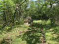
In June, whilst the weather was fine, we walked this hiking trail in the Frau moorland. It’s a route through a picturesque forest, very easy to access, and therefore ideal for inexperienced walkers and children. Along the way, we were able to enjoy the area’s unusual flora, its ponds and a few interesting viewpoints. We particularly appreciated the care taken by the teams who put up the signposts, which explain very clearly everything worth noting. The huts at the start of the walk are also a pleasant feature to discover. All in all, a lovely little two-hour stroll, mostly in the shade.

Machine-translated

MNORDIC
MNORDIC

Overall rating : 3 / 5

Date of your route : May 25, 2025
Reliability of the description : Not used / Not applicable
Ease of following the route : Not used / Not applicable
Route interest : ★★★☆☆ Average
Very busy route : No

It’s a very short and rather disappointing route… though there are some lovely eagle ferns and umbrella pines
This area has been left to run wild… information boards are either missing or rusted… and there are plenty of stinging nettles and brambles!
And some areas have been clear-cut

Machine-translated

Other walks in the area

For more walks, use our search engine .

The GPS track and description are the property of this route's author. Please do not copy them without permission.