The Douime route starting from Granges d’Ans

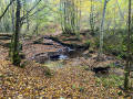
A walk south of Granges D’ans that winds through the Douime valley, passing through the causse and the land of the cicadas. On a private plot, you can see the ruins of two mills and the Douime waterfall which powered them. They were used by the locals until the arrival of electricity.

Details

32291612
Creation:
Last update:
Last review:
  • Walking
    Activity: Walking
  • ↔
    Distance: 6.76 mi
  • ◔
    Average duration: 3h 40 
  • ▲
    Difficulty: Moderate

  • ⚐
    Back to start: Yes
  • ↗
    Ascent: + 607 ft
  • ↘
    Descent: - 630 ft

  • ▲
    Highest point: 974 ft
  • ▼
    Lowest point: 597 ft

Photos

Description of the walk

The walk starts at a place called Lemboucade. Parking is available on the village meadow.
N.B. In the description, the term ‘access’ refers to a path not shown on the map which quickly ends in a dead end in a meadow or woodland.

(S/E) Opposite the house at No. 384, walk along the fence to the left, then take the path opposite. About 200 m further on, at a junction, turn right onto a path marked in yellow. Pass a track on the right, then another on the left, and continue following the yellow markings.

(1) At the next junction, veer to the right (the path shown on the IGN map turning right at a 90° angle does not exist) and let the yellow markings head off to the left. Head downhill and pass a turn-off on the right. Then turn left and then right.

(2) Pass two turn-offs on the right, then turn left and head uphill. Almost at the top of the hill, ignore a turn-off on the right.

(3) You’ll come out onto a tarmac road (Route du Marché) and follow it to the left for about a hundred metres. Then take a path on the right at an acute angle. At the next junction, ignore the path on the right into the meadow and turn left. Then pass a path on the right.

(4) At the stony track, opposite the herb garden, turn right. Shortly afterwards, at a Fork in the road, take the left-hand track (not shown on the map). Follow a hedge on your left for about a hundred metres to reach the woodland. Follow a track that goes downhill and pass a path on your left. At the bottom, take the forest track on the right and then head back uphill.

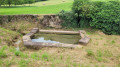
(5) Turn left. Further on, leave the main path – which turns right and ends in a meadow – and take a small grassy path opposite that turns left. Continue downhill (in wet weather, the path may be slippery). You’ll reach the ruins of the old watermills (on the left, on private property).

(6) Continue down the path, then head back up. Pass a turn-off on the right, then another on the left, and carry on until you reach the tarmac road (Route du Douime).

(7) Follow the road to the right as far as the hamlet known as Le Poirier. On the way, on the left, take in the view of the hamlet of Lacoste, built on the hillside. Follow the road to the hamlet of La Plansonnie.

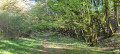
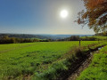
(8) Turn right and take a grassy path (yellow markings). At the picnic table, follow the path marked in yellow to the right. Pass a path on your right and carry on following the yellow markings (view of the Causse).

(9) At the junction, with a path to the left and an access road to the right, carry on straight ahead until you reach a tarmac road, staying on the path.

(10) Cross a tarmac road (at the boundary between the municipalities of Grand Coderc and Azerat) and continue along the path opposite. Pass a private track on your left.

(11) At a fork in the road, turn left. Pass a track on your left and carry on straight ahead. At the next junction (which is not shown on the map), turn left. At the next junction, go straight ahead. Then carry on straight ahead, passing a track on your left.

(12) At the next junction, follow a narrow path to the right (yellow markings). Pass a track on your left. At the crossroads, ignore the path to the right. At the Fork in the road, ignore the path and turn right. Follow the sign for ‘Azerat circular Douime’ (green markings). Follow the green markings and head down to the left at the next Fork in the road, then head back up. At the Fork in the road, turn right to reach Lemboucade (S/E).

Waypoints

  1. S/E : mi 0 - alt. 853 ft - Lemboucade
  2. 1 : mi 0.36 - alt. 902 ft - Junction
  3. 2 : mi 0.62 - alt. 853 ft - Crossroads
  4. 3 : mi 1.13 - alt. 942 ft - Route du Marché
  5. 4 : mi 1.65 - alt. 974 ft - Aromatic herb plantation
  6. 5 : mi 2.25 - alt. 948 ft - Descent towards the Douime
  7. 6 : mi 2.81 - alt. 627 ft - Source du Douime - Cern (cours d'eau) - Affluent de la Vézère
  8. 7 : mi 3.26 - alt. 712 ft - Route du Douime
  9. 8 : mi 3.64 - alt. 702 ft - La Plansonnie
  10. 9 : mi 4.36 - alt. 938 ft - Crossroads
  11. 10 : mi 4.89 - alt. 942 ft - Crossing the Route du Marché
  12. 11 : mi 5.25 - alt. 912 ft - Fork
  13. 12 : mi 5.61 - alt. 860 ft - Junction
  14. S/E : mi 6.76 - alt. 853 ft - Lemboucade

Worth a visit

The Douime is a stream that rises in the protected area of the Azerat caves in the Périgord Noir. It is home to distinctive, rather wild vegetation and flows for three kilometres before joining the Cern. The clear, crystal-clear waters of the Douime provide an important breeding ground; it is no surprise to see trout, young fish or crayfish in this stream.

Along the way, between waypoint (4) and waypoint (5), you can see the ruins of two watermills on the Douime (please note: private property). These were used by the inhabitants of Grand Coderc to grind grain before the arrival of electricity. The first mill, by the side of the path, was unfortunately destroyed by a bush fire.
After the waypoint (7), the causse is bordered by stone walls. The farmers of the time removed the stones from their plots to cultivate vines there until the phylloxera outbreak (1863).

Reviews and comments

4.3 / 5
Based on 3 reviews

Reliability of the description
3.7 / 5
Ease of following the route
4.7 / 5
Route interest
4.7 / 5
User 21841051
• Edited:

Overall rating : 4.7 / 5

Date of your route : Sep 26, 2025
Reliability of the description : ★★★★★ Very good
Ease of following the route : ★★★★☆ Good
Route interest : ★★★★★ Very good
Very busy route : No

A very beautiful hike, with pretty stony paths lined with stone walls. The description is well explained, but we used the GPX file when we were unsure. Please note that several trees have fallen, but they are easy to go around or under.

Machine-translated

Sophal
Sophal

Overall rating : 5 / 5

Date of your route : Feb 09, 2025
Reliability of the description : ★★★★★ Very good
Ease of following the route : ★★★★★ Very good
Route interest : ★★★★★ Very good
Very busy route : No

A very pleasant route along some lovely paths.

Machine-translated

jean.favre
jean.favre

Hello,
Thank you.
In my opinion, I did indeed make a mistake at a junction almost right at the start. Perhaps a wooden sign pointing the way and showing the name of the walk would be helpful. It’s just a suggestion.
In any case, thank you for introducing me to this magnificent walk.
Have a lovely day. Jean

Machine-translated

François 24390
François 24390

Hello, thank you for your comment.
To help us improve the route description, could you please let us know which part needs clarifying? It is specified that you should leave the yellow markings by turning right shortly after setting off.
Kind regards

Machine-translated

jean.favre
jean.favre

Overall rating : 3.3 / 5

Date of your route : Aug 02, 2023
Reliability of the description : ★☆☆☆☆ Very disappointing
Ease of following the route : ★★★★★ Very good
Route interest : ★★★★☆ Good
Very busy route : No

Hello,
Mistakes can always happen,
I was helped by a friendly local to find the car park and the starting point.
I followed some clear, regular yellow signposts. These led me along paths and through hamlets not mentioned in the guide. I enjoyed a lovely circular walk of about 10 km.

Machine-translated

Other walks in the area

For more walks, use our search engine .

The GPS track and description are the property of this route's author. Please do not copy them without permission.