Refine your search for walks in Cern (cours d'eau) - Affluent de la Vézère
Cern (cours d'eau) - Affluent de la Vézère walks


 Circular route around Saint-Rabier via the Moulin de la Douime
 Visorando Member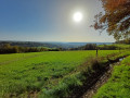
 9.69 mi
 +1,158 ft
 -1,178 ft
 5h 30
5h 30
 Moderate
 Departure from Saint-Rabier (Dordogne)
Route along the Ruisseau de la Douime, from Saint-Rabier via Le Grand-Coderc.
This walk encapsulates the essence of the Périgord Noir with its truffle fields, walnut trees, châteaux, streams and ponds, all set against a beautiful backdrop of rolling hills.
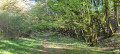
The Douime route starting from Granges d’Ans
 6.76 mi
+607 ft
-630 ft
3h 40
Moderate
Departure from Granges-d'Ans (Dordogne)
6.76 mi
+607 ft
-630 ft
3h 40
Moderate
Departure from Granges-d'Ans (Dordogne)
A walk south of Granges D’ans that winds through the Douime valley, passing through the causse and the land of the cicadas. On a private plot, you can see the ruins of two mills and the Douime waterfall which powered them. They were used by the locals until the arrival of electricity.