From Les Grands Chambons to the banks of the Loire at Balbigny

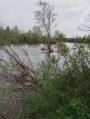
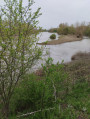
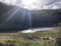
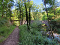
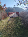
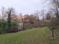
A walking route through the Grands Chambons countryside, as well as between the ponds and the banks of the Loire.

Details

47908477
Creation:
Last update:
Last review:
  • Walking
    Activity: Walking
  • ↔
    Distance: 5.09 mi
  • ◔
    Average duration: 2h 20 
  • ▲
    Difficulty: Easy

  • ⚐
    Back to start: Yes
  • ↗
    Ascent: + 20 ft
  • ↘
    Descent: - 20 ft

  • ▲
    Highest point: 1,066 ft
  • ▼
    Lowest point: 1,040 ft

Photos

Description of the walk

The starting point is in the village of Nervieux, in the car park on the banks of the Loire, on Route de Balbigny. Note on the car park: coming from Nervieux and before reaching the Balbigny bridge, it is on the left.

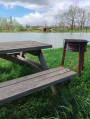
(S/E) With your back to the road, follow the yellow ‘Nervieux’ sign. Take the first path on the left and you’ll come to a picnic area with a picnic table and a sign for ‘La balade des bords de Loire’.

(1) Turn left to cross the road carefully and join the path directly opposite. At the next junction, go straight on through the Grands Chambons estate. As you continue, you’ll see the church spires of Nervieux on the right and Mizérieux on the left. When you reach a T-junction, turn right and continue to the nearby four-way junction.

(2) Turn left, cross the small tarmac road to reach the path opposite, and do the same further on with a small track. Continue along the Étangs Guillaumes and reach a Fork in the road.

(3) Turn left, with your back to the ponds. Once at the bend, follow the path to the right leading to the embankment.

(4) Take the path downhill which leads to the banks of the Loire and follows them as closely as possible. Be careful: there is a hole in the ground just after the junction on the descent.

(5) At the junction before the ponds, turn left, then further on turn right to reach the Mizérieux lake.

(6) Carry on straight ahead.

(7) At the sign for “Les Ronzières, alt. 323 m”, take the embankment on the right, where there is a large rectangular stone.

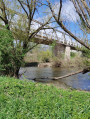
(8) Turn onto the path that descends to the right and leads to the Loire. Continue along the riverbank, go under the bridge and turn left to return to the car park (S/E).


Waypoints

  1. S/E : mi 0 - alt. 1,060 ft - Car park on the banks of - La Loire
  2. 1 : mi 0.57 - alt. 1,053 ft - Picnic table, sign
  3. 2 : mi 1.6 - alt. 1,053 ft - Junction, turn left
  4. 3 : mi 2.54 - alt. 1,066 ft - Guillaume Ponds
  5. 4 : mi 2.83 - alt. 1,060 ft - Survey
  6. 5 : mi 3.03 - alt. 1,053 ft - Junction, turn left
  7. 6 : mi 3.32 - alt. 1,056 ft - Mizérieux Lake
  8. 7 : mi 3.5 - alt. 1,060 ft - Sign for ‘Les Ronzières’
  9. 8 : mi 3.88 - alt. 1,056 ft - Path on the right
  10. S/E : mi 5.09 - alt. 1,060 ft - Car park on the banks of the Loire

Notes

(1) Picnic table.

(4) Caution: there is a hole in the ground just after the junction on the downhill section.

Worth a visit

(5) Instead of turning left, turn right to stroll between the Loire and the ponds. Further on, you’ll rejoin the route described in (7).

Reviews and comments

4.8 / 5
Based on 2 reviews

Reliability of the description
5 / 5
Ease of following the route
5 / 5
Route interest
4.5 / 5
JPC-AURA
JPC-AURA

Overall rating : 4.5 / 5

Date of your route : Sep 22, 2026
Reliability of the description : Not used / Not applicable
Ease of following the route : ★★★★★ Very good
Route interest : ★★★★☆ Good
Very busy route : No

A very easy walk as there’s virtually no change in altitude.
The second section along the banks of the Loire is more pleasant than the long stretch across the rather mundane fields after the harvest.
Be careful, though, if you’re afraid of cows – you’ll be crossing a meadow where they’re grazing peacefully.

Machine-translated

User 263110

Overall rating : 5 / 5

Date of your route : Jul 25, 2025
Reliability of the description : ★★★★★ Very good
Ease of following the route : ★★★★★ Very good
Route interest : ★★★★★ Very good
Very busy route : Yes

A sign indicated that the path along the Loire had been restored in the spring and was once again accessible (after the Loire floods of autumn 2024)

Machine-translated

Other walks in the area

For more walks, use our search engine .

The GPS track and description are the property of this route's author. Please do not copy them without permission.