Route des Vallons, Saint-Didier

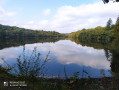
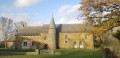
A well, a bread oven, old wash houses, a mill and a wayside chapel add to the charm of this route through the Vilaine Valley.
Signposted in a clockwise direction.

Details

n°31034963
Creation:
Last update:
Last review:
  • Walking
    Activity: Walking
  • ↔
    Distance: 2.89 mi
  • ◔
    Average duration: 1h 25 
  • ▲
    Difficulty: Easy

  • ⚐
    Back to start: Yes
  • ↗
    Ascent: + 112 ft
  • ↘
    Descent: - 118 ft

  • ▲
    Highest point: 249 ft
  • ▼
    Lowest point: 144 ft

Photos

Description of the walk

YellowPR® signposting supplemented by green arrows marked with the number 18.
Start at Place de la Mairie.

(S/E) Head down to the right towards a small street. Follow it for 50 metres, then turn left into the housing estate. Cross the small square and head towards the dirt track opposite. Follow it until you reach the road.

(1) Turn right, then take the third street on the left. Carry on straight ahead until you come out onto a country road.

(2) Turn left, then, once at the end of the road, turn right onto the D33. Then take the first left. Go to the far end of the car park and follow a small dirt track that leads to the edge of a field. Walk along the edge of the field, then turn right once you reach the end.

(3) Go round a roundabout and turn left, then take the second road on the right. Follow the path which passes close to three hamlets, then continue along the edge of the field.

(4) At the end of the track, head left onto the road, then 50 metres further on, turn left onto a small path leading downhill. At the end of the path, turn right, then take the first path on the left.

(5) Then follow the path leading into a small park with a pond. Stay on the same side of the pond throughout and leave the park. Take the same small street as on the way there to return to the starting point (S/E).

Waypoints

  1. S/E : mi 0 - alt. 223 ft - Town Hall Square
  2. 1 : mi 0.16 - alt. 223 ft - Road junction
  3. 2 : mi 0.42 - alt. 243 ft - Exit the housing estate onto a country road
  4. 3 : mi 1.08 - alt. 230 ft - Roundabout
  5. 4 : mi 2.13 - alt. 200 ft - End of the path
  6. 5 : mi 2.45 - alt. 226 ft - Path on the left
  7. S/E : mi 2.89 - alt. 223 ft - Town Hall Square

Notes

Car park, shops and toilets near the starting point.

Always be cautious and plan ahead when you're outdoors. Visorando and the author of this route cannot be held responsible for any accidents occurring on this route.

The GR® and PR® markings are the intellectual property of the Fédération Française de Randonnée Pédestre.

Reviews and comments

3.5 / 5
Based on 2 reviews

Reliability of the description
3.5 / 5
Ease of following the route
3.5 / 5
Route interest
3.5 / 5
Dom1
Dom1

Overall rating : 2.3 / 5

Date of your route : Jul 08, 2024
Reliability of the description : ★★☆☆☆ Disappointing
Ease of following the route : ★★☆☆☆ Disappointing
Route interest : ★★★☆☆ Average
Very busy route : No

Walking through the village via the housing estates is of little interest. There’s a lovely sunken path after that, but we got lost on it… and were forced to cut through a farm, where we were given a cold reception despite our apologies. The landowner was exasperated at seeing walkers passing through her land… check the signposting again from the sunken path…

Machine-translated

jacdav35
jacdav35

Overall rating : 4.7 / 5

Date of your route : Jul 08, 2024
Reliability of the description : ★★★★★ Very good
Ease of following the route : ★★★★★ Very good
Route interest : ★★★★☆ Good
Very busy route : No

A pleasant route, with a bit of road but easy going

Machine-translated

Other walks in the area

For more walks, use our search engine .

The GPS track and description are the property of this route's author. Please do not copy them without permission.