The Moulin Route in Broons-sur-Vilaine

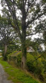
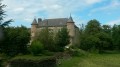
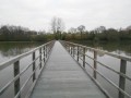
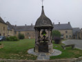
The charming little village of Broons, whose church was built using stone from the quarries in the Corbière Forest. A mill, the edge of the forest, ponds, a beautiful sunken path and distant views towards the south at Les Quatre Vents add to the charm of this idyllic route, which holds the FFRandonnée label.

Details

30327320
Creation:
Last update:
Last review:
  • Walking
    Activity: Walking
  • ↔
    Distance: 3.46 mi
  • ◔
    Average duration: 1h 45 
  • ▲
    Difficulty: Easy

  • ⚐
    Back to start: Yes
  • ↗
    Ascent: + 157 ft
  • ↘
    Descent: - 154 ft

  • ▲
    Highest point: 351 ft
  • ▼
    Lowest point: 220 ft

Description of the walk

Starting point: Rue des Randonneurs. Park opposite the church.

YellowPR® signposting supplemented by green arrows marked with the number 35.

(S/E) On leaving the car park, head to the right, follow the road and pass the hamlet of La Croix.

(1) Turn left, pass the Étang de Pont de Pierre and continue along a path to a T-junction.

(2) Turn right, then left, and follow the track. Pass the hamlet of Le Houx Vert and arrive at a T-junction.

(3) Turn right, go round the Étang des Roches Bises and come out onto a road.

(4) Cross the road and continue along the path opposite until you reach the D95.

(5) Turn right, pass under a power line and, at the end of the road, continue along the path until you reach Rue des Randonneurs.

(1) Turn left to return to the starting car park (S/E).

Waypoints

  1. S/E : mi 0 - alt. 233 ft - Car park on Rue des Randonneurs
  2. 1 : mi 0.29 - alt. 262 ft - Junction of the circular loop
  3. 2 : mi 0.72 - alt. 276 ft - Junction
  4. 3 : mi 1.6 - alt. 266 ft - Junction after Le Houx Vert
  5. 4 : mi 2.03 - alt. 266 ft - Road junction
  6. 5 : mi 2.55 - alt. 351 ft - D95
  7. S/E : mi 3.46 - alt. 233 ft - Car park on Rue des Randonneurs

Notes

Signposted in a clockwise direction.
Suitable for both walking and cycling.

Car park, toilets and drinking water point near the starting point.

Always be cautious and plan ahead when you're outdoors. Visorando and the author of this route cannot be held responsible for any accidents occurring on this route.

The GR® and PR® markings are the intellectual property of the Fédération Française de Randonnée Pédestre.

Reviews and comments

4.5 / 5
Based on 2 reviews

Reliability of the description
5 / 5
Ease of following the route
5 / 5
Route interest
3.5 / 5
David_Maegh
David_Maegh

Overall rating : 4.3 / 5

Date of your route : Mar 29, 2026
Reliability of the description : ★★★★★ Very good
Ease of following the route : ★★★★★ Very good
Route interest : ★★★☆☆ Average
Very busy route : No

A simple route, but sections that run right through farmyards, even though these are public thoroughfares
That’s a bit of a nuisance

Machine-translated

Rico3562
Rico3562

Overall rating : 4.7 / 5

Date of your route : Sep 01, 2025
Reliability of the description : ★★★★★ Very good
Ease of following the route : ★★★★★ Very good
Route interest : ★★★★☆ Good
Very busy route : No

A circuit that takes about an hour and fifteen minutes to complete at a leisurely pace, very pleasant in the countryside and woods.

Machine-translated

Other walks in the area

For more walks, use our search engine .

The GPS track and description are the property of this route's author. Please do not copy them without permission.