The Taillon

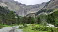
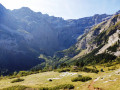
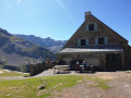
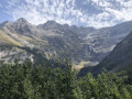
The summit of the Taillon as seen from Gavarnie, via the Brèche de Roland refuge.

Details

1545
Creation:
Last update:
Last review:
  • Walking
    Activity: Walking
  • ↔
    Distance: 12.76 mi
  • ◔
    Duration according to the author: 6 hrs 
  • ▲
    Difficulty: Very difficult

  • ⚐
    Back to start: Yes
  • ↗
    Ascent: + 6,680 ft
  • ↘
    Descent: - 6,706 ft

  • ▲
    Highest point: 10,308 ft
  • ▼
    Lowest point: 4,478 ft

Description of the walk

Park in the car park alongside the D128.

(S/E) Walk down the road towards the village.

(1) At the crossroads, turn right and walk through the village along the Route du Cirque.

(2) At Pont Brioule, do not cross the stream but continue straight on for 800 metres to Pont de Nadau.

(3) Cross the bridge and continue along this wide path towards the Hôtellerie du Cirque. Head for the Hôtellerie du Cirque.

(4) Follow the path towards the Cirque de Gavarnie, then turn right, heading south-west, towards the rock face.

(5) Climb the Sarradets ladder (take care) and reach the Sarradets or Brèche de Roland refuge.

(6) Turn left, heading due south, to reach the Brèche de Roland.

(7) Next, take the path immediately on the right. It runs along the cliff face until it is directly below the Doigt, then follows the ridge. The ascent of the Taillon is via this clearly visible path.

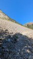
(8) Once at the summit, follow the southern ridge then veer left to descend into the stream bed. Follow the stream east-southeast, taking care of the snowfields which can sometimes persist. Then begin the ascent back towards the Brèche de Roland, which is tricky through the scree.

(7) Descend back to the Sarradets refuge. This descent requires a bit of care to avoid ending up on your backside, but does not present any major difficulties.

(6) Follow the outward route in the opposite direction as far as the ladders.

(5) Continue along the path to return to the Hôtellerie du Cirque, then on to Gavarnie and the starting point (S/E)

Waypoints

  1. S/E : mi 0 - alt. 4,505 ft - Car park - Village de Gavarnie
  2. 1 : mi 0.14 - alt. 4,478 ft - Crossroads: turn right towards the village
  3. 2 : mi 0.68 - alt. 4,528 ft - Pont Brioule, straight ahead - Gave de Pau
  4. 3 : mi 1.12 - alt. 4,577 ft - Nadua Bridge: turn left to cross it
  5. 4 : mi 2.56 - alt. 5,128 ft - Hostellerie du Cirque
  6. 5 : mi 3.45 - alt. 6,270 ft - Echelle des Sarradets
  7. 6 : mi 4.65 - alt. 8,471 ft - Refuge des Sarradets
  8. 7 : mi 5.11 - alt. 9,160 ft - Brèche de Roland
  9. 8 : mi 6.13 - alt. 10,308 ft - The - Taillon (3144m)
  10. S/E : mi 12.76 - alt. 4,501 ft - Gavarnie car park

Notes

The return journey from the Taillon (8) to the Brèche de Roland (7) can be made via the same route as on the way there to avoid the climb up to the pass, which is tricky due to the scree.

As the water at the refuge comes from the glacier, there may be none in the morning (due to freezing).

This route passes through a protected area, which may be subject to special regulations:

Reviews and comments

4.9 / 5
Based on 3 reviews

Reliability of the description
5 / 5
Ease of following the route
4.7 / 5
Route interest
5 / 5
User 21298583

Overall rating : 4.7 / 5

Date of your route : Jul 20, 2026
Reliability of the description : ★★★★★ Very good
Ease of following the route : ★★★★☆ Good
Route interest : ★★★★★ Very good
Very busy route : Yes

Nothing to report

Machine-translated

Shakaspir
Shakaspir

Overall rating : 5 / 5

Date of your route : Sep 08, 2025
Reliability of the description : ★★★★★ Very good
Ease of following the route : ★★★★★ Very good
Route interest : ★★★★★ Very good
Very busy route : Yes

But what a hike!
We did it in early September, and the first part of the route was relatively quiet, but we caught up with other people once we passed the refuge and headed for the summit. When climbing from the bottom of the Cirque de Gavarnie to the refuge, be careful, keep your hands steady and take it slowly. It's fine, but it is a bit exposed in places.
For the return trip, we decided to avoid this section by descending to Gavarnie via the Vallée des Pouey and the Bellevue plateau, following the path that runs alongside (and sometimes crosses) the Taillon stream (at the refuge, head towards the Col des Tentes and don't miss the path that branches off to the right). It's a bit longer (about 25km in total) but it's much safer and you end on a high note with a unique view of the Cirque de Gavarnie from the Bellevue plateau.
This hike is a must-do and a great physical challenge!

Machine-translated

celinetterando
celinetterando

Overall rating : 5 / 5

Date of your route : Jul 28, 2017
Reliability of the description : ★★★★★ Very good
Ease of following the route : ★★★★★ Very good
Route interest : ★★★★★ Very good

If there’s one hike you simply must do, it’s this one! A real treat for the eyes…

Please note that in summer 2017, the Brèche de Roland mountain refuge will be closed for refurbishment.

Machine-translated

MALRIF
MALRIF

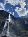
The Taillon is one of the most ‘easily’ accessible of the Pyrenean ‘3,000s’. I climbed to the summit of the Taillon at the end of August, not setting off from the village of Gavarnie as suggested in the guide, but from the Col des Tentes. You can leave your car in the car park there and then walk up towards the Port de Boucharo, which you reach in 25 minutes. At the junction at the Port de Boucharo, you’ll see a sign pointing left towards the Brèche de Roland mountain hut. The path climbs gently at the foot of the Gabiétous and then the Taillon. You reach the base of the Taillon waterfall in 1 hour 15 minutes without stopping. You’ll reach the Col des Sarradets (1 hour 35 minutes without stops). The rather narrow path descends slightly before reaching the refuge in 5 minutes from the pass. The view of the Brèche de Roland is breathtaking!
For this hike, it’s best to set off early (6 hours’ walking, not including stops), in good weather, wearing suitable footwear and being in good physical condition. Take care in late spring, when snow may still be present.

Machine-translated

Nono
Nono ★

Malrif, could you post your route starting from the Col des Tentes? I think it might be of interest.

Machine-translated

Nono
Nono ★

MALRIF has just posted the route starting from the Col des Tentes: https://www.visorando.com/randonnee-le-ta...

Thanks, it’s really detailed and I think I’ll approve it later today.

Machine-translated

Other walks in the area

For more walks, use our search engine .

The GPS track and description are the property of this route's author. Please do not copy them without permission.