Route of the Lakes around Mount Verosso

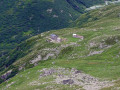
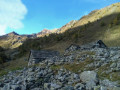
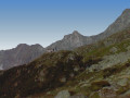
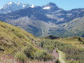
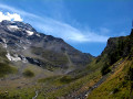
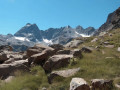
A walk through the heart of the upper Bognanco Valley, with its lakes, peat bogs and snow-capped peaks.

Details

n°1500122
Creation:
Last update:
Last review:
  • Walking
    Activity: Walking
  • ↔
    Distance: 7.02 mi
  • ◔
    Average duration: 5h 25 
  • ▲
    Difficulty: Difficult

  • ⚐
    Back to start: Yes
  • ↗
    Ascent: + 2,493 ft
  • ↘
    Descent: - 2,500 ft

  • ▲
    Highest point: 7,654 ft
  • ▼
    Lowest point: 5,233 ft

Photos

Description of the walk

Park in the large car park in front of the San-Bernardo mountain hut.

(S/E) At the entrance to the car park, take the forest track on your right towards Lake Ragozza and the Gattascosa mountain hut; this becomes a footpath a little further on, branching off to the right (marked Red-White-Red).

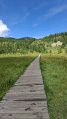
(1) After a gentle climb through the larch trees, pass close to the small Lake Arza (information board – the lake is not visible from the path as it lies below) before emerging onto the magnificent Gattascosa bog (information board on the other side of the bog, which you cross via a wooden footbridge).

(2) Continue straight on until you reach Lake Ragozza, then the Gattascosa Mountain Hut, from where you can admire the magnificent Bognanco Valley.

(3) Take the path to the left of the refuge, which climbs steeply up to the Gattascosa Pass (2,158 m – marked Red-White-Red).

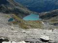
(4) Continue to the left, along the mountainside, across scree slopes (marked red-white-red) to a beautiful glacial lake.

(5) Go round it to the right, then leave the path to the right before climbing straight up through a large scree slope to the Col de Oriaccia (marked Red-White-Red).

(6) From the pass, descend to Lake Oriaccia, which you can see below (very steep descent).

(7) From the lake, take the path on your left towards the San-Bernardo Hut (marked Red-White-Red) and Monte del Dente.

(8) At the small pass above Monte del Dente, take the path on your right which descends rapidly to some ruins and a white cross (marked red-white-red).

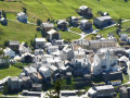
(9) Turn left towards San-Bernardo; the path runs along the mountainside to the first house in Ciuppinella (numerous exposed sections).

(10) Join the forest track which leads to the small chapel before reaching the mountain hut and the car park (S/E).

Waypoints

  1. S/E : mi 0 - alt. 5,374 ft - Car park in front of the San-Bernardo mountain refuge
  2. 1 : mi 0.78 - alt. 5,702 ft - Lake Arza
  3. 2 : mi 1.45 - alt. 6,243 ft - Gattascosa Moor
  4. 3 : mi 1.91 - alt. 6,532 ft - Gattascosa Mountain Hut
  5. 4 : mi 2.34 - alt. 7,113 ft - Gattascosa Pass
  6. 5 : mi 2.93 - alt. 7,257 ft - Glacial lake
  7. 6 : mi 3.45 - alt. 7,654 ft - Oriaccia Pass
  8. 7 : mi 4.09 - alt. 6,946 ft - Lake Oriaccia
  9. 8 : mi 4.89 - alt. 6,831 ft - Small pass of Monte del Dente
  10. 9 : mi 5.34 - alt. 6,148 ft - White Cross
  11. 10 : mi 6.66 - alt. 5,266 ft - Ciuppinella
  12. S/E : mi 7.02 - alt. 5,371 ft - Car park in front of the San-Bernardo mountain hut

Reviews and comments

5 / 5
Based on 1 review

Reliability of the description
5 / 5
Ease of following the route
5 / 5
Route interest
5 / 5
donm
donm

Overall rating : 5 / 5

Date of your route : Jul 16, 2026
Reliability of the description : ★★★★★ Very good
Ease of following the route : ★★★★★ Very good
Route interest : ★★★★★ Very good
Very busy route : No

A lovely horse ride along the Italian-Swiss border!
As for the GPS track, we didn’t find it particularly accurate (it often strayed from the actual path), but this isn’t a major issue.
As for the description at point (9), we don’t entirely agree with the description of ‘numerous exposed sections’: whilst the path does run along a steep hillside, it doesn’t present any particular difficulties. I’m personally quite prone to vertigo, but I managed it without any trouble.
Thank you for this suggestion: this walk suited us perfectly!

Machine-translated

Other walks in the area

For more walks, use our search engine .

The GPS track and description are the property of this route's author. Please do not copy them without permission.