


Refine your search for walks in Férel
Férel walks


 Circular cycling route: Férel – Pénestin – Assérac
 Visorando Member
 33.38 mi
 +486 ft
 -459 ft
 4 hrs
4 hrs
 Moderate
 Departure from Férel (Morbihan)
Between Mès and Vilaine lies a little-known corner where the landscapes change constantly, from the banks of the Vilaine to the Atlantic coast at Pénestin, via the salt marshes of Mès and the wooded areas of Monchoix and Coët Castel. So hop on your bike and explore it along roads and paths away from heavy traffic.
 The paths of Saint-Dys
7.32 mi
+112 ft
-92 ft
3h 30
Moderate
Departure from Férel (Morbihan)
The commune of Férel comprised five ‘frairies’ (sub-parishes), including that of Saint-Dys (or Teiz), which covers the wooded south-western part of the commune’s territory. The suggested route follows country lanes and forest tracks around Coët Castel and Ally.
Route des Coulées
7.52 mi
+138 ft
-138 ft
3h 35
Moderate
Departure from Férel (Morbihan)
The plateau on which the village of Férel lies is situated at an altitude of 30 to 50 metres above sea level. It overlooks the southern bank of the Vilaine, sometimes quite steeply, and the streams flow along the bottoms of wooded valleys (the Coulées), which are ideal for walks in all seasons.
A walk around the Férel bell tower
 5.67 mi
+69 ft
-72 ft
2h 40
5.67 mi
+69 ft
-72 ft
2h 40
 Easy
Departure from Férel (Morbihan)
Easy
Departure from Férel (Morbihan)
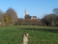
Situated about ten kilometres inland from the coast, on a plateau sloping down from the banks of the Vilaine to the first marshes of Briéron, the commune of Férel has managed to preserve its bocage landscape and a network of paths offering a wide range of walking options. This route offers an almost constant view of the bell tower, which, being tall and sharply pointed, is one of the area’s main landmarks.
Circular Vilaine Route via the Arzal Dam and the Roche-Bernard Bridge
 14.39 mi
+1,083 ft
-1,070 ft
7h 35
14.39 mi
+1,083 ft
-1,070 ft
7h 35
 Difficult
Departure from Arzal (Morbihan)
Difficult
Departure from Arzal (Morbihan)
A pleasant, easy walk along the banks of the Vilaine through wooded countryside, forests and small villages.
The path is fully signposted in white and red by theGR®39(left bank) andGR®349(right bank).
Vieille Roche Route
5.78 mi
+112 ft
-128 ft
2h 45
Easy
Departure from Camoël (Morbihan)
In the past, the Vilaine was crossed by ferry downstream of La Roche-Bernard. This was the case between Vieille Roche in Camoël and Arzal. The construction of the dam in the 1970s significantly changed these practices, as a fixed link now allows people to cross from one bank to the other. The suggested route allows you to explore the dam and the paths along the left bank of the Vilaine around Camoël.
From one port to another along the Vilaine
6.34 mi
+420 ft
-436 ft
3h 15
Moderate
Departure from Camoël (Morbihan)
Running along the left bank of the Vilaine, this path follows the riverbank closely, linking the two ports of Arzal and La Roche-Bernard, and offering a multitude of landscapes and views of the Basse-Vilaine. In summer, you can also return by boat or canoe.
From the Arzal dam to La Roche Bernard along the left bank of the Vilaine
9.57 mi
+965 ft
-961 ft
5h 15
Moderate
Departure from Camoël (Morbihan)
Walk starting from the Arzal Dam, following the Vilaine upstream on the left bank, circular route via the two bridges and finishing at the port of La Roche-Bernard. The scenery along the Vilaine is breathtaking.
Circular route between the Arzal Dam and Ferel
8.17 mi
+197 ft
-197 ft
3h 55
Easy
Departure from Camoël (Morbihan)
This circular walk allows you to enjoy the scenery along the River Vilaine, the woodland on the way to Ferel, and finally a return journey through the countryside around Camoël.
The Vilaine and the countryside around Arzal
10.75 mi
+449 ft
-459 ft
5h 20
Moderate
Departure from Arzal (Morbihan)
During this hike, discover a variety of landscapes: the river, the ocean and the countryside.
Between the Vilaine and the Étang du Pont de Fer
6.27 mi
+249 ft
-243 ft
3h 05
Easy
Departure from Camoël (Morbihan)
To the south of the Vilaine estuary, the gentle terrain encourages the intermingling of wetlands and agricultural land. The village of Camoël is built on a slight rise overlooking both the river and the marshes situated upstream of Pont Mahé Bay.The suggested route allows you to explore the river where its estuary begins and one of the streams that feed the Étang du Pont de Fer, a hidden nature reserve that can be glimpsed when the foliage is not too dense.
A walk through wooded countryside and forests south-west of Marzan
4.69 mi
+381 ft
-377 ft
2h 30
Easy
Departure from Marzan (Morbihan)
As is often the case in Brittany, the landscape is not the result of tectonic forces, which would have created a few sharp-peaked mountains, but rather the result of numerous watercourses that have carved their way through the plateaus. The proximity of the Vilaine, which flows here through a narrow, steep-sided valley, has led secondary watercourses to cut through the moorland to join the river. Starting on the wooded plateau, the proposed route soon winds its way through these valleys, which, due to the decline of agriculture or the low value of this poor soil, have been left to more or less spontaneous woodland growth. The result is a undulating route that runs mostly in the shade of tall, beautiful trees, whilst connecting the countless hamlets that dot this lovely countryside.
Between bocage and Vilaine in Arzal
7.06 mi
+223 ft
-210 ft
3h 25
Moderate
Departure from Arzal (Morbihan)
The village of Arzal stretches from the foot of the church's pointed bell tower to the edge of the dam. Upstream, the river has become a huge body of water where thousands of boats are moored, while downstream, the maritime character of the estuary remains. The proposed route allows you to discover both aspects of the river and the bocage that overlooks it.
The Herbignac Potters’ Trail
8.17 mi
+79 ft
-79 ft
3h 50
Moderate
Departure from Herbignac (Loire-Atlantique)
Passing through clay extraction sites and former pottery villages, this route pays tribute to one of Herbignac’s traditional trades, which continued until the mid-20th century.
Around La Roche-Bernard
5.30 mi
+272 ft
-266 ft
2h 40
Easy
Departure from La Roche-Bernard (Morbihan)
Although La Roche-Bernard is an urban centre that locals refer to as a ‘town’, its area (40 ha) and population (approx. 700 inhabitants) make it one of the smallest county towns in France. It is surrounded by the communes of Nivillac, Herbignac and Férel, across which the majority of the urban area is spread. The proposed route takes you around the area.
The banks of the Vilaine
 11.32 mi
+614 ft
-614 ft
5h 45
Moderate
Departure from La Roche-Bernard (Morbihan)
11.32 mi
+614 ft
-614 ft
5h 45
Moderate
Departure from La Roche-Bernard (Morbihan)
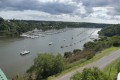
A very pretty route which starts in the countryside and forest and then follows the course of the Vilaine river.
The start and finish are at the very pretty port of La Roche-Bernard.
La Roche-Bernard bridge loop
 3.07 mi
+518 ft
-499 ft
1h 50
Moderate
Departure from La Roche-Bernard (Morbihan)
3.07 mi
+518 ft
-499 ft
1h 50
Moderate
Departure from La Roche-Bernard (Morbihan)
An hour-and-a-half circuit with a few tricky sections. This pleasant walk alternates seamlessly between passages at water's edge and ridge-climbing, and also spans two bridges some 50 m above the Vilaine. The bridge circuit allows you to discover a small section of the river as it crosses the Sillon de Bretagne. Get your calves ready!
De Lantiern à la Vilaine
 6.94 mi
+285 ft
-285 ft
3h 25
Moderate
Departure from Arzal (Morbihan)
6.94 mi
+285 ft
-285 ft
3h 25
Moderate
Departure from Arzal (Morbihan)
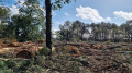
A country walk between Cosca, a stone's throw from the Arzal dam, and the Templar village of Lantiern.This walk along beautiful tree-lined paths and a few small roads connects the banks of the Vilaine estuary to the beautiful Saint-Jean-Baptiste Chapel, through pleasantly rolling countryside.The end of the route follows the botanical trail.The trail has been modified after the point (1), following the clear-cutting of the wooded area it used to cross, which made the trail disappear.
From Ranrouët Castle to La Brière
7.49 mi
+26 ft
-26 ft
3h 30
Moderate
Departure from Herbignac (Loire-Atlantique)
The Château de Ranrouët is a medieval gem nestled on the edge of the marshes. Here, there is no fortified rock, but a slight elevation in the greenery. The marshes that surround it provided protection, and the proposed route winds through the surrounding countryside where land and water constantly mix.
The Vilaine river, right bank and left bank at La Roche-Bernard
 5.96 mi
+522 ft
-518 ft
3h 10
Moderate
Departure from Nivillac (Morbihan)
5.96 mi
+522 ft
-518 ft
3h 10
Moderate
Departure from Nivillac (Morbihan)
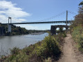
As you approach La Roche-Bernard, the Vilaine river winds its way through the geological folds of southern Armorica. The result is a rugged, wooded landscape that is very pleasant to walk through.