


ecby

 Visorando Member
 Premium user
Sign up:
Published route(s)
 Clarafilisecrémontins Route
 5.40 mi
 +449 ft
 -440 ft
 2h 50
 Easy
 Departure from Clairefougère (Orne)
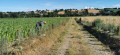
‘The Clarafilisecrémontins walk’, starting from the village of Clairefougère, takes you through both communes, following routes such as the Chemin du Moulin, Grippe-Chat and the old railway line, and climbs almost as far as the wind turbines.
Around Mont Secret
 4.37 mi
+640 ft
-650 ft
2h 35
Easy
Departure from Montsecret (Orne)
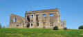
Circling Mont Secret with an off-centre start at the car park near L’Aufrairie, this more challenging route climbs towards Mont de Cerisy along the section belonging to the commune of Montsecret. Between two hills, will Mont Secret perhaps reveal itself?
Along the River Noireau from Montsecret
 5.06 mi
+164 ft
-164 ft
2h 30
 Moderate
Departure from Montsecret (Orne)
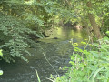
The walk begins in the village of Montsecret. After passing the highest point, the streams flowing into the Noireau will lead you towards Les Vaux in the Noireau valley, bringing you closer to Mont Secret… via Vieux-Saint-Pierre.