Country:

 City:


Park in Rue du Haut Barr. Plenty of spaces available. Let’s get going for the first 200 metres of elevation gain. Follow this road southwards.
(1) Take the signposted path. There are several paths to choose from, but the one shown on the map can be easily tackled by mountain bike.
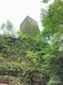
This path will take you to the foot of Haut Barr Castle.
You can visit the castle and climb its towers to enjoy the view.
(2) After a few metres along the road, take the small path on the left leading to the Tour du Télégraphe and continue along this path.
(3) Pass by the two ruined castles of Grand and Petit Geroldseck and continue along the path.
(4) At the junction with the forest track, you’ll find the Table des Sorcières, where you can sit down with a group of friends around this round table. Take the main path opposite and you’ll reach the Rocher Huck viewpoint.
(5) Continue along the main path before turning left onto a small track towards the Brotsch Tower.
(6) At the summit, you’ll find a shelter on Brotschberg and the Brotsch Tower.
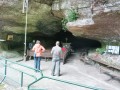
Carry on along the path towards the Grotte du Brotsch and make your way to the site.
(7) The start of the path is very technical. The more experienced cyclists may be able to ride the whole way. For others, there are two or three hairpin bends where you’ll need to take care, but the rest of the descent shouldn’t pose too much of a problem.
(8) At the bottom, at the Schaeferplatz Forest House, take the first path on the right straight away: the Chemin du Président, which is generally flat.
(9) Turn onto the path on the left. Stay on this main path until you come to a larger track leading back down to the Maisonnette de Pierres.
(10) Follow the small tarmac road heading westwards up the valley. After about a hundred metres, take the narrow footpath running alongside the road on the right, thus avoiding the tarmac.
(11) At the junction with the forest track, a long, very steady climb begins along the forest track to the summit, with an elevation gain of around 200 metres. Stay on the main track until you reach the summit.
(12) At the summit, head straight ahead and then immediately turn right onto the path between the two woods.
As this path isn’t very well cleared, watch out for your derailleurs.
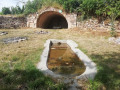
You can continue along the main forest track instead of taking this path, and then quickly turn left to descend a path amongst the Gallo-Roman ruins (you can’t go wrong – the path is flanked by two low stone walls).
Turn left when you reach the forest track until you come to the junction with the tarmac road. Turn right towards the descent.
(13) At a right-hand bend on the descent, don’t forget to take the dirt track on the left. Then turn right to reach the forest track at the bottom of the valley. You’ll come out onto the D132. Follow it to the left for a few hundred metres towards the lock.
(14) Cross the lock and turn onto the footpath opposite, which leads back onto the forest track to the left.
(15) Take the footpath on the right to reach the summit. Please note: it’s a steady climb but with a steep gradient; however, it’s manageable by mountain bike in dry weather. Another 200 metres of elevation gain.
(16) At the summit, turn right onto the path, which is becoming overgrown with small shrubs. A few hundred metres further on, the path improves until you reach the main track; follow this to the right to reach the Grotte Saint-Vit.
(17) Enjoy the magnificent garden at this grotto and its chapel carved out of the rock. Then continue along the forest track.
(18) Follow the signposted path to the right towards the last castle of the day.
(19) At Greifenstein Castle, take the signposted path towards Saverne to head downhill.
There are a few tricky sections at the start (only the fittest will tackle these on a bike), but it very quickly becomes a lovely downhill track again.
(20) The final stage of the descent follows the signposted mountain bike trail.
(21) Cut across the fitness trail to return to Saverne and finish the route. Follow the canal and take the main road at the traffic lights on the right, then immediately turn right after the canal to return to the starting point (S/E).

 Visorando Member

 Moderate
 Easy