Country:

 City:
City:


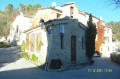
Park in the small car park at Vescous.
(S/E) Walk back 100 metres. At the junction, turn left for a few metres.
(1) Take a small, very steep concrete slope on the left for 25 metres before turning left again towards the west, then north-west, to join the Piera Longa forest track; cross it and continue slightly to the left to take the path on the right, which serves as a shortcut and rejoins the same forest track further up.
Continue along the track lined with olive trees to the right, heading north.
(2) After about 400 m, take the path on the left to join the track (marker 56a)
(3) At marker 56a, turn right; at the small signpost, turn left to follow a wooded path through pine and oak trees, gently sloping down to the valley.
(4) At marker 56b, take the path on the left that leads uphill. Take care before marker 77a: there has been a landslide, but the path continues on the other side of the landslide (10 m).
(5) At marker 77a, keep to the right and follow the ridge along a gently ascending path until you reach the Costa d’Aigla track. Take the descending track on the left.
(6) Ignore the path on the left – which you’ll take later – and carry on straight ahead. After the water tank, turn right to reach the Pinéa plateau.
(7) Turn back.
(6) Take the path on the right, which is a bit steep for the first hundred metres, followed by a lovely path running along the edge of the Pinéa valley. After crossing the valley, the path joins the Uesti track at an old hillside reservoir currently being restored.
(8) At the walking signpost, take the track on the left.
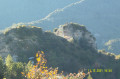
After a few bends, admire the bell tower of Pierrefeu church, nestled between the two rocks.
Continue until you reach a junction.
(9) After taking in the view and perhaps resting on the bench, carry on along the track.
(10) At the next junction, turn left onto the Boscaglion track, then take the Piera Longa track to quickly reach marker 56a.
(3) Return along the same path as on the way out, keeping to the right, to reach Vescous (S/E).

 Visorando Member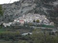
 Difficult